XTools Pro Online Tools

Find out which XTools Pro tools are available for use online and how they can be used.
Some of the XTools Pro tools can now be used online, just in the browser. The initial version is free and available to anyone, it includes 15 well-known and most popular XTools Pro tools as well as a few extra tools for creating and viewing features, and building buffers around them. See the full list of tools below.
Whether you may need an additional toolset to enrich and extend your standard GIS arsenal or need to provide certain tools to the contractors or staff outside of the office without access to the desktop GIS, for these and many other occasions try the XTools Pro online tools.
How to use
In order to use the tools online you can follow a few simple steps:
- Select the required tool from the tools Catalog.
A new map opens with the selected tool window. - Select the input dataset.
The tools can process input data in many various formats:- Shapefiles, selected with all the related files at once or zipped
- Zipped Esri file geodatabases
- GeoPackages
- KML/KMZ files
- GPX files
- MapInfo TAB files, selected with all the related files at once or zipped.
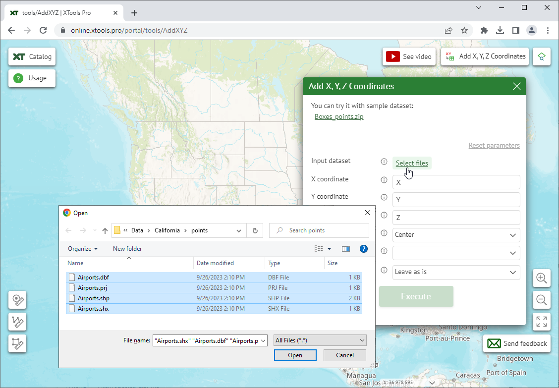
Note, if you don’t have an appropriate dataset at hand, you can try the tools with sample datasets. The download link is available on top of the tool window.
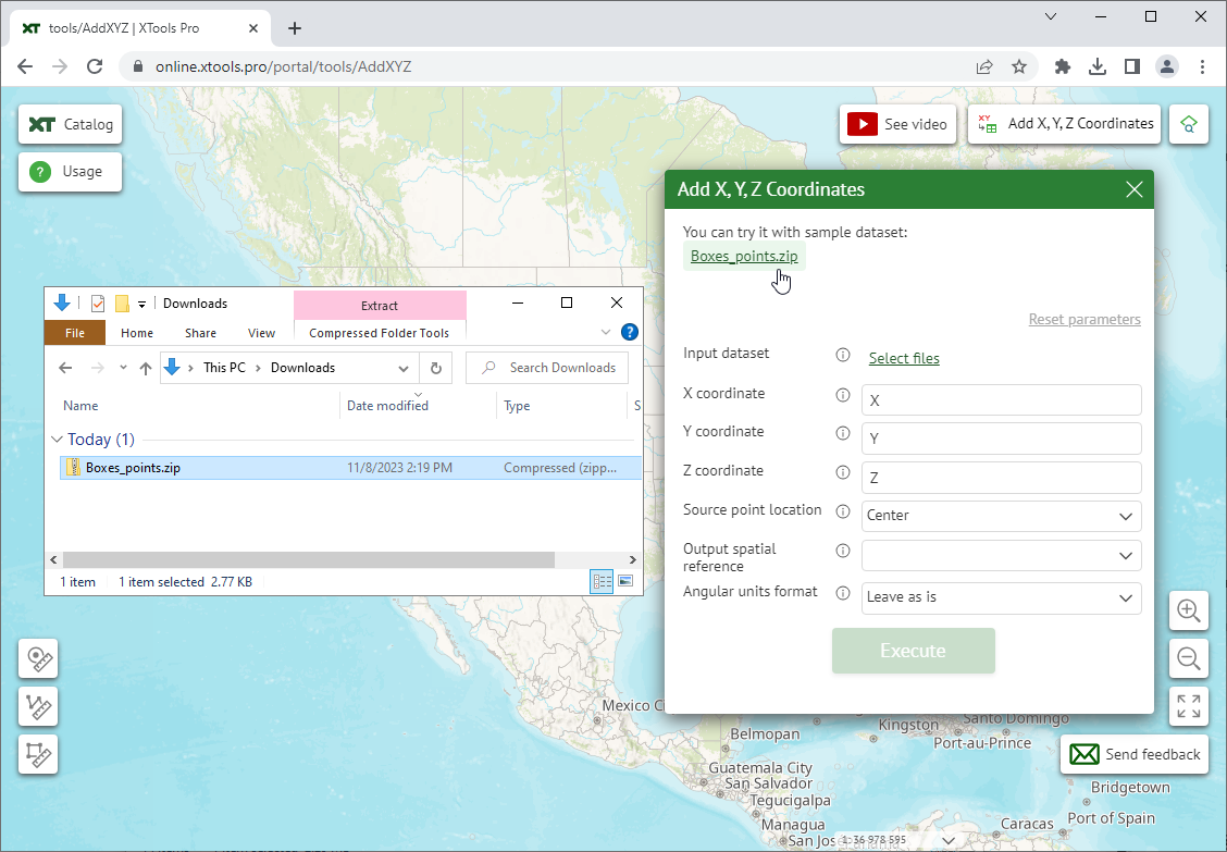
- Specify the required parameters.
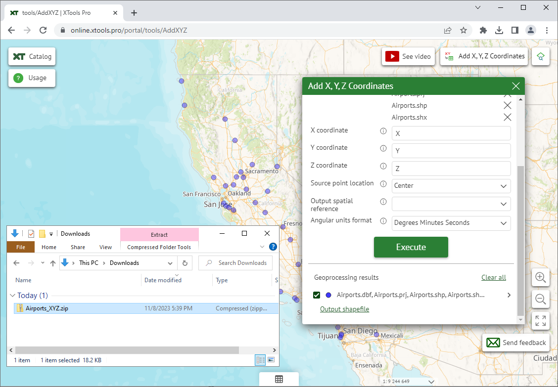
This can be field names, numeric values, spatial reference or various methods to use. All the parameters can be reset to the default state. - Execute the tool.
You will get a zipped shapefile in your system Downloads folder as an output. At that, the output features will be displayed on the map as well.
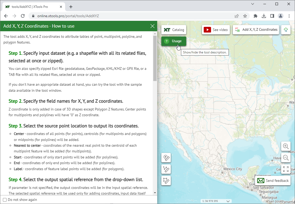
A detailed instruction on how to use the selected tool is provided in the Usage panel on the left.
Viewing the data
In addition to processing the data with the tools you can also view your data on the map using the separate Data Viewer tool available from the Catalog:
or from the selected tool page.
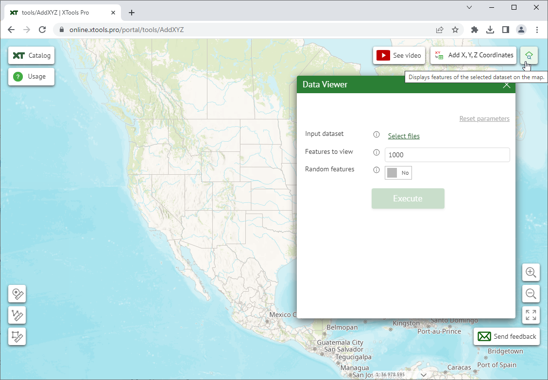
The selected dataset will be added to the current map.
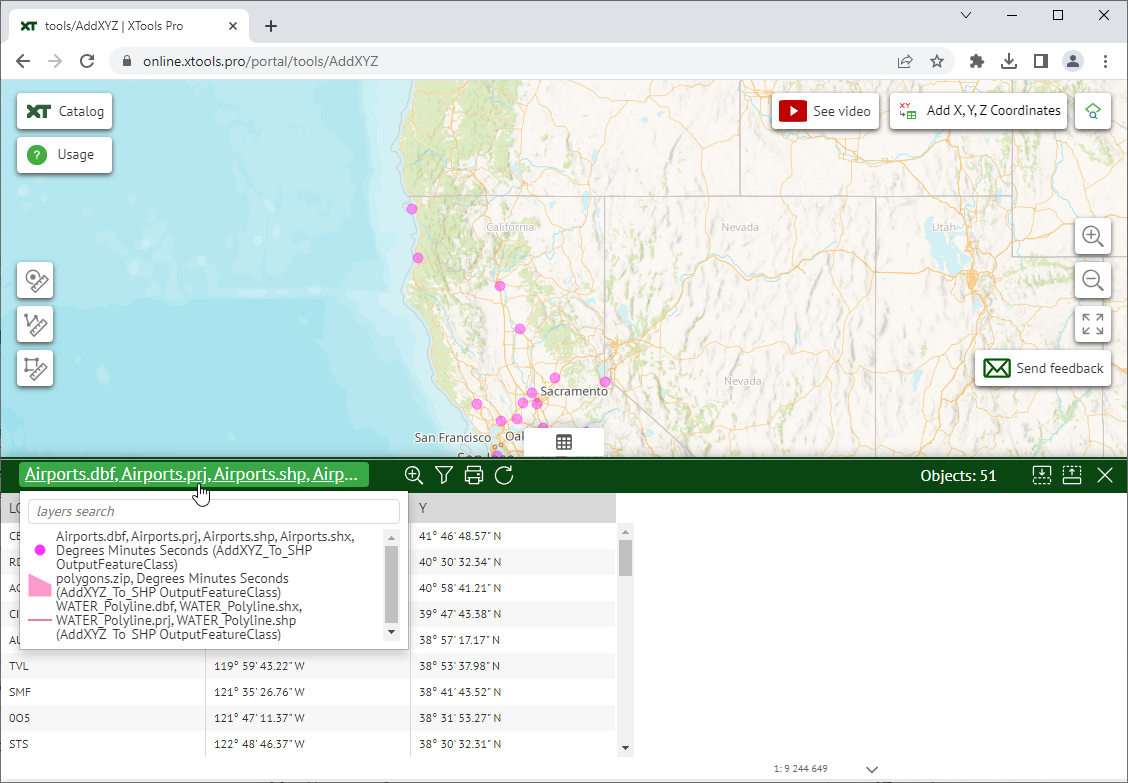
Opening the attribute table
After processing data with the tools, you can open an attribute table of the processed dataset. The table is available at the bottom of the map.
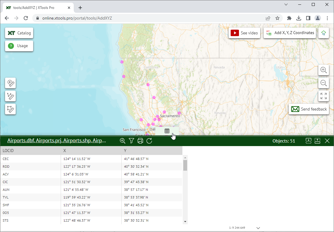
If you have viewed or processed a few datasets, you can choose the attribute table to be opened from the list clicking on the table title.
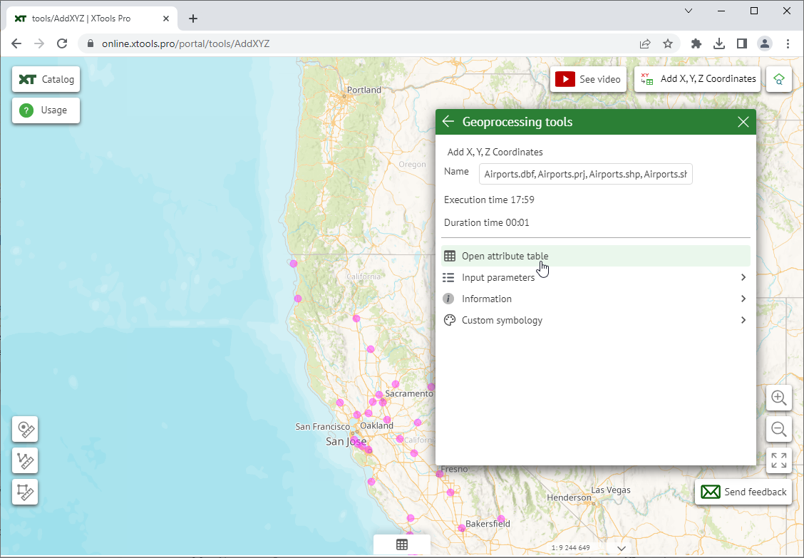
The attribute table can also be opened from the Geoprocessing results list.
For the selected attribute table you can:
- Zoom the map to the processed dataset extent.
- Filter table by the selected attributes.
- Print table.
- Refresh table view.
and also see the number of features/records.
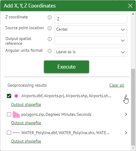
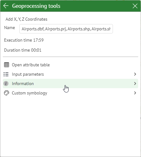
Geoprocessing results
In the Geoprocessing results part of the tool window you can see the list of tool sessions that contains input and output features with displayed symbols. Besides, you can see the details of the executed processes.
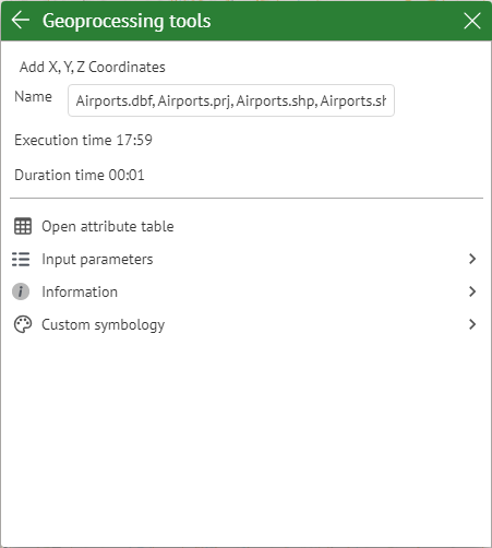
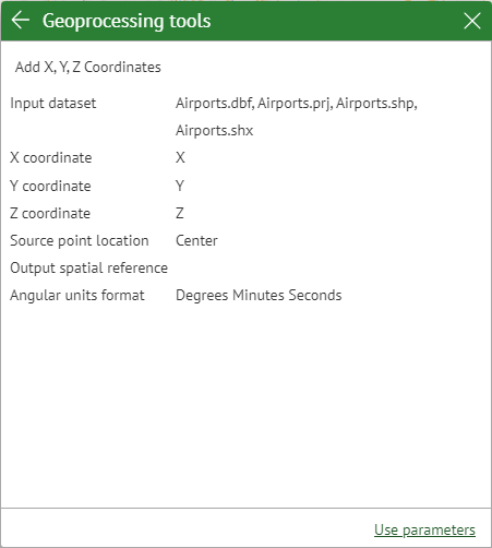
Among the details you can see the tool parameters it has been executed with (click on Input parameters).
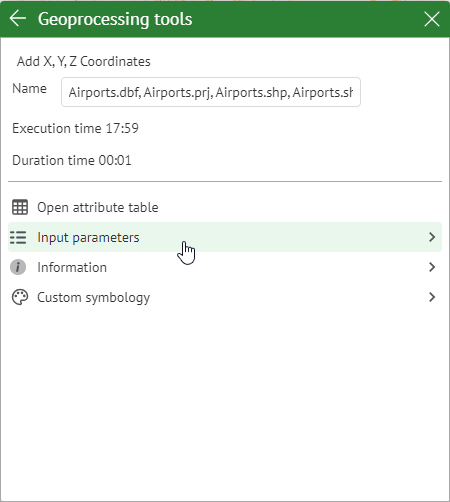
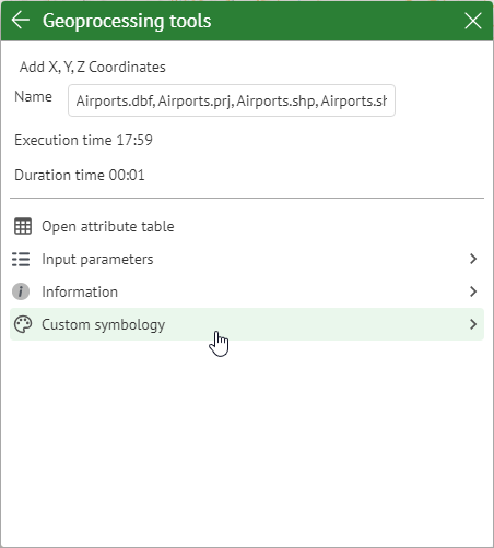
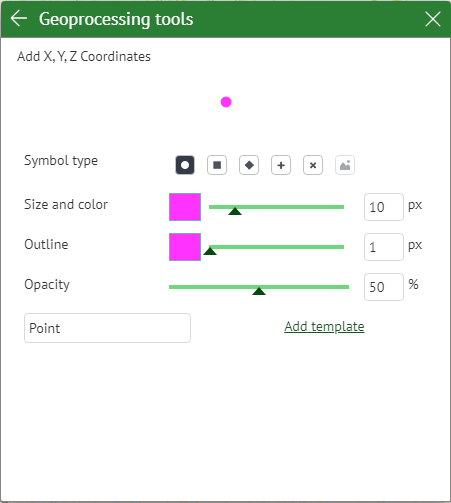
At that, the displayed feature symbols can be customized (click on Custom symbology).
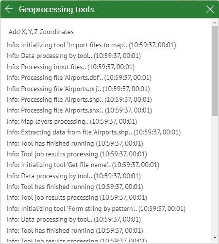
Finally, you can see details of the executed tool in the provided tool log (click on Information).
Geoprocessing results list can be cleared if not needed.
Tools Catalog
The following tools are currently available online.
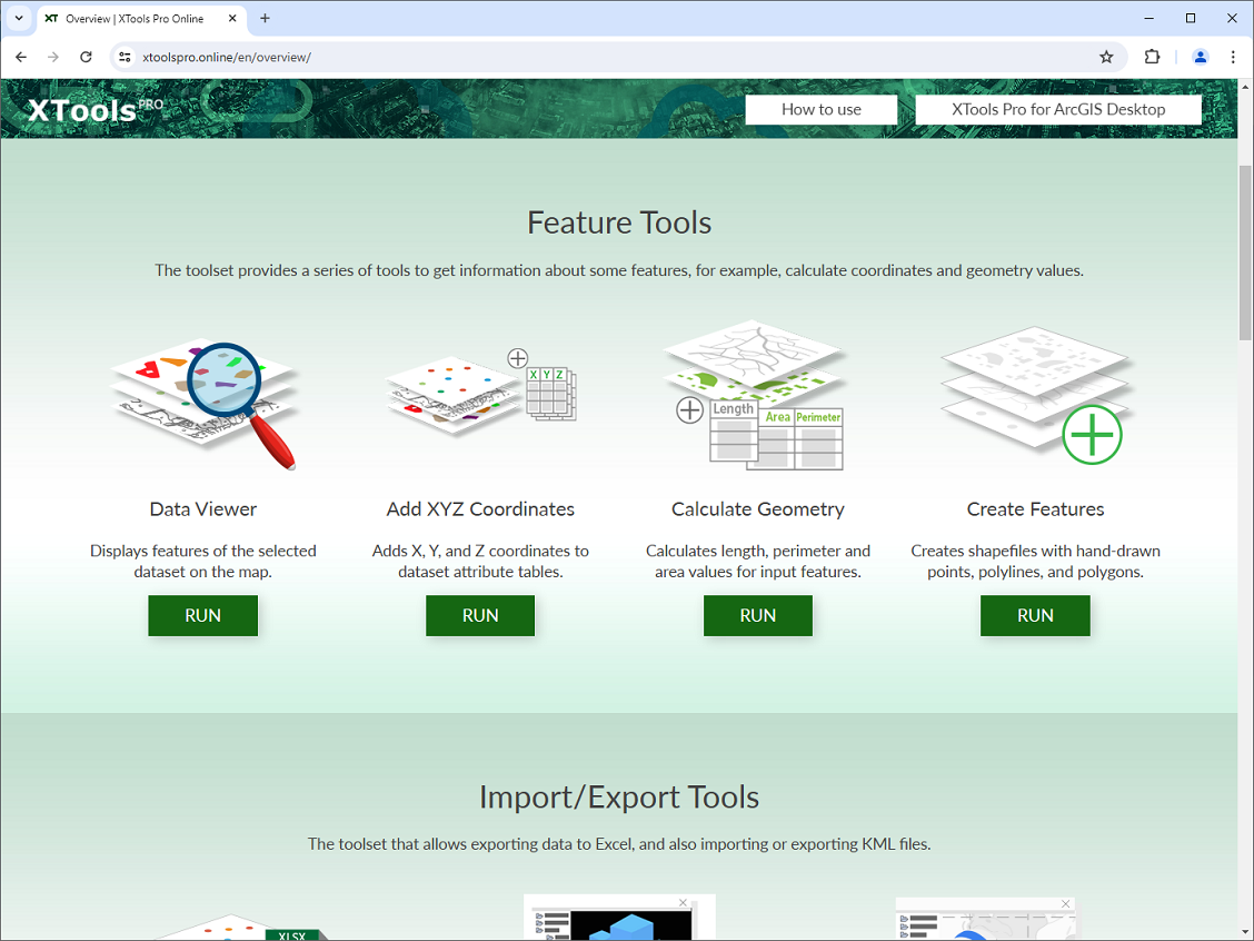
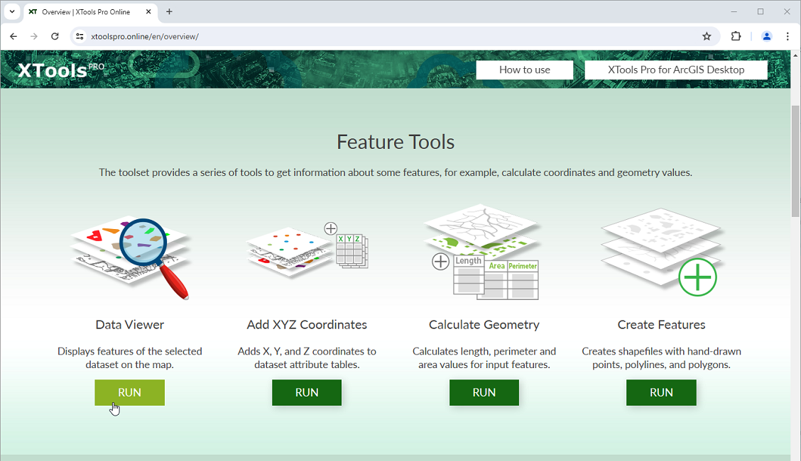
Feature Tools
- Data Viewer
- displays features of the selected dataset on the map. - Add X, Y, Z Coordinates
- adds X, Y, and Z coordinates to attribute tables of point, multipoint, polyline and polygon features. - Calculate Geometry
- calculates perimeter and area values (including acres and hectares) for polygon features and length for polyline features. - Create Features
- creates shapefiles with new hand-drawn points, polylines and polygons.
Import/Export Tools
- Export to Excel
- exports attribute tables of vector datasets to Microsoft Excel .xlsx files. - Export to KML
- exports selected vector datasets with added labels to KML/KMZ files. - Import from KML
- imports data from KML/KMZ files to shapefiles, GeoPackage or Microsoft Excel files.
Analysis Tools
- Concave Hull
- builds concave hull for point, multipoint, polyline and polygon features.
Specifying the “Level of detail” parameter, you may get a convex hull or detailed concave hull with holes inside. - Random Sampling Points
- creates randomly spread points within specified constraining polygons. - Create Rectangular Fishnet
- creates a rectangular fishnet dataset within one or several specified extents. - Create Hexagonal Fishnet
- creates a hexagonal fishnet dataset within one or several specified extents. - Thiessen Polygons
- builds Thiessen polygons from point features.
It can also build weighted Thiessen polygons taking into account the specified attribute field with weights.
Conversion Tools
- Features to Points
- converts polygon and polyline features to points. - Polygons from Points
- creates a new polyline from input point features. - Polylines from Points
- creates a new polygon from input point features.
Geometry Tools
- Buffer
- creates buffer polygons around input features to a specified distance. - Divide Overlapping Areas
- divides overlapping polygons by the central line of the intersection area.
Table Tools
- Delete Multiple Fields
- deletes selected attribute fields from input table.
Please let us know if you need certain XTools Pro tools and features online and we may make them available for use.