Features
More than 100 tools and functions for spatial analysis, shape conversions and table management in ArcGIS
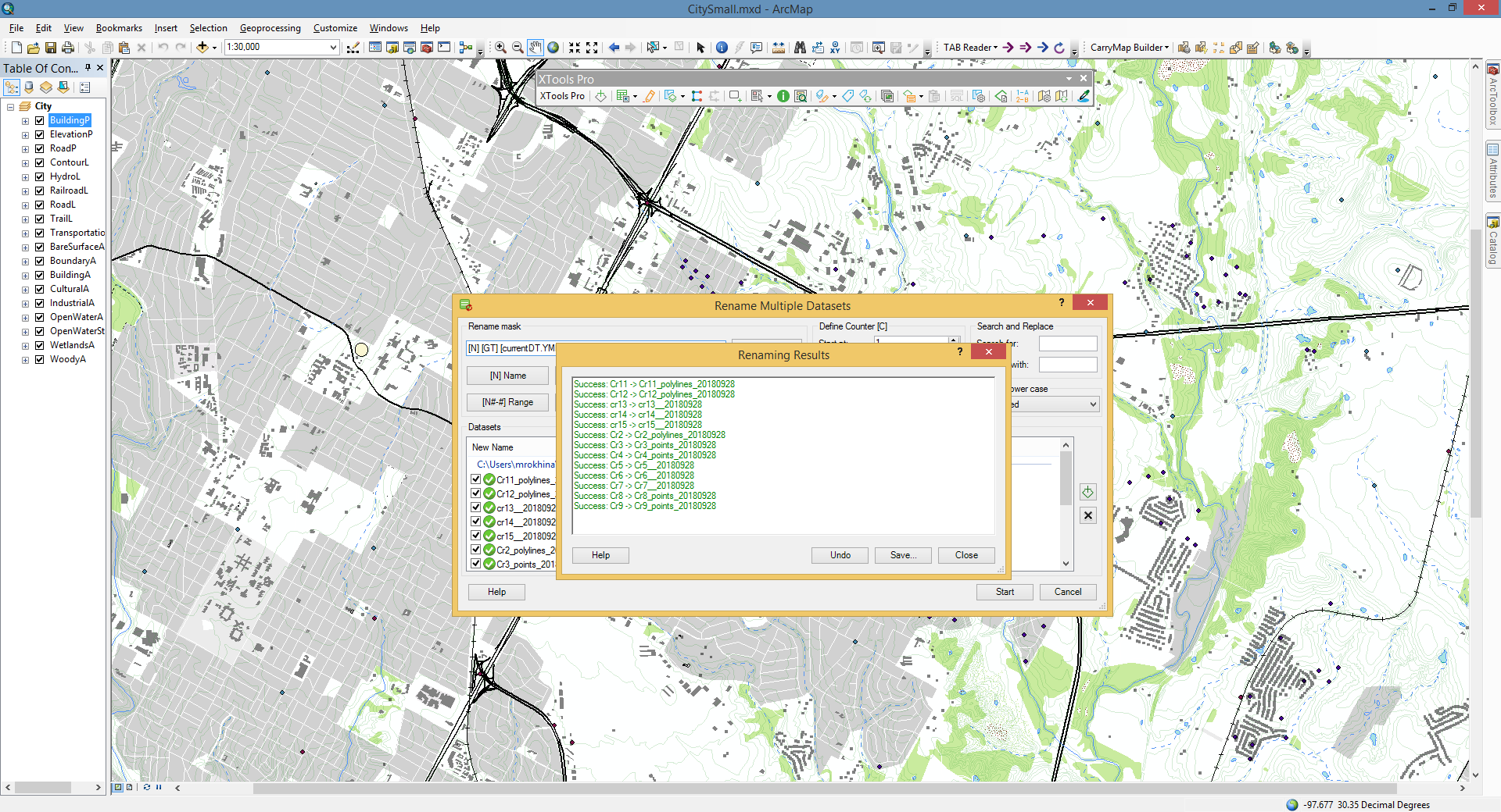
The toolset that allows creating new geodatabases, feature classes and tables, deleting datasets, changing data sources and also renaming multiple datasets in an advanced way.
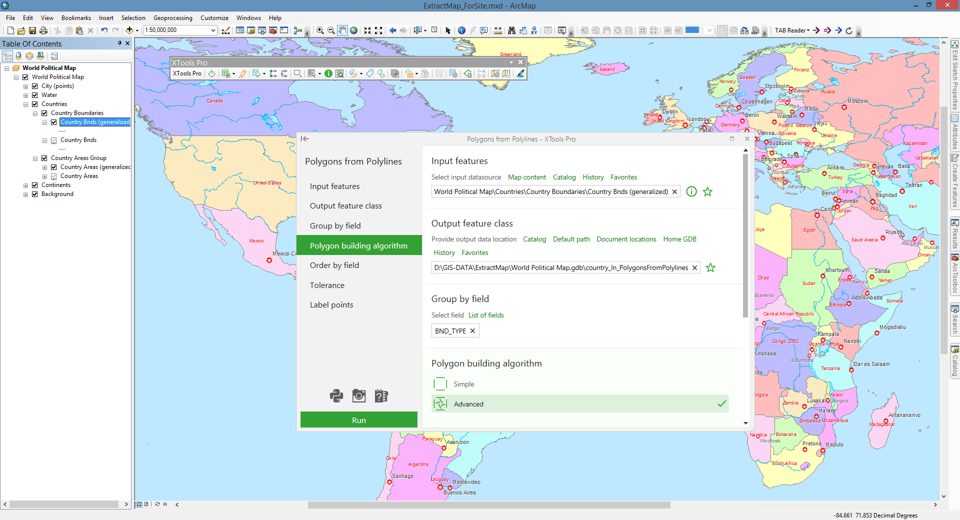
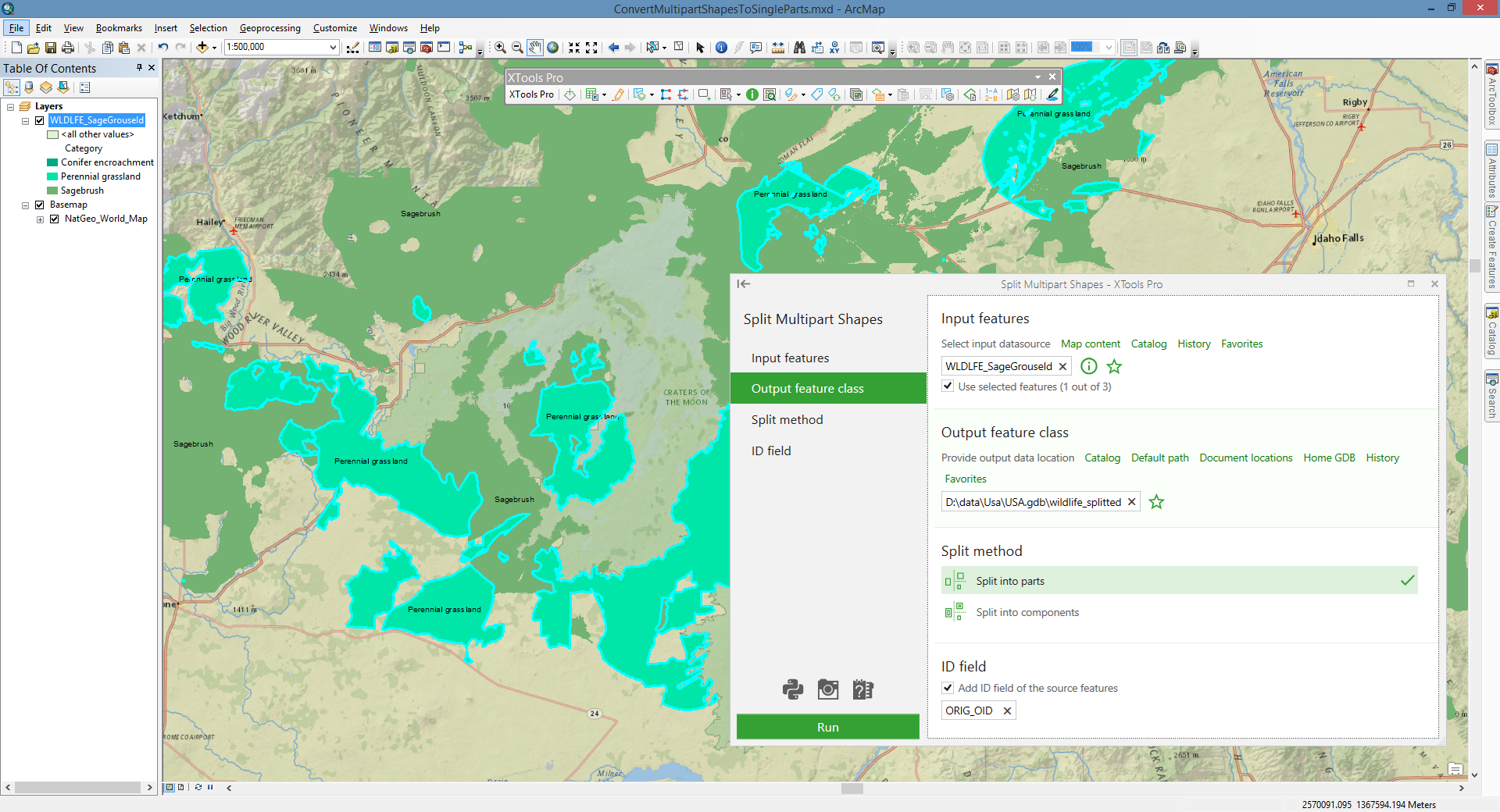
The series of tools for processing feature classes, including tools for performing various conversions between feature types, for work with multipart features and graphic objects.
The series of tools to transform geometry of feature classes, including tools for aligning, attracting, dispersing, simplifying and splitting features.
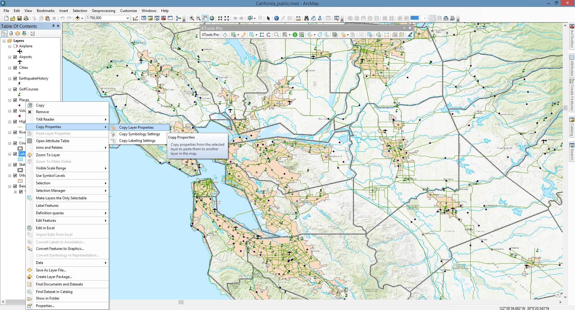
The toolset provides various capabilities for work with map layers - copy layer properties between layers, define and manage definition queries, start editing layers, make layers selectable and more.
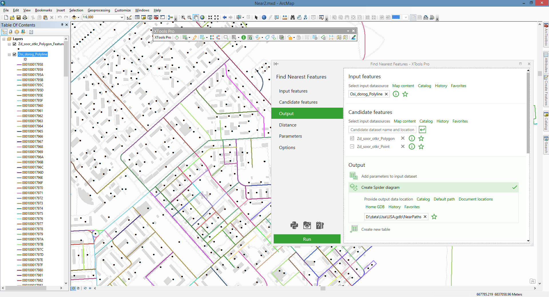
These tools are provided for performing some basic overlay operations like erase, identity and update, as well as advanced tools for finding nearest features.
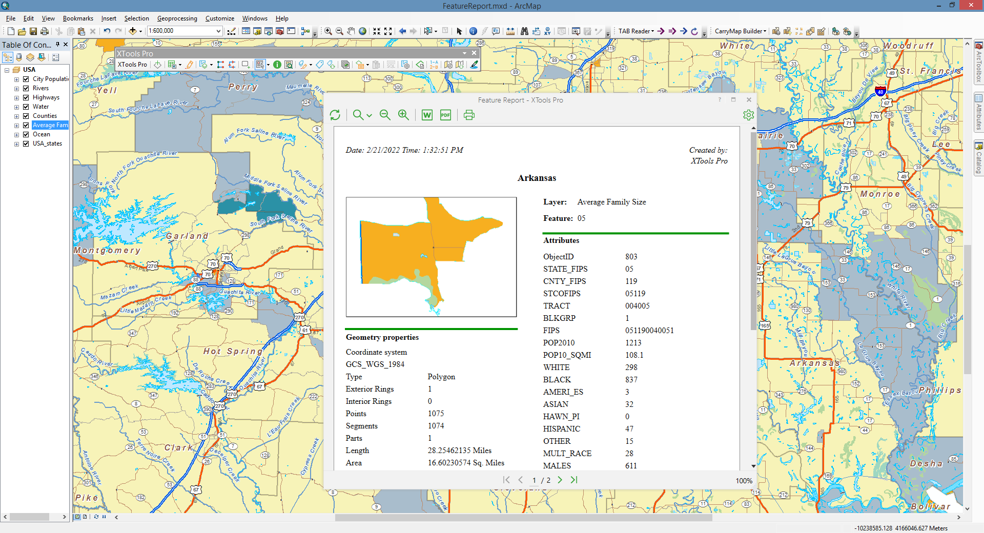
If you wish to save information about some features in a file, identify ones or edit its attributes, calculate coordinates or geometry values, sort or transfer features, this toolset will help you. Its tools also allow aggregating features by attributes.
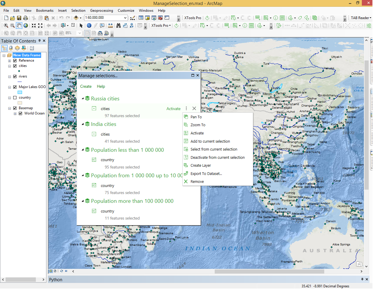
These tools allow managing selections or map scales, working with map themes, layouts or other map document information, creating backup copies, showing features nodes and directions, rotating point symbols.
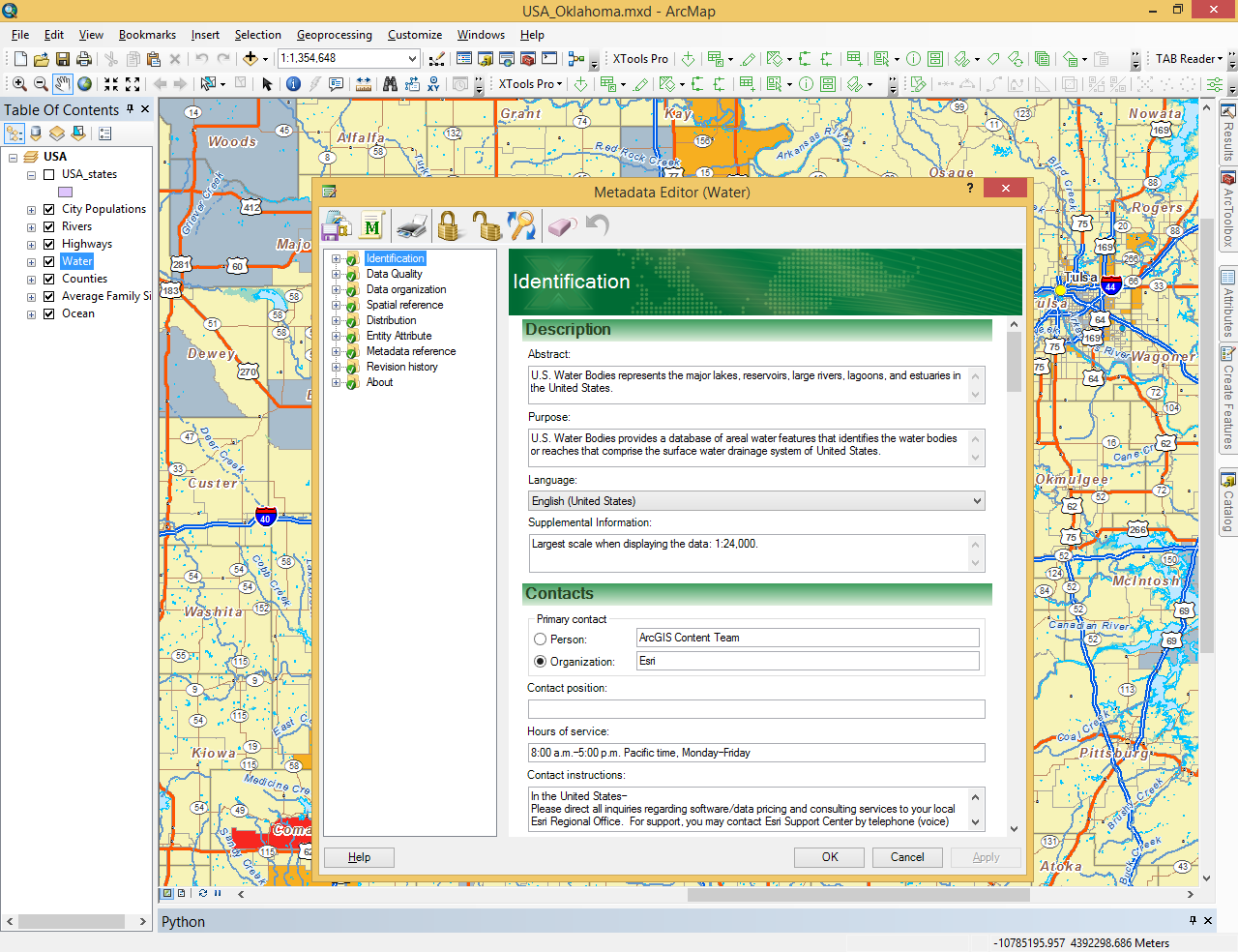
These are tools for your metadata - create, edit, view, export and clean metadata. At that, some of the tools allow for batch processing.
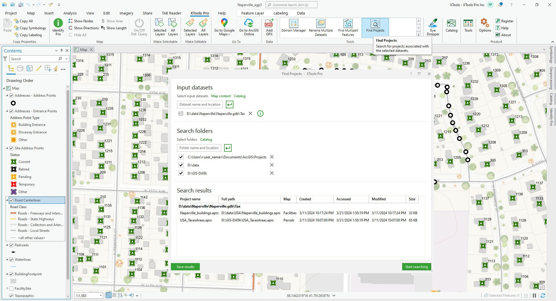
This is all about searching. With these tools you can search for features, duplicate features and multipart features on the maps. You can search for associated projects, map documents and datasets. And they can also help you find your data in Catalog or in Explorer on the disk.
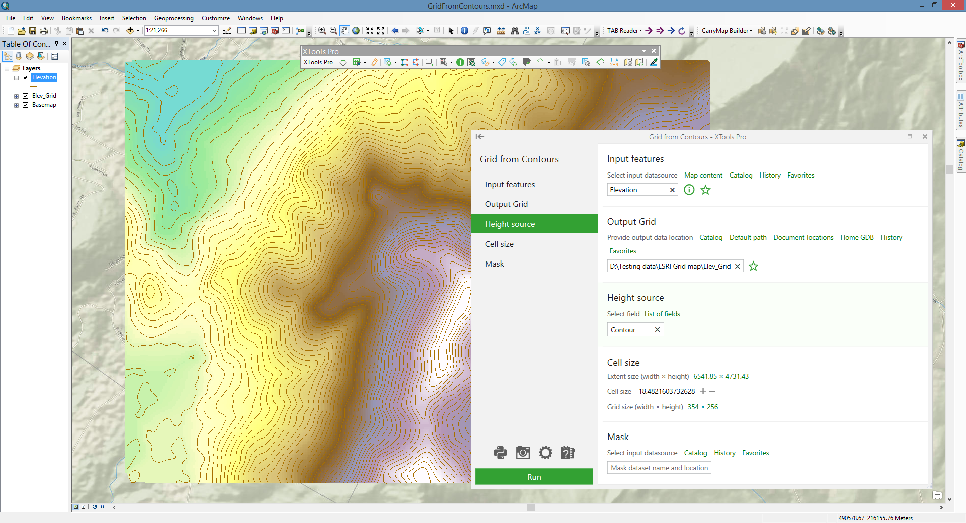
The series of tools for creating surfaces (Grids) from polyline and point data, converting Grids to contour polylines and extracting values and zonal statistics from rasters.
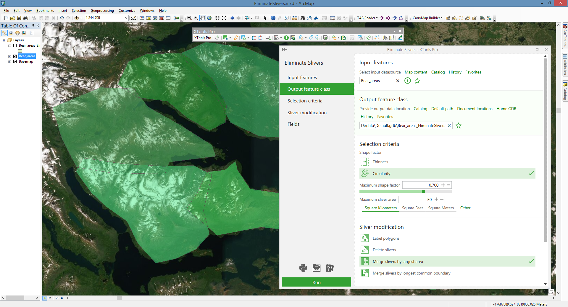
The toolset includes tools for analysis and creating new geometry based on existing features. With these tools you can calculate the polygon width, construct the inner and outside center lines, create random points, build convex or concave hulls for your features. This toolset also provides opportunities to find intersection points in your features, eliminate slivers and analyze your point data with Thiessen polygons.
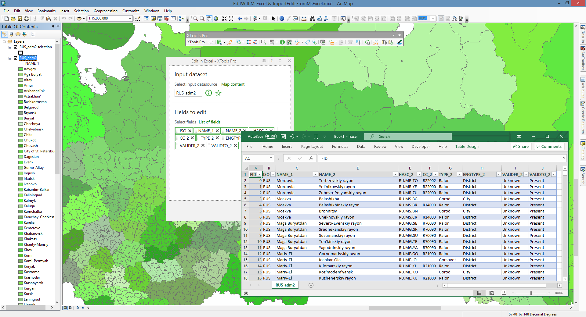
The series of tools to effectively manage your attribute tables, to edit your table data with Microsoft Excel, to delete multiple fields at once, to collect various statistics and modify tables in many advanced ways.
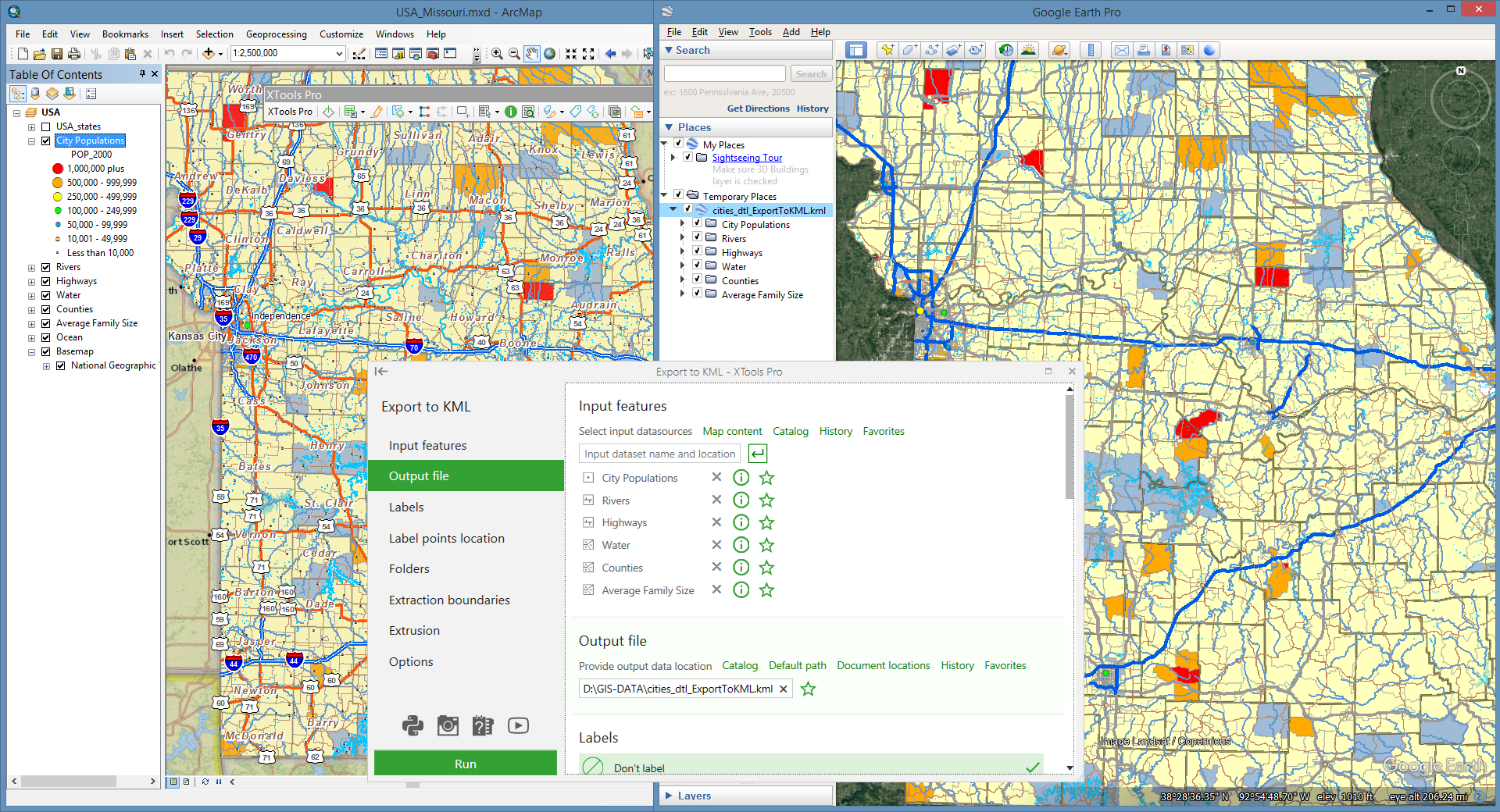
The toolset that allows extracting maps, exporting coordinates and tables to Excel, text files and also importing or exporting KML and GPX files.
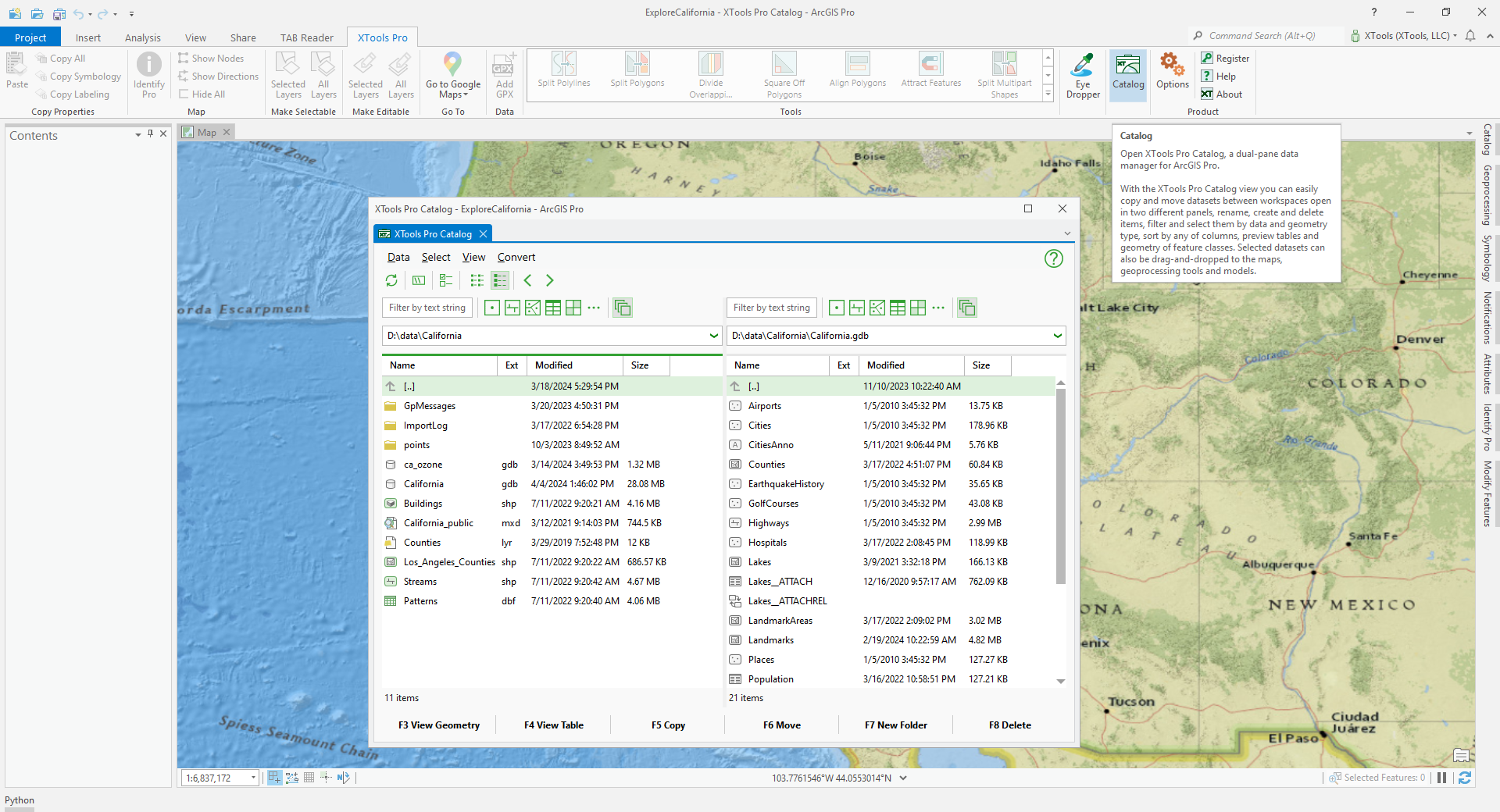
This group includes data manager XTools Pro Catalog, Eye Dropper, Interactive and Go To tools and features for working with GeoRSS, GPX and ArcGIS Pro layer files.