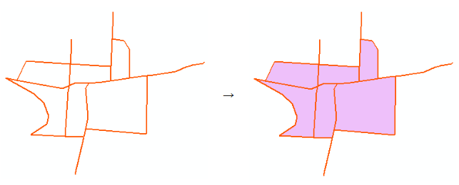
Polygons from Polylines
Allows converting polylines into one or multiple polygons.
 Available in XTools Pro for ArcMap and for ArcGIS Pro
This tool allows converting polylines into one or multiple polygons. Source polylines can be single part, multi-part or mixed in the layer. Resulting polygons can be saved in a new shapefile or as a geodatabase feature class.
Polygon building algorithm
There are two algorithms to build polygons from polylines.
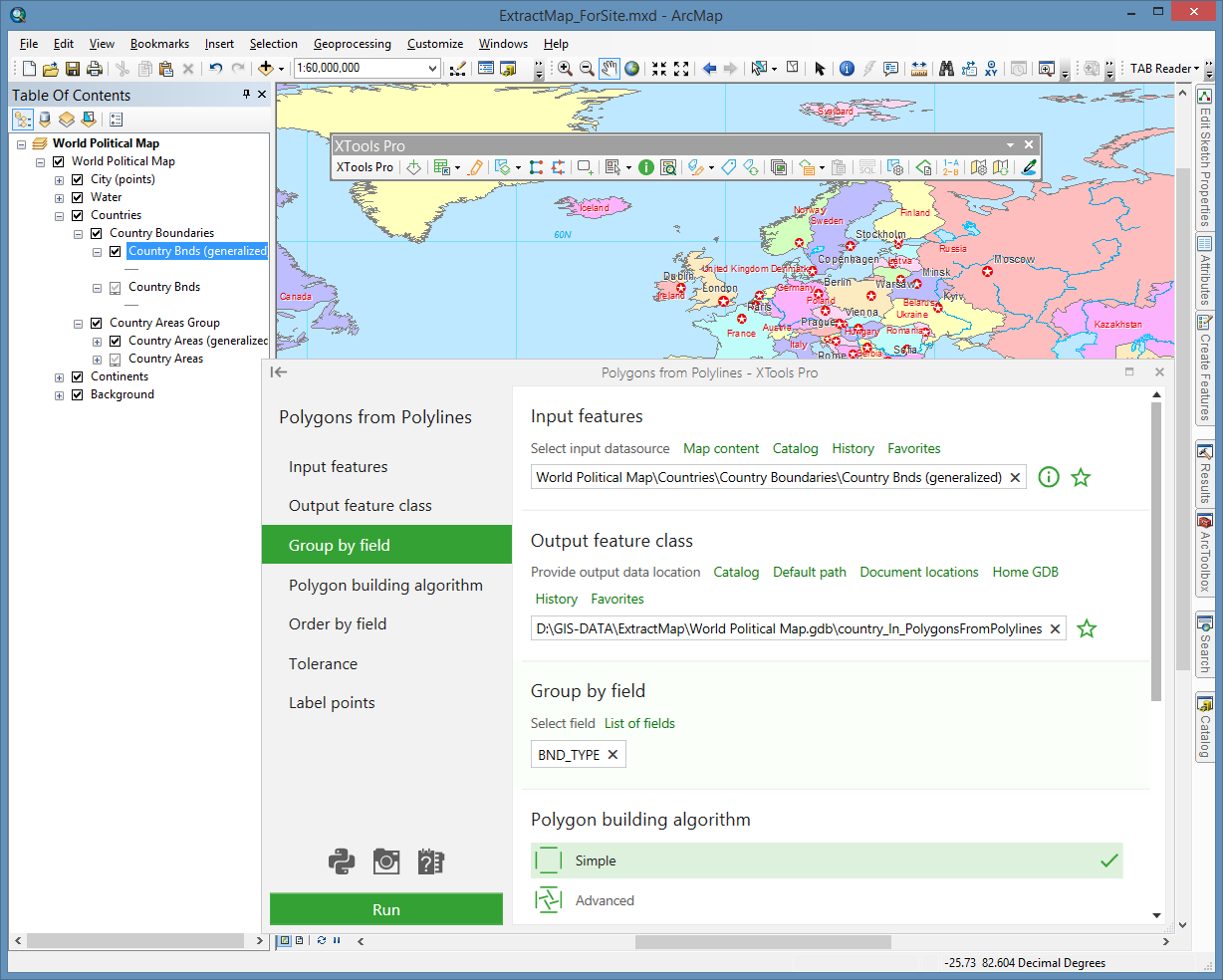
Simple algorithm – for this method the polylines do not need to be snapped together. Gaps between polylines will be bridged with a straight line. But the order of input polylines, sorting, and topological accuracy of the input data are very important to get the expected result. The tool does not break the polylines at the crossing points, that is, you will need to manually remove intersections and dangling nodes related to these intersections and only after that to run the tool using the simple algorithm option on the newly prepared polyline layer.
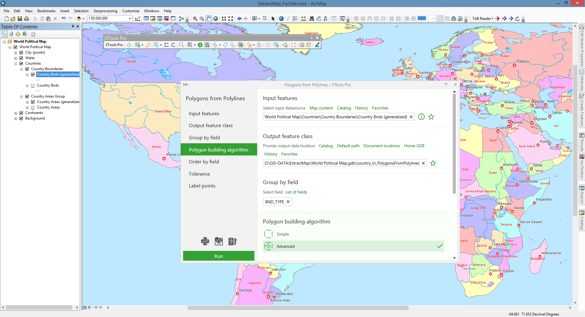
Advanced algorithm – this method does not require specifying the field for ordering and does not consider the digitizing order or the input polylines sorting. Unlike the simple algorithm, the advanced algorithm allows building more accurate polygons and does not require checking the topological accuracy of the input data.
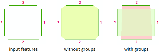
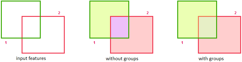
Group by field
The Group by field option allows creating multiple polygons by selecting the field, by which the input features will be grouped.
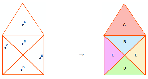
With Simple building algorithm
With Advanced building algorithm
Order by field
The Order by field option allows specifying the order of input polylines for polygons creating. The option can be used if input features order is known and should be considered. Input features direction is also taken into account when ordering.
The option is available only for Simple building algorithm.
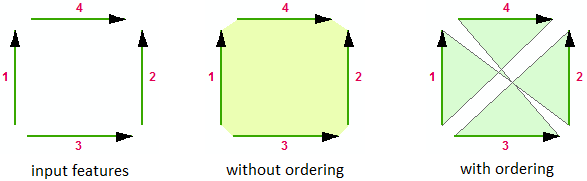
By default no field is selected. As an example, ordering can be defined either by the FID field (the polylines digitizing order) or by any other appropriate attribute field.
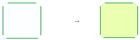
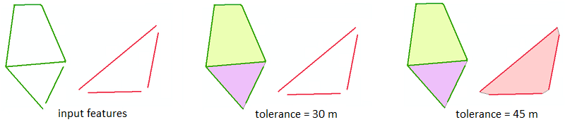
Tolerance
The Tolerance option allows specifying the distance between lines that are not connected with each other, within which the points coordinates are considered identical (with Simple building algorithm).
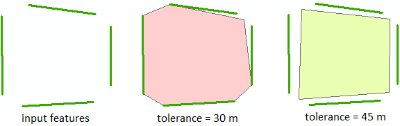
Specifying the tolerance with Advanced building algorithm, you can decrease number of “dangling” polylines and so get more output polygons without preliminary topological correction of the input data.
Label points
The Label points option allows using the point feature class as the labels source for the output polygons. The attribute field specified in the Display Expression on the Display tab of the point layer properties is used as label values. As a result, the label values from the specified point layer will be saved in the attribute table of the output polygons (Label field).