September 28, 2018
Reading time: 2 minute(s)
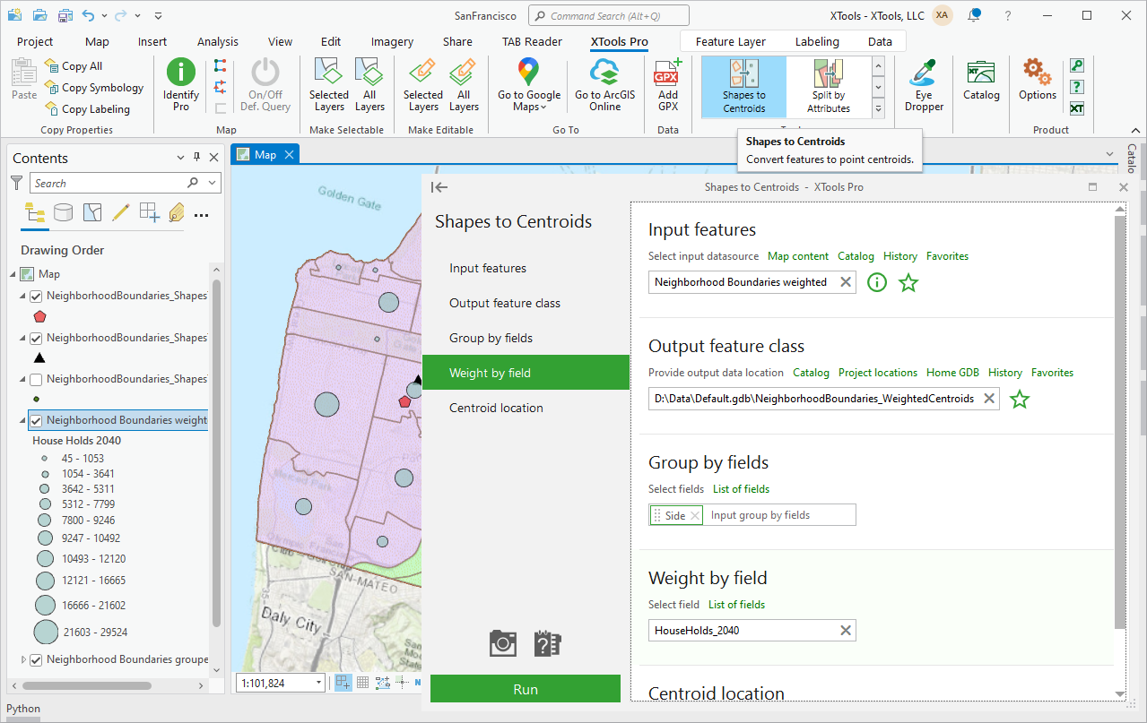
Shapes to Centroids
Reading time: 2 minute(s)
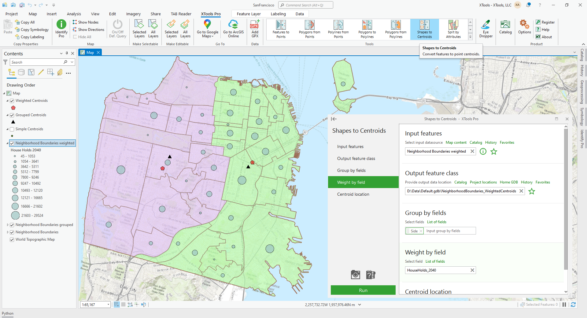
Creates new point feature class from centroids of shapes in input feature layer.
 Available in XTools Pro for ArcMap and for ArcGIS Pro
The “Shapes to Centroids” tool creates a new point feature class from the centroids of the shapes in the input feature layer.
Layers of any geometry type are supported by the tool:
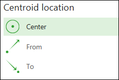
- For polygon layers in addition to the center point a label point can also be derived (in this case centroid is always placed within a polygon).

- For polyline layers FROM and TO points are available in addition to the center points.
- For multipoint layers both the center points and the nearest to center real points are the options.

Points and any other objects can be grouped by one or several attributes and centroids for feature group can be created.
Examples of using the tool:
- Use it to represent two properties of the same shapefile at the same time. Use the input layer legend to represent the first property while the legend of the new centroid point layer will represent a second property using the transferred attributes.
- Use it for spatial joins. Suppose you have two polygon shapefiles A and B. You want to transfer attributes of A to B. Of course, you could do something like an overlay, but sometimes this is undesirable. Also, there are no unique identifiers identical for two layers on which you could make a normal join. Here is one of the approaches to the task accomplishment: create a centroid layer from shapefile B, and then create a spatial join with shapefile A. Now the data from the polygons from A may be joined to the centroid shapefile (you cannot perform a spatial join in case when the data from points were transferred to polygons, because there might be more than one point inside one polygon). Since you have the unique identifiers from B in your centroid layer, you can now join the centroid layer to the layer table of B. Data transferred!