XTools Pro 20 Released
The new XTools Pro 20 version for ArcMap introduces such new tools and features as GPX and ArcGIS Pro LYRX plug-in data sources, Import/Export to GPX, Export Coordinates, Eye Dropper and updated Table to Excel, Table to Text tools. The new version can be installed and used with the new ArcGIS 10.8.
In XTools Pro 20 version for ArcGIS Pro users will find a few geoprocessing tools, new tools - Add GPX, Import/Export to GPX, Export Coordinates, Make Layers the Only Selectable, Make All Layers Selectable, updated Table to Excel, Table to Text, Scale Manager tools and more properties added to the Copy Properties tool.
What’s new in XTools Pro 20 for ArcGIS Pro
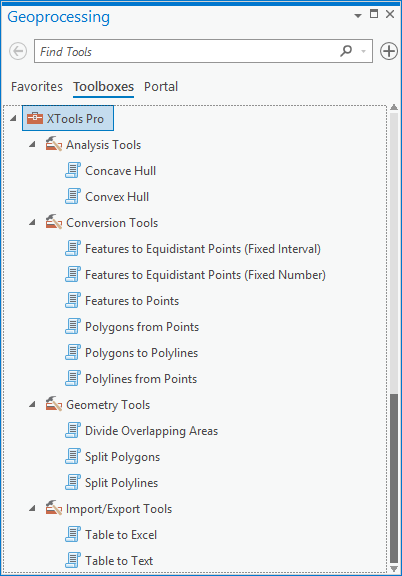
Geoprocessing tools
Following geoprocessing tools have been added and are available from ArcToolbox:
- Conversion Tools include Features to Points, Features to Equidistant Points (Fixed Interval), Features to Equidistant Points (Fixed Number), Polygons from Points, Polygons to Polylines, Polylines from Points
- Import/Export Tools include Table to Excel, Table to Text
- Geometry Tools include Divide Overlapping Areas, Split Polygons, Split Polylines
- Analysis Tools include Convex Hull, Concave Hull
GPX Plug-in data source
Now you can directly read GPX files (version 1.0 and 1.1) in ArcGIS Pro.
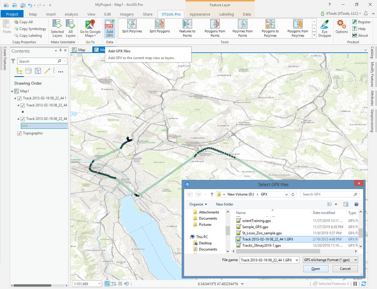
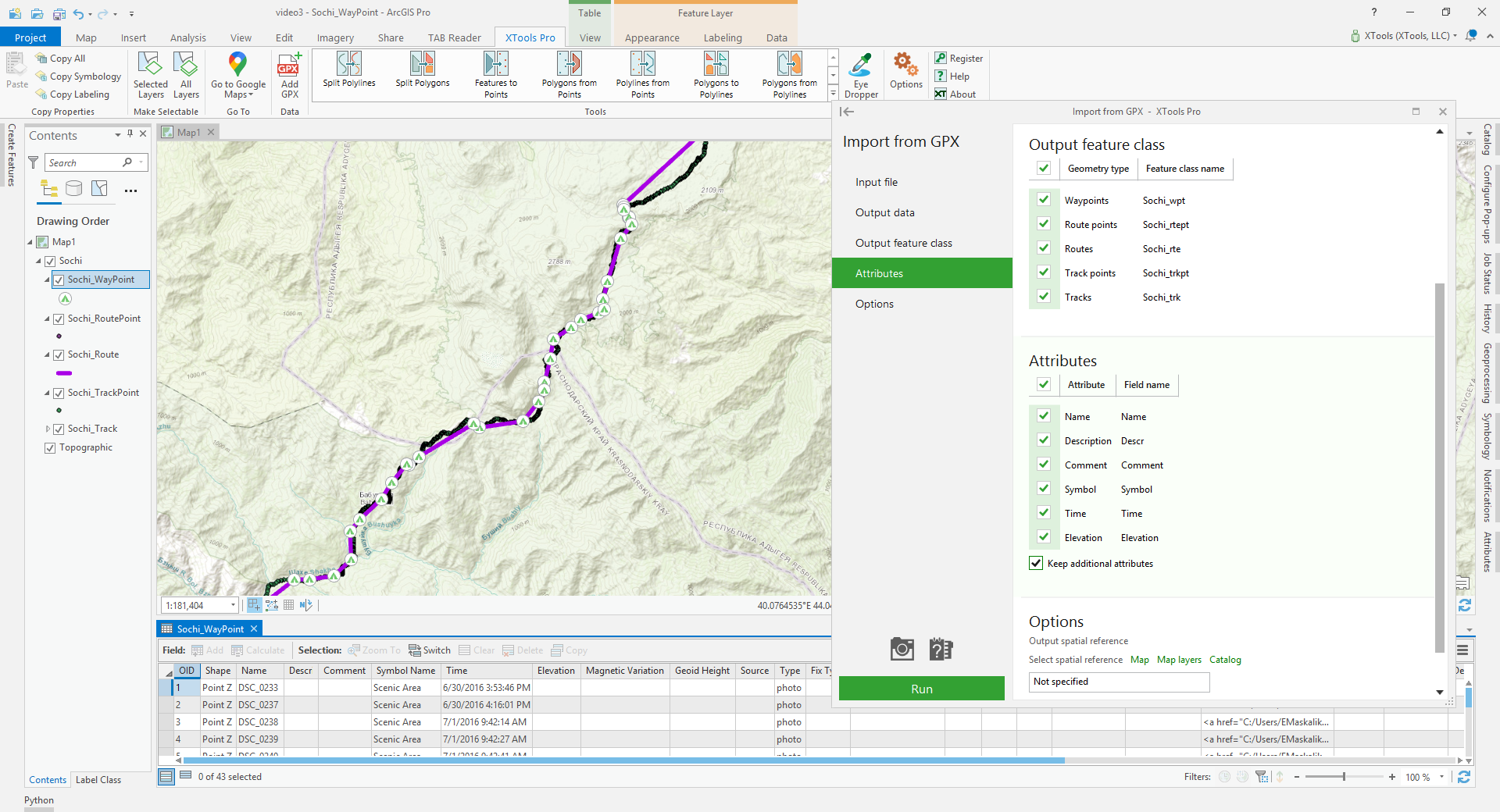
Import from GPX
- A new tool imports GPX files to shapefiles and geodatabase feature classes (points and polylines) keeping all attributes (including extensions).
- Output spatial reference and time zone can be modified when importing GPX files.
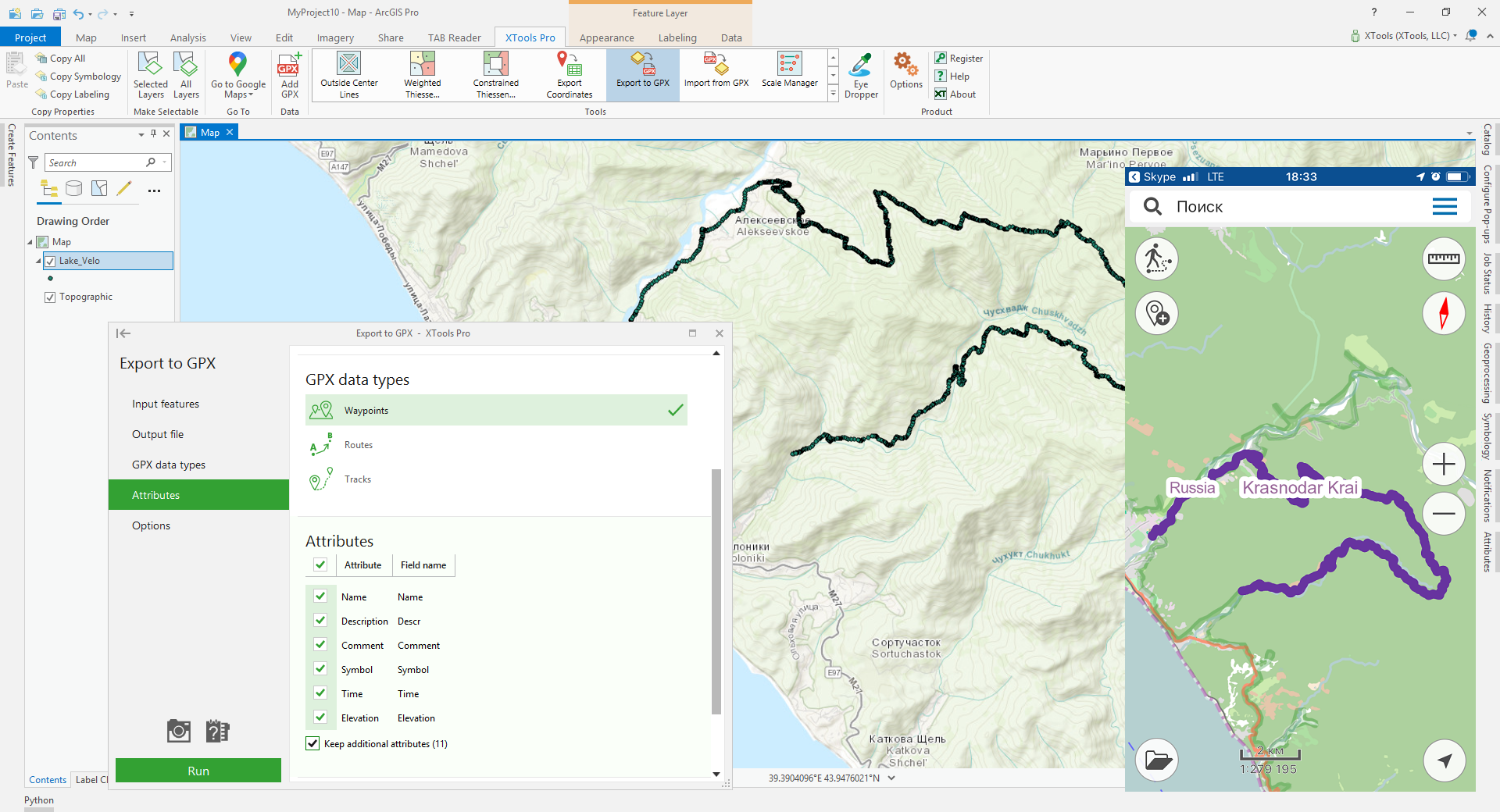
Export to GPX
- A new tool allows exporting point and polyline features from shapefiles or geodatabases to GPX file (version 1.1) for use on mobile devices.
- Time zone of input features or "zero date" can be set to record timestamps in output GPX file.
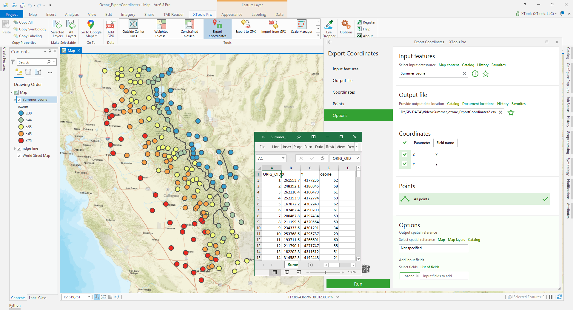
Export Coordinates
A new tool for exporting coordinates of point, multipoint, polyline and polygon features to Excel (.xlsx) or text files (.csv).
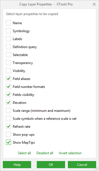
Copy Layer Properties
More layer properties are now supported. Such properties as field properties (aliases, number formats and visibility), elevation, refresh rate and showing MapTips can now be copied between layers.
Make Layers the Only Selectable, Make All Layers Selectable
A couple of new features for ArcGIS Pro users to easily and promptly manage layers selectability in the maps.
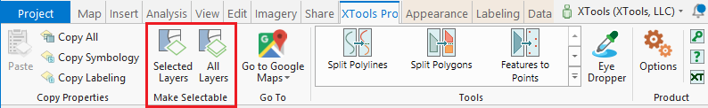
Table to Excel
- The reworked tool allows exporting tables to Microsoft Excel files (.xlsx).
- A new option "Open file after exporting" is added to open output files in the Microsoft Excel application right after exporting.
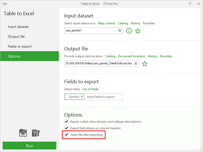
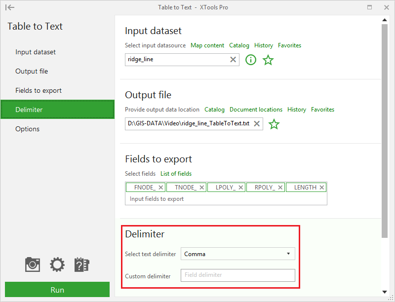
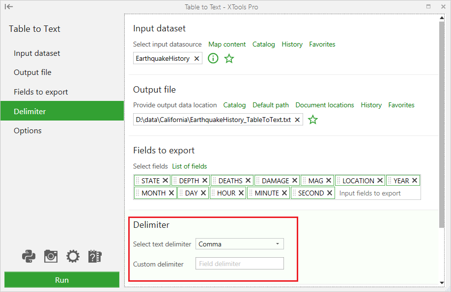
Table to Text
- The tool has been reworked from the Table to File tool.
- New tool allows to specify a delimiter to separate fields in the output text file.
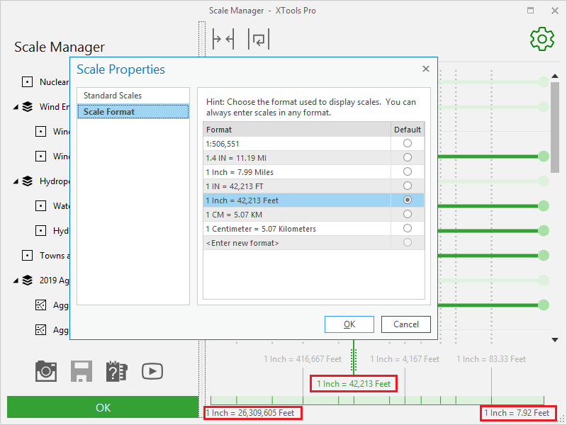
Scale Manager
Specified scale format is now supported for use in a map scale grid.
Options
XTools Pro user interface theme (dark or light) is now changed with the ArcGIS Pro application theme (see ArcGIS Pro Options).

Other changes
- XTools Pro 20.0 can be used with ArcGIS Pro 2.4 - 2.5 versions.
- New notifications in the ArcGIS Pro Notifications pane.
- Minor bug fixes and enhancements.
What’s new in XTools Pro 20 for ArcMap
ArcGIS Pro LYRX Plug-in data source
- Now you can bring ArcGIS Pro layer files (.lyrx) directly to ArcMap.
- Save as Layer file command of LYRX file context menu allows saving ArcGIS Pro layer file as ArcMap layer file without adding it to map.
GPX Plug-in data source
Now you can directly read GPX files (version 1.0 and 1.1) in ArcMap.
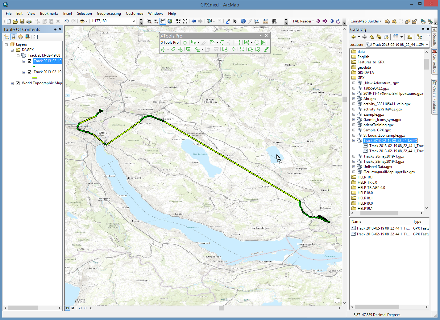
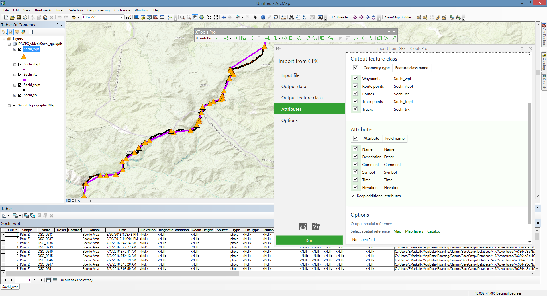
Import from GPX
- A new tool imports GPX files to shapefiles and geodatabase feature classes (points and polylines) keeping all attributes (including extensions).
- Output spatial reference and time zone can be modified when importing GPX files.
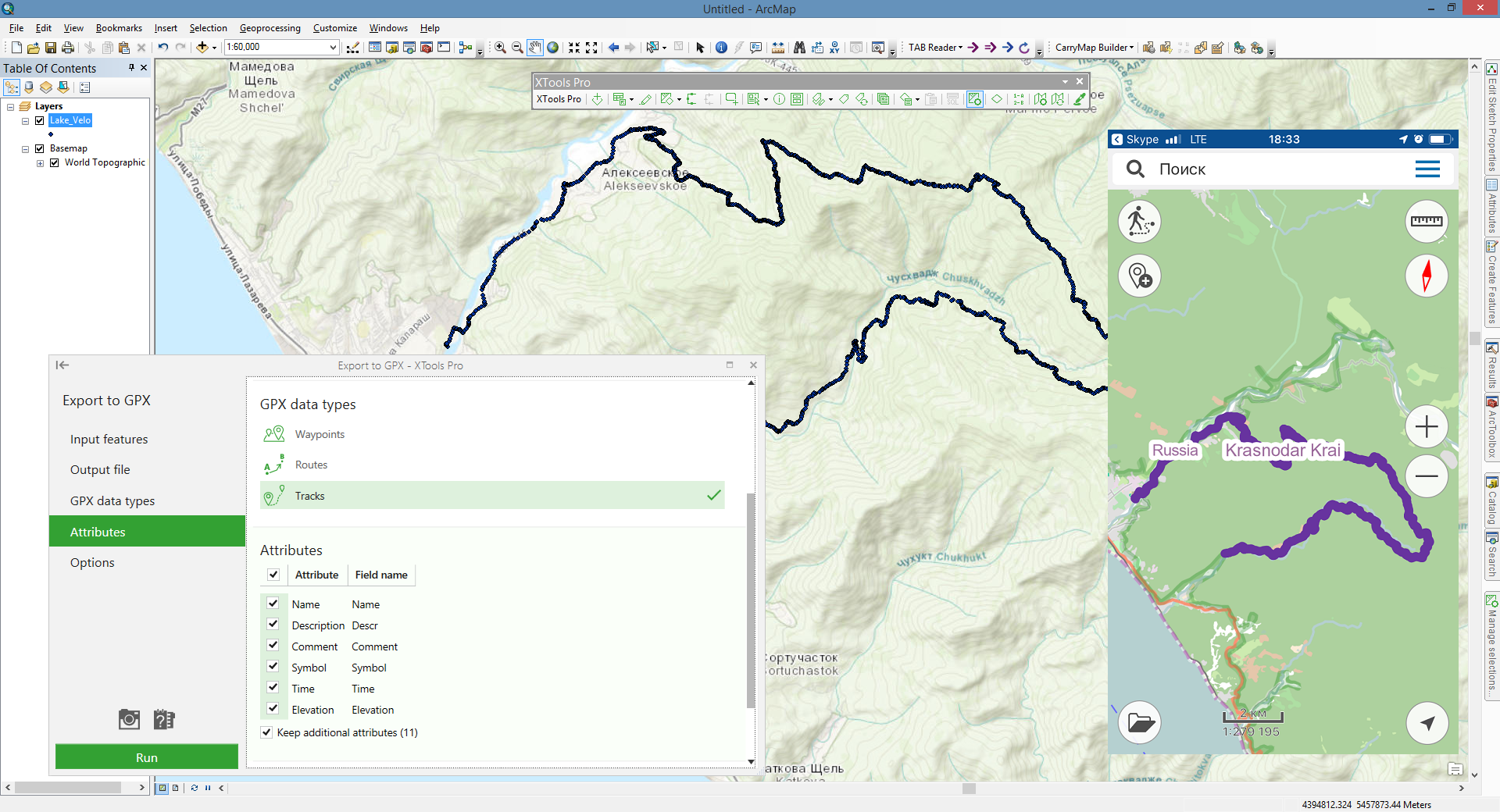
Export to GPX
- A new tool allows exporting point and polyline features from shapefiles or geodatabases to GPX files (version 1.1) for use on mobile devices.
- Time zone of input features or "zero date" can be set to record timestamps in output GPX files.
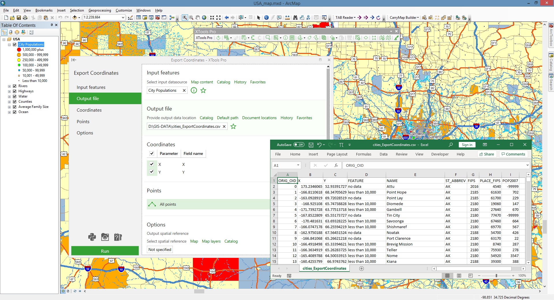
Export Coordinates
A new tool for exporting coordinates of point, multipoint, polyline and polygon features to Excel (.xlsx) or text files (.csv).
Eye Dropper
A new feature for picking colors on the maps or from other applications and online services (ArcGIS Pro, ArcGIS Online etc.) and saving them to style gallery for reuse later.
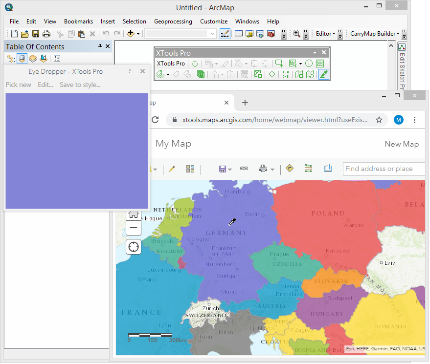
Table to Excel
- The reworked tool allows exporting tables to Microsoft Excel files (.xlsx).
- A new option "Open file after exporting" is added to open output files in the Microsoft Excel application right after exporting.
- New geoprocessing tool is available in the Table Operations toolset.
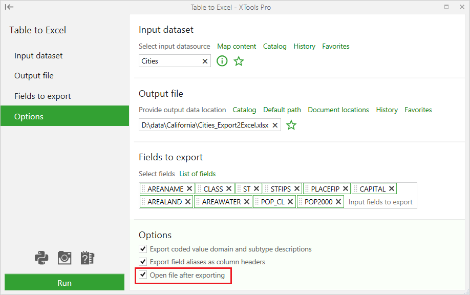
Table to Text
- The tool has been reworked from the Table to File tool.
- New tool allows to specify a delimiter to separate fields in the output text file.
Data Source Manager
- Fixed “Apply to” functionality.
- Fixed templates for maps with duplicated data sources.
- Now status marks (Changed, Invalid) for data sources are correctly updated.
Support for ArcGIS 10.8
XTools Pro 20 version can be installed and used with ArcGIS 10.8.