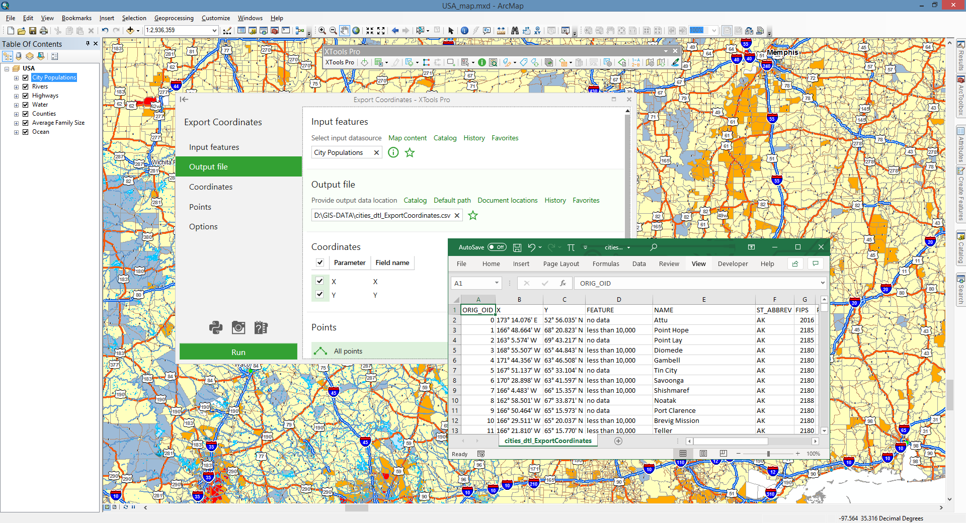
Export Coordinates
Exports X, Y and Z coordinates of point, multipoint, polyline and polygon features to Excel (.xlsx) or text file (.csv).
 Available in XTools Pro for ArcMap and for ArcGIS Pro
The Export Coordinates tool exports X, Y and Z coordinates of point, multipoint, polyline and polygon features to Excel (.xlsx) or text file (.csv).
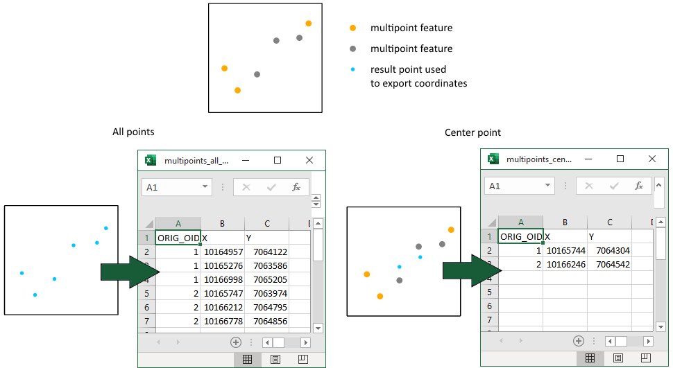
X, Y, Z coordinates of the following feature points can be exported:
-
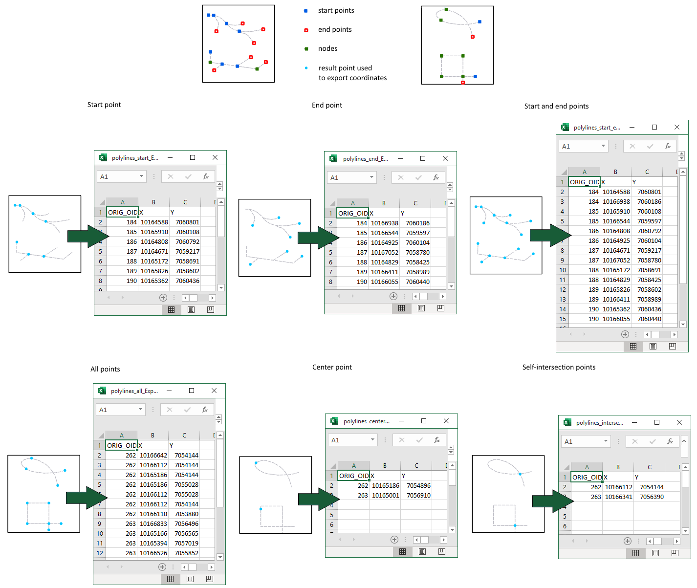
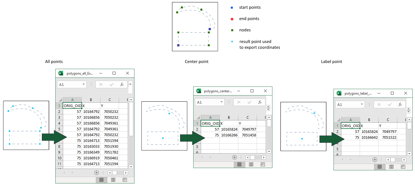
All points - coordinates of all feature nodes will be exported (for points, multipoints, polylines and polygons).
-
Start point - coordinates of only start points will be exported (for polylines).
-
End point - coordinates of only end points will be exported (for polylines).
-
Start and end points - coordinates of both start and end points will be exported (for polylines).
-
Center point - coordinates of centroid (for multipoints and polygons) or midpoint (for polylines) will be exported.
-
Self-intersection points - coordinates of self-intersection points will be exported (for polylines).
-
Label point - coordinates of label points will be exported (for polygons).
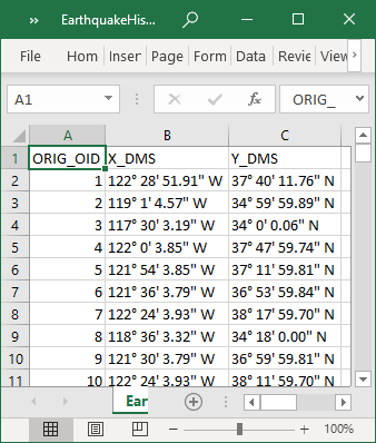
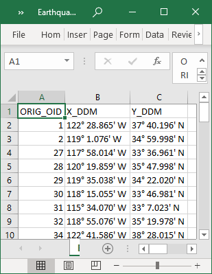
At that there are options to specify required spatial reference that will be applied only to the output coordinates, convert angular units to DMS or DDM formats and you may also select input attribute fields to add them to output table.
Notes:
-
Z coordinates are exported only for feature classes with Shape field having Z.
-
For polygon layers only X and Y coordinates will be exported. Z coordinate is not supported for polygons.
-
Label points are always taken inside polygons.
-
Multipart input feature (polyline or polygon) are considered as single feature with one start, one end, one center and one label points. If you need to export coordinates of these point types for each part separately, it is recommended to split multipart features to single part shapes before running the tool.
-
Output table will contain the field with ID of input features (called as ORIG_OID field) by default for matching input features and output records.
Examples
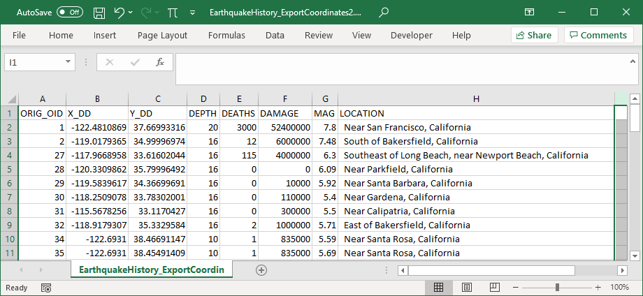
For points:
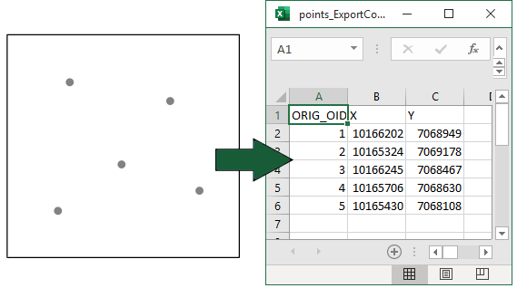
For multipoints:
For polylines:
For polygons:
Angular units in DMS or DDM formats:
Added input fields:
 Paid tool. Try this and all other XTools Pro features free for 14 days or buy XTools Pro license now.