Feature Report
Allows creating reports on selected features.
 Available in XTools Pro for ArcMap
The XTools Pro Feature Report tool is an additional and alternate way for creating reports in ArcGIS. Feature reports display feature geometry and include attribute and geometry information derived from the selected feature(s). Created reports can be modified, printed and exported to MS Word file for editing or to PDF file for distribution purposes.
Supported report templates
- Feature Report
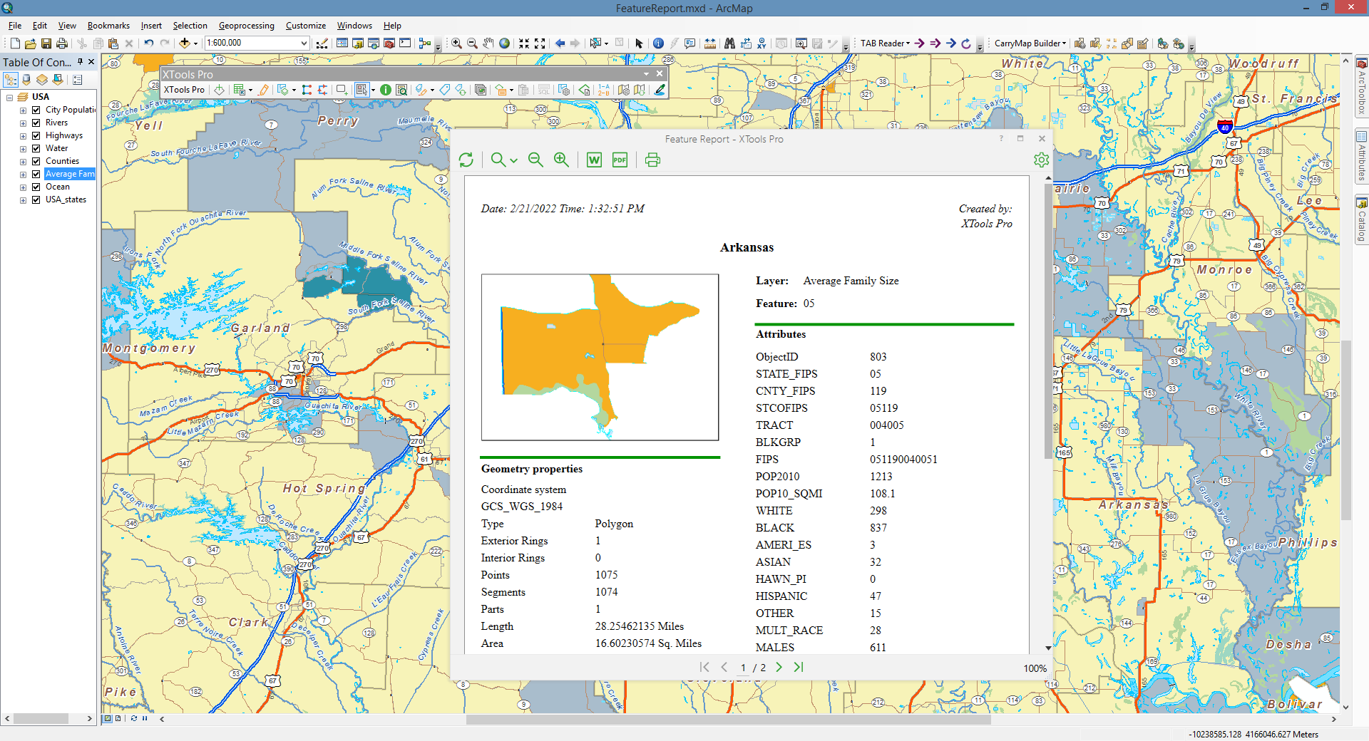
Contains information about one selected feature of a feature layer: feature geometry, attributes and geometry properties.
Besides, this report template also supports joins. If there are any tables joined to the target feature class attribute table, then by default joined attributes will be displayed in reports. Attributes values are displayed according to the fields settings specified in the layer properties.
At that, there are options in the Report properties allowing to hide joins or hide geometry information.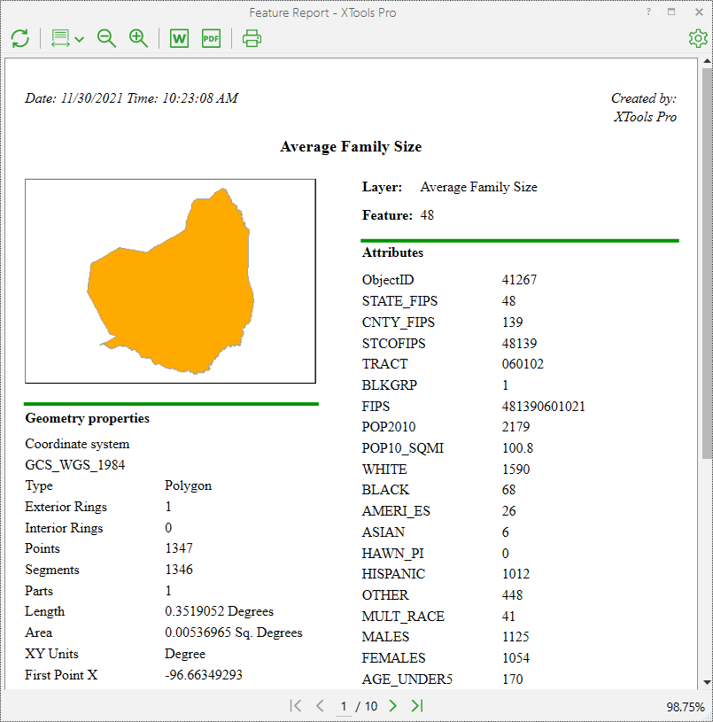
- Feature Report with Relates
Contains basically the same information as simple feature reports but in addition they allow to display relates, if any tables are related to the feature class.
Feature Reports with Relates created on the features with related tables display an additional section "Related tables" in the lower right corner (or on the next pages if there are too many attribute fields).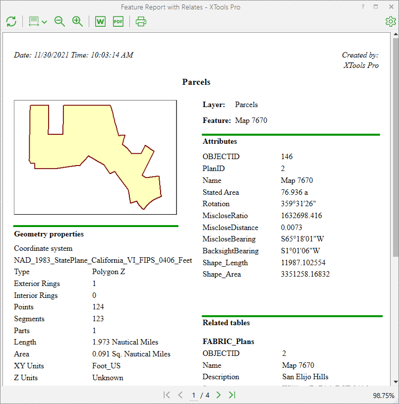
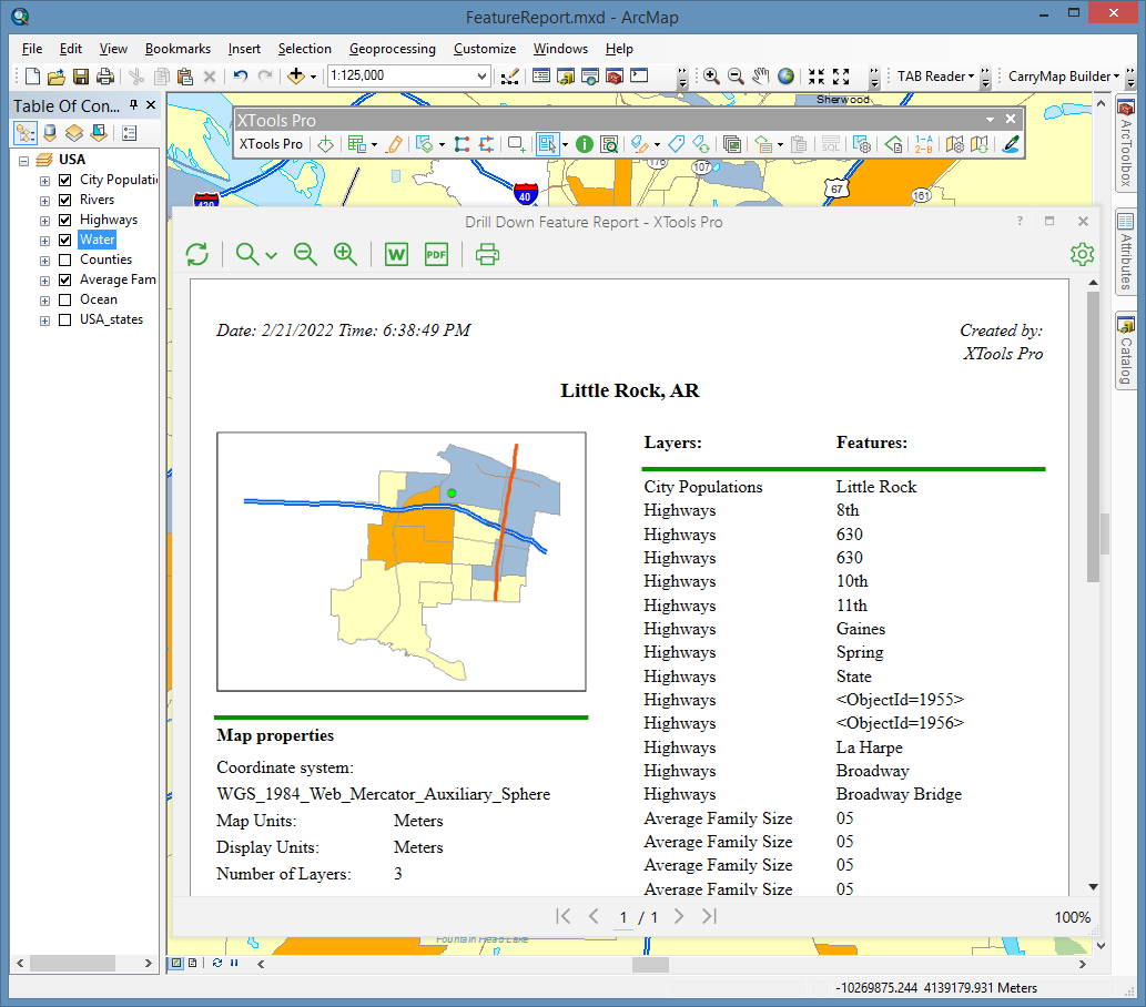
- Drill Down Feature Report
Displays information about all the layers found under cursor: features geometry, coordinate system, units, number of layers, layer names and features attributes (displayed attribute is taken from the layer's primary display field). Layers order in Drill Down Feature Reports is the same as the layers order in the table of contents window.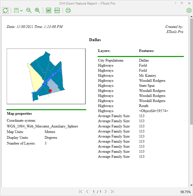
Creating Feature Reports
To start creating reports with the “Feature Report” tool select the tool in the XTools Pro toolbar and a report template to be used.
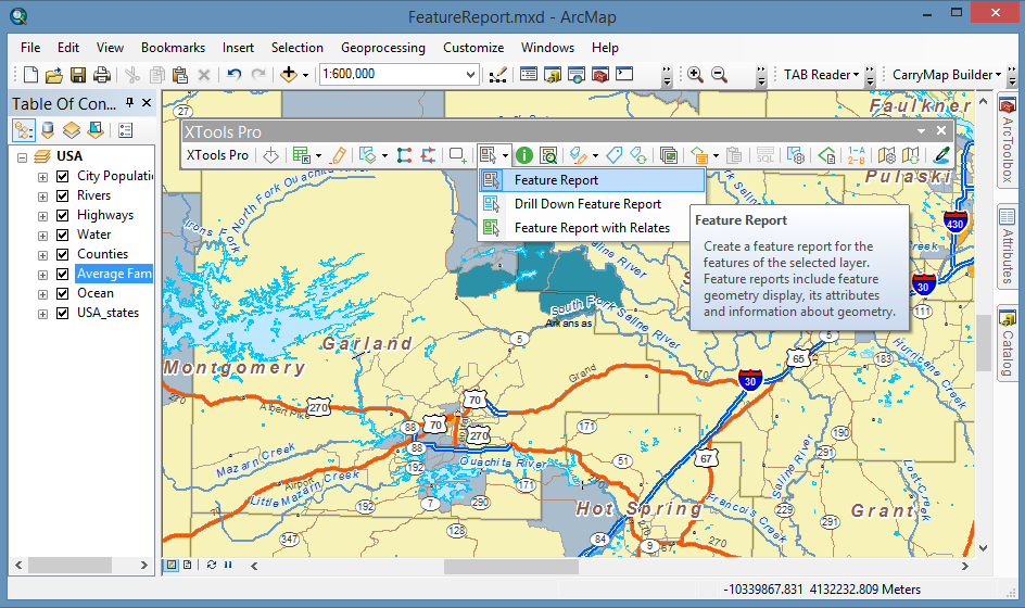
If you choose to create Feature Report then you need to select also a feature layer in the table of contents window. After that, just click on the required feature on the map, and the report will be generated and displayed in a separate window. Chosen features are flashed in the map. Generated feature reports can be modified, refreshed, printed out, exported to MS Word or PDF file.
Options
Modification capabilities in the Report properties include the following sections:
- General
- you can specify the report author and change the title, show/hide joined fields and feature geometry information. - Measurements
- you can define the Unknown units, specify the spatial reference and measuring units to display the feature length (perimeter) and the area in the geometry properties section of the generated report. - Drawing
- feature can be drawn as a simple contour, drawn with a current symbol used in the map, or a part of the map with all other layers can be displayed. - Text styles
- you can specify your own font and font size for different parts of the report. Also the text can be made bold, italicized, or underlined and aligned with the left or right side, or centered.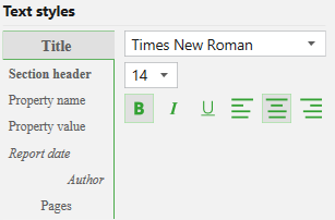
 Paid tool. Try this and all other XTools Pro features free for 14 days or buy XTools Pro license now.