Working with GeoRSS
GeoRSS is an emerging standard for encoding location as part of a web news feed. The name "GeoRSS" is derived from RSS, the most known web feed and syndication format.
 Available in XTools Pro for ArcMap
GeoRSS is an emerging standard for encoding location as part of a web news feed. The name "GeoRSS" is derived from RSS, the most known web feed and syndication format.
In GeoRSS, location content consists of geographical points, lines, and polygons of interest and related feature descriptions. GeoRSS feeds are designed to be consumed by geographic software such as map generators.
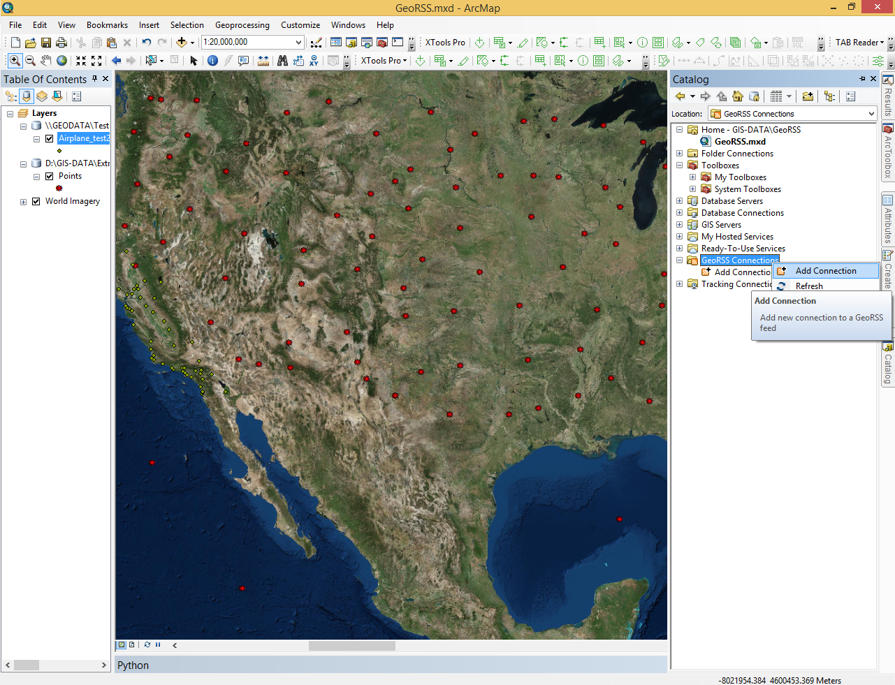
GeoRSS is supported in two ways with XTools Pro. First, XTools Pro adds an additional GeoRSS Connections node to Catalog. Here you can connect to the GeoRSS feeds and bring published data from these feeds to the maps. Then, there is an Export Data to GeoRSS tool in the XTools Pro toolbox.
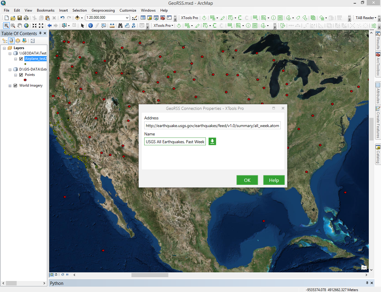
To add a new GeoRSS feed right-click on the “GeoRSS Connections” item in the Catalog window and select “Add Connection”.
In the “GeoRSS Connection Properties” window specify the address and name for the new connections and press OK. Connection name can be derived from the specified GeoRSS feed.
GeoRSS data from the connection can be added to the map for viewing the published features and their attributes. From the map these data can be further exported to the other ArcGIS formats using the standard ArcGIS capabilities.
Usually data from GeoRSS connections are “web news feeds”. If their content has been updated, you will see the small green dot on the connection icon indicating the content change. In this case you can refresh connection to get the most recent web feed.
 Paid tool. Try this and all other XTools Pro features free for 14 days or buy XTools Pro license now.