Find Nearest Features
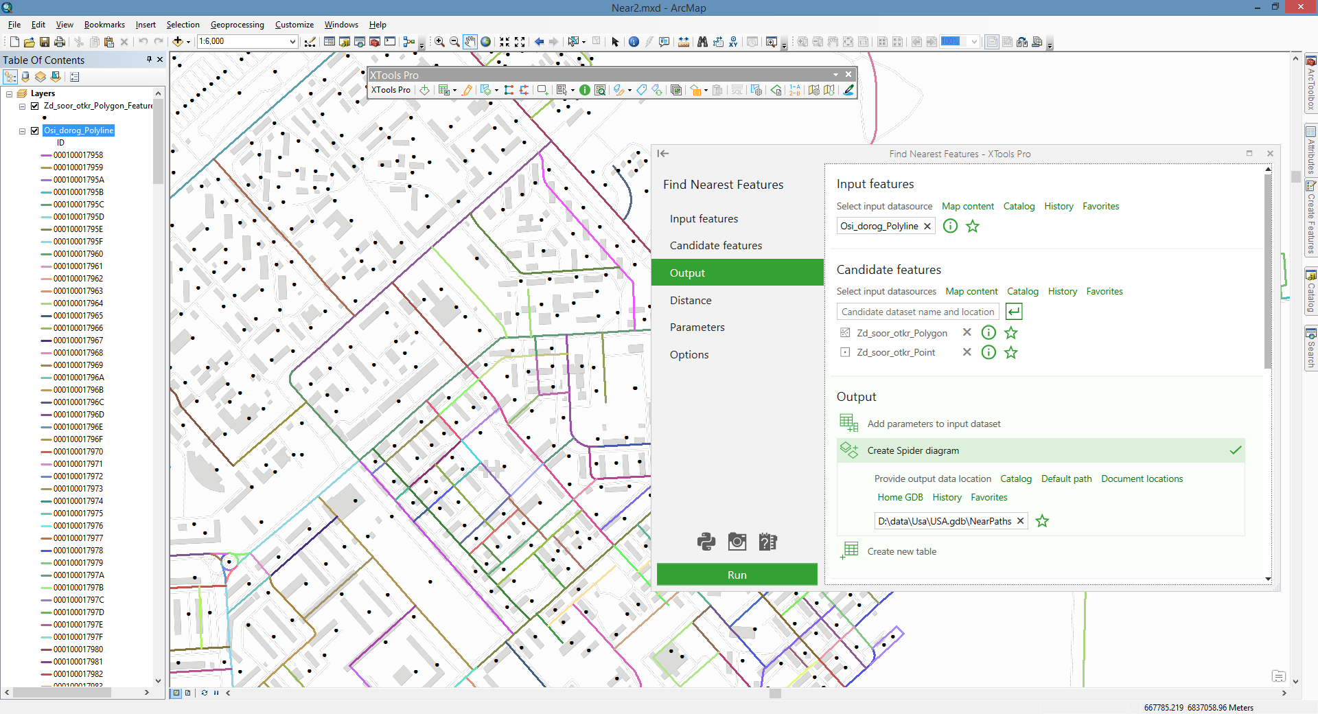
Finds nearest features from same or other layers and calculates proximity details.
 Available in XTools Pro for ArcMap and for ArcGIS Pro
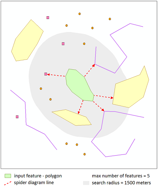
The “Find Nearest Features” tool allows finding the nearest features in specified search radius and calculates the proximity parameters. You can select Planar method or Geodesic to calculate distances between input and candidate features for finding the nearest features. Both the input and candidate features can be points, multipoints, polylines, and polygons.
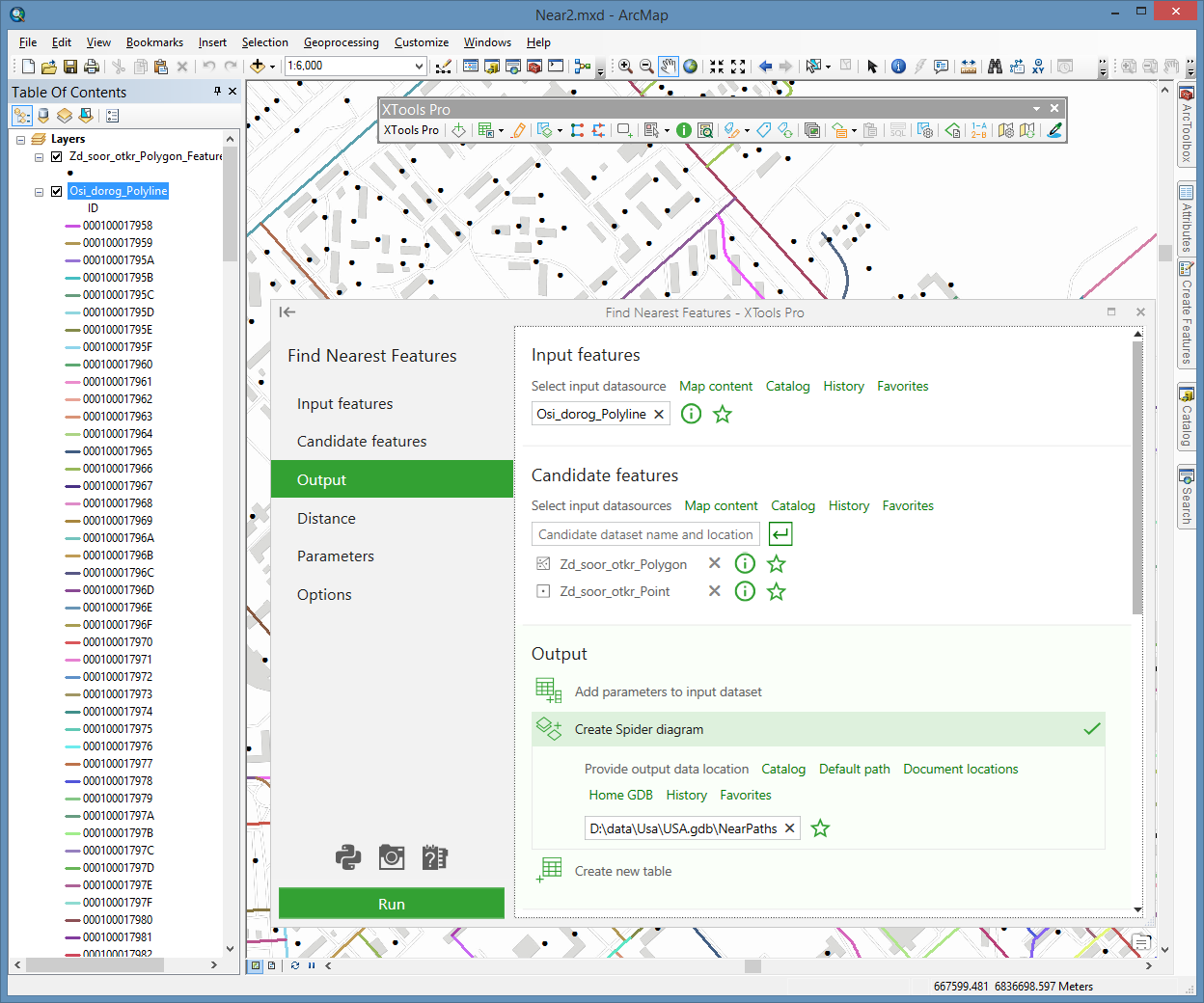
The following proximity attributes can be added to the input dataset, the created output feature class with spider diagram lines or a new table:
- Distance
- the shortest distance between input and near features (Planar or Geodesic). - Distance along line
- the distance from the first point of the near line feature to the projection of the closest input feature location onto this line (available for the line candidate features). - Near feature ID
- ID of the candidate feature containing the nearest location to the input feature. - Dataset path
- the path to candidate feature class containing near feature. - X coordinate
- X coordinate of the near feature location. - Y coordinate
- Y coordinate of the near feature location. - Angle
- the angle in degrees between a line, connecting input feature and near feature location in the shortest distance, and X-axis (0° - East, 90° - North, -90° - South, used with selected Planar distances) or North (0° - North, 90° - East, -90° - West, used with selected Geodesic distances). - Line side
- the side of near line feature (by its direction) where there is the closest input feature location (0 - left side, 1 - right side, available for the line candidate features). - Input ID
- the input feature ID which the near feature has been found for (available if creating Spider diagram or new table as output). - Input X coordinate
- X coordinate of the closest input feature location to the near feature (available if creating Spider diagram or new table as output). - Input Y coordinate
- Y coordinate of the closest input feature location to the near feature (available if creating Spider diagram or new table as output).
Processing only selected features in the input and candidate layers is supported. If the nearest feature hasn't been found for the input feature (if output is added to the input dataset), "Dataset path" parameter will be empty, "Angle" will be "0", other parameters will be "-1".
Adding proximity parameters to the input dataset, the nearest feature only can be found for each input feature. Creating Spider diagram lines or new table as output, you can specify maximum number of the nearest features and find more than one near feature for each input feature.
 Paid tool. Try this and all other XTools Pro features free for 14 days or buy XTools Pro license now.