XTools Pro 16.0 and XTools AGP 16.0 Released

The new 16.0 version introduces more than 80 tools for vector spatial analysis, shape conversion and table management, and more than 50 geoprocessing tools.
XTools Pro 16.0 is a new major version introducing many new tools, features, options and improvements.
XTools AGP is a new add-in for ArcGIS Pro application. Initially provided with a fewer tools and features it will represent broader functionality of the XTools Pro extension to ArcGIS for Desktop extending ArcGIS Pro and facilitating transition to this new GIS application for the end-users.
New XTools AGP 16.0
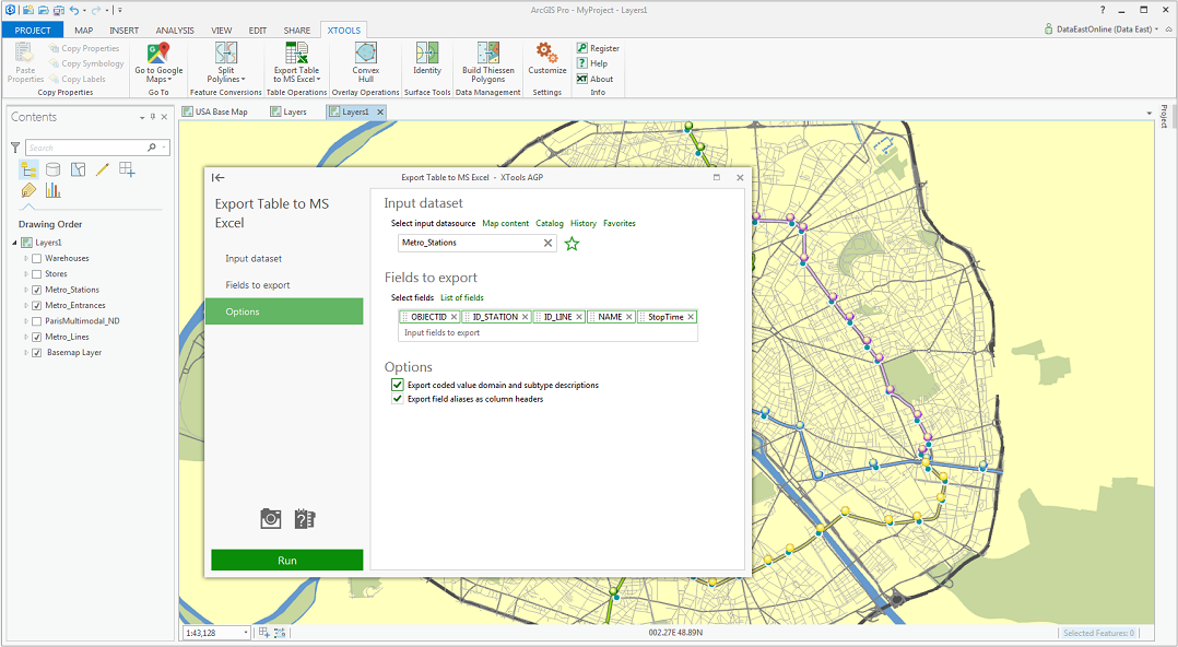
XTools version for ArcGIS Pro, XTools AGP, now consists of the following tools: Split Polylines, Split Polygons, Convert Features to Points, Convex Hull, Convert Polygons to Polylines, Make Polygons from Points, Make Polygons from Polylines, Make Polylines from Points, Add X, Y, Z Coordinates, Calculate Geometry, Export Table to MS Excel, Export Table to File, “Go to” tools, Copy Layer Properties, Build Thiessen Polygons, Identity.
What's new in XTools Pro 16.0
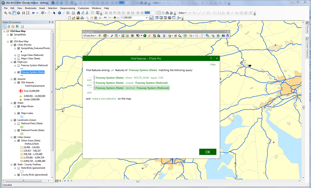
Find Features
A new tool allowing searching for features in a given layer and combining multiple attribute and spatial expressions in one search query.
Find in Catalog
A new tiny feature allowing to quickly find in Catalog datasets for the items (layers, tables) selected in the table of contents in ArcMap.
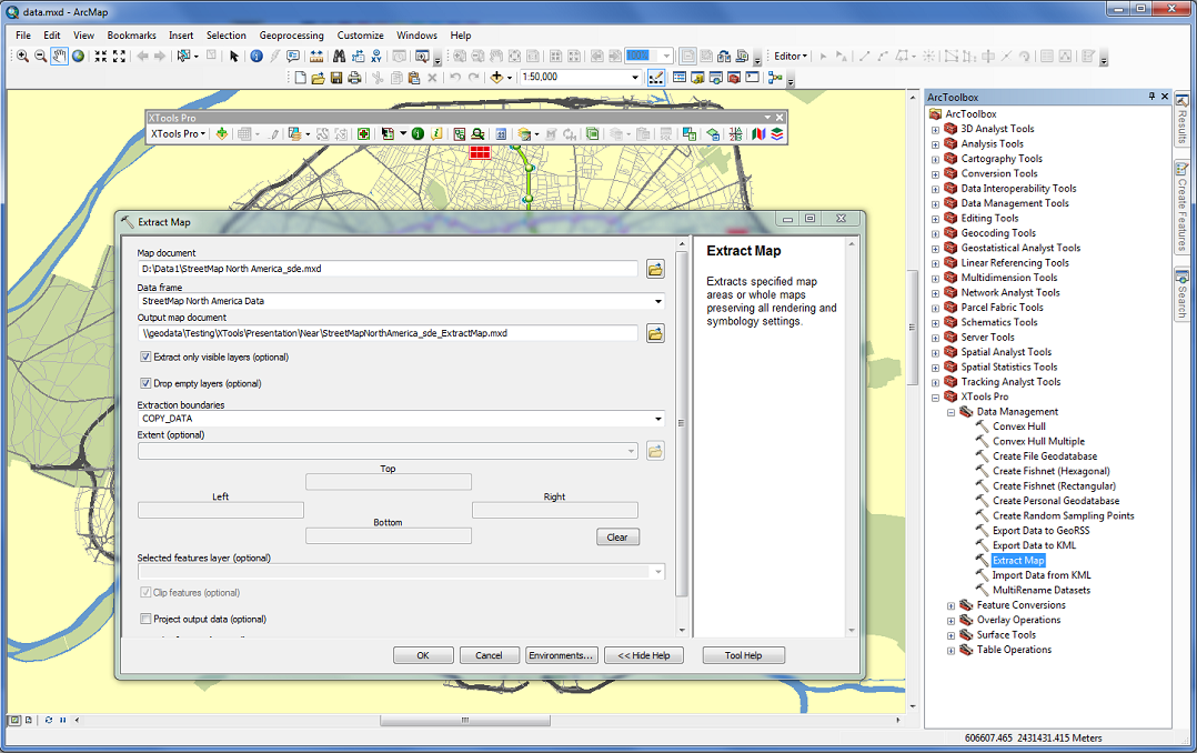
Extract Map GP tool
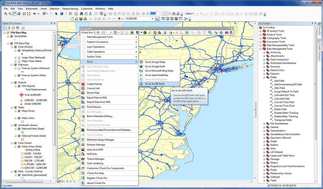
Go to ArcGIS Earth
A new command added to the Go to menu for the new ArcGIS Earth application.
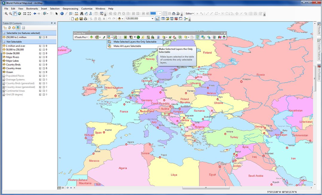
Make Selected Layers the Only Selectable
A new simple feature to make selected layers the only selectable and all layers selectable in just a couple of clicks.
REDESIGNED AND REWORKED TOOLS
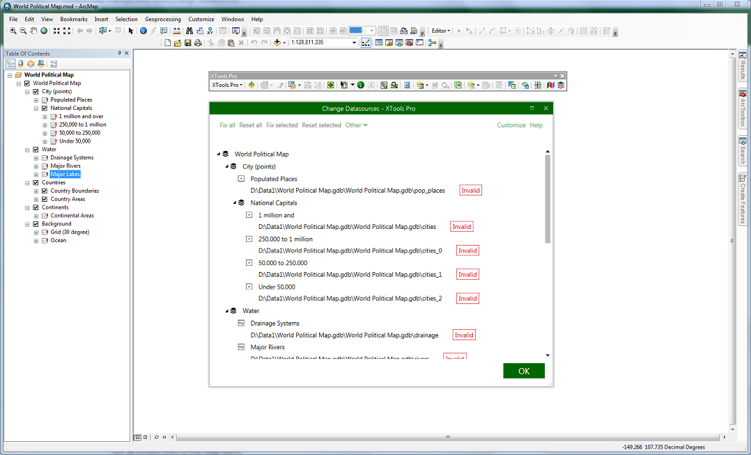
Change Datasources
- New user interface.
- New search algorithm.
- Now you can get multiple search results when fixing broken data sources or searching for other data sources and select the one you need.
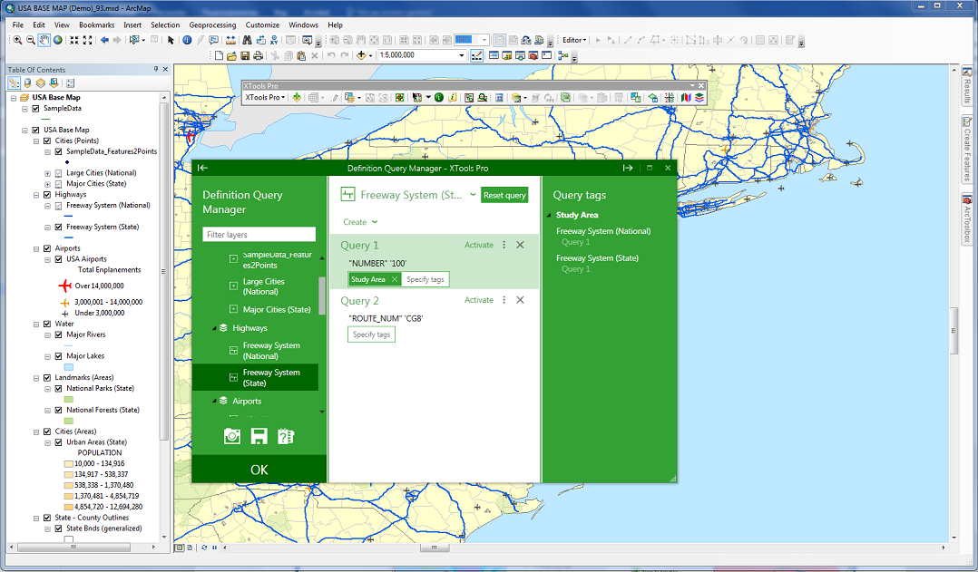
Definition Query Manager
- New user interface.
- New tags now allow to group layers and queries and enable/disable them at once.
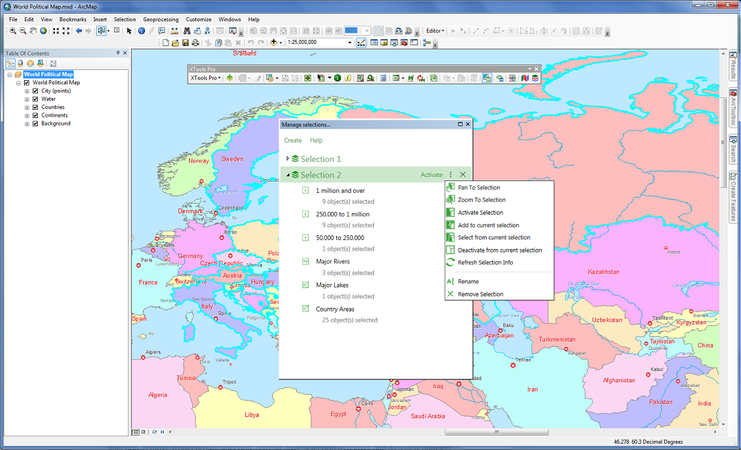
Selection Manager
- New user interface, the tool is now represented as a dockable window in ArcMap.
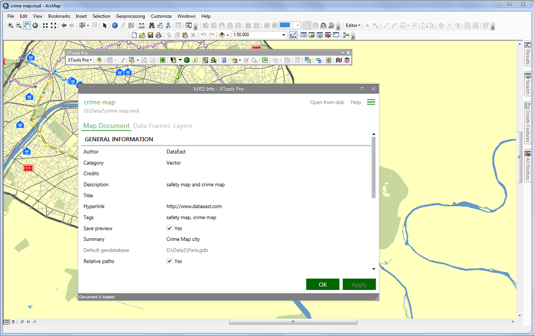
MXD Info
- New user interface.
- Improved usability.
UPDATED AND ENHANCED TOOLS
Copy/Paste Layer Properties
- Added support for some of fields properties for feature layers.
- Added support for raster layer properties.
- Added support for additional definition queries created with Definition Query Manager.
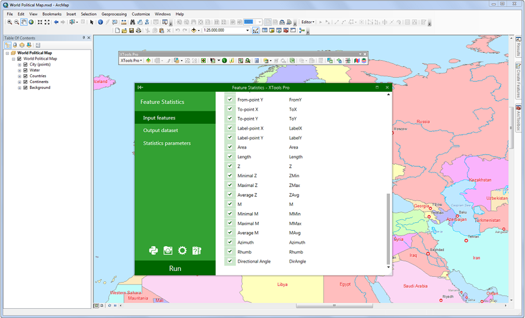
Feature Statistics
- Added new linear parameters (azimuth, rhumb, directional angle).
Export Data to KML
- Now supports rotation angle and size values from attribute fields for points.
- Added support for dimension feature classes.
GeoRSS Support
- Fixed a bug in working with feeds in W3C Geo format (messed up lat/long coordinates resulted in flipped data loaded to the map).
Other changes
- Updated more compact user interface.
- Other minor enhancements and bug fixes.
- New 14-days trial period.