XTools Pro 16.1 and XTools AGP 16.1 Released
These minor 16.1 updates introduce new features, options and improvements.
What's new in XTools AGP 16.1
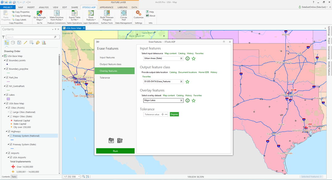
Erase Features
A new Layer Operations tool allowing to erase features in one layer by overlaying features of another layer has been added.
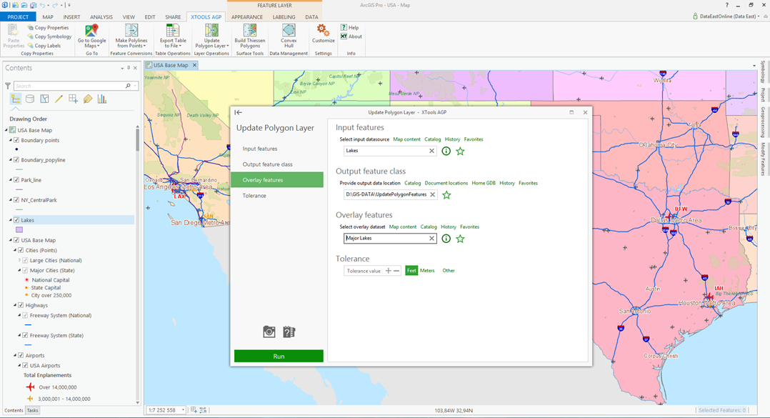
Update Polygon Layer
A new Layer Operations tool for updating polygon features has been added.
Other changes
- XTools AGP 16.1 version can be used with ArcGIS Pro 1.3 and 1.3.1.
- Minor bug fixes.
What's new in XTools Pro 16.1
Support for ArcGIS 10.5
XTools Pro 16.1 version is ready for use with the new ArcGIS 10.5 version.
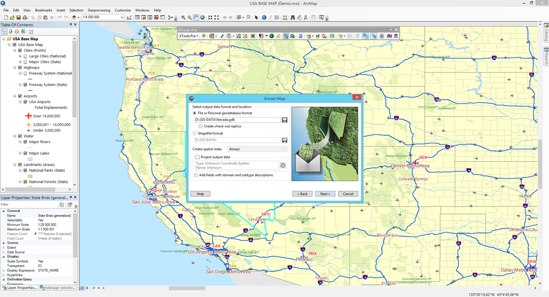
Extract Map
A new option to add new fields with domain and subtype descriptions to the extracted output datasets.
Extract Map GP tool
Fixed issue causing errors when the tool was used in Python scripts.
Find Features
Fixed support for layers with related tables.
Added support for Multipatch datasets.
Selection Manager
Now the tool does not cause problems for publishing a feature service from ArcMap to ArcGIS Online (or ArcGIS for Server) if no selections saved.
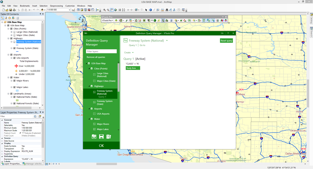
Definition Query Manager
A new option to remove all added definition queries from all map layers.
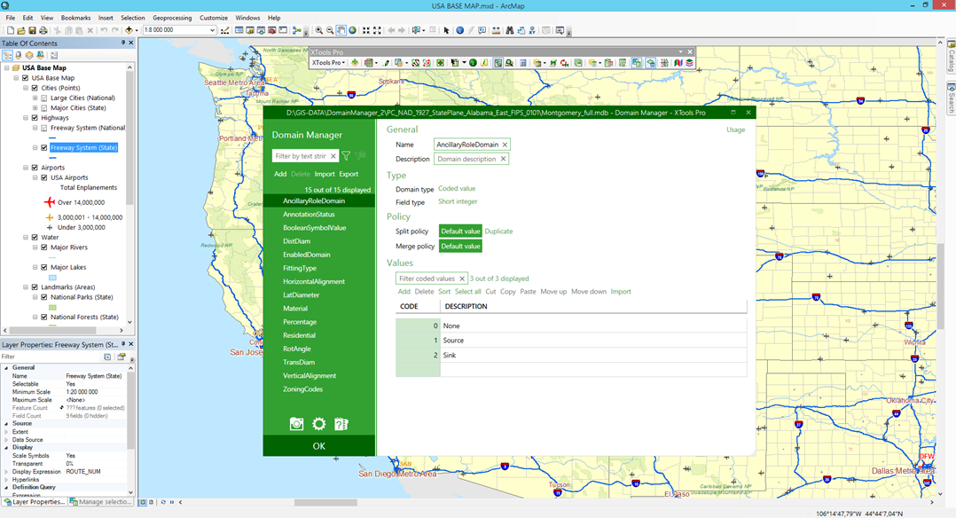
Domain Manager
A new option added to show only domains with errors.
Fixed error when saving changes in coded values domains.
Fixed error for SDE geodatabases.
Change Datasources
Fixed error caused by unsupported data in the map, e.g. basemap layers added from the online resources (e.g. ArcGIS Online).
MXD Info
Added history of the recent map documents opened with the tool for faster access.
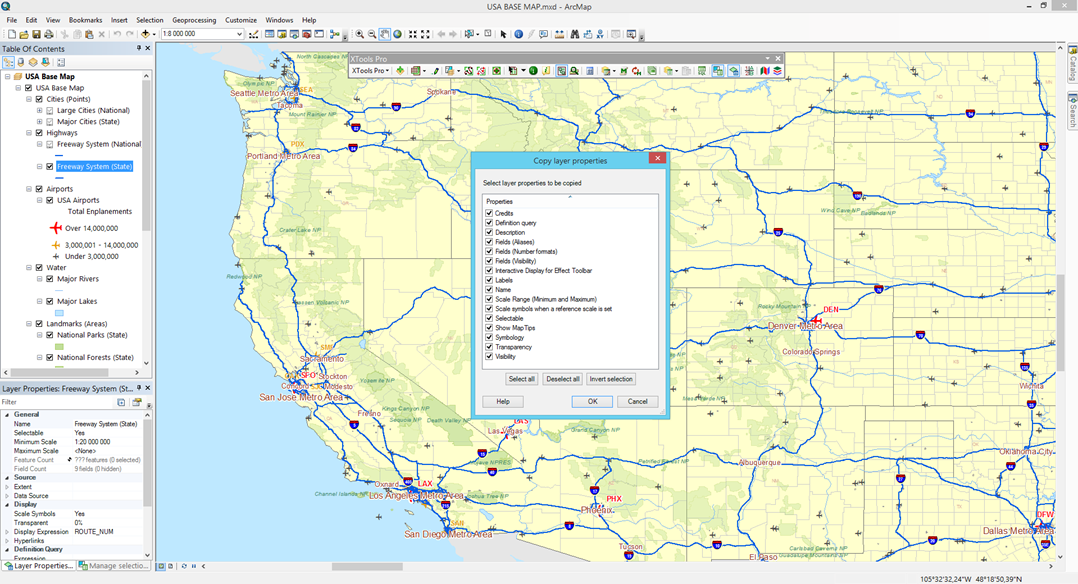
Copy Layer Properties
Added support for group layers.
Convert Features to Points
Added support for 3D features.
Create Intersection Points
Now correctly works with 3D features.
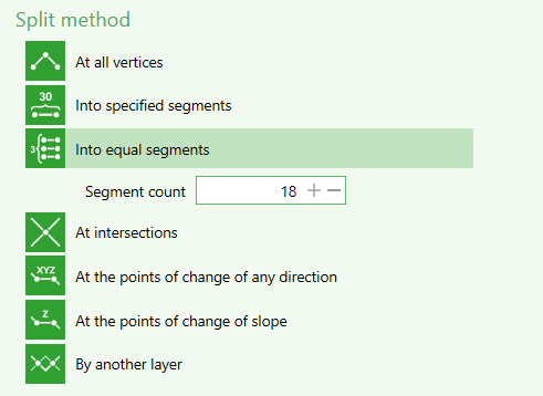
Split Polylines
Option to split polylines at the points of change of any direction is moved from the Customize dialog to the tool dialog window.
Extract Raster Values
Fixed generation of Python scripts for the tool.
Background geoprocessing
- Fixed license check procedure with the enabled security policy "System cryptography: Use FIPS compliant algorithms for encryption, hashing, and signing".
- Fixed license check in various IDE supporting Python (ERROR 000824: The tool is not licensed).
Other changes
- New warning messages in addition to error messages in the tool dialogs.
- Other minor enhancements and bug fixes.
- New 14-days trial period.