Document Info
Provided for viewing and editing information about MXD documents without actually opening them in ArcMap.
 Available in XTools Pro for ArcMap
The XTools Pro “Document Info” tool is provided for viewing and editing information about MXD documents in one window. In general, the tool dialog contains the same information as the ArcMap document properties but provides more details. At that, you can see information about MXD document without opening it in ArcMap.
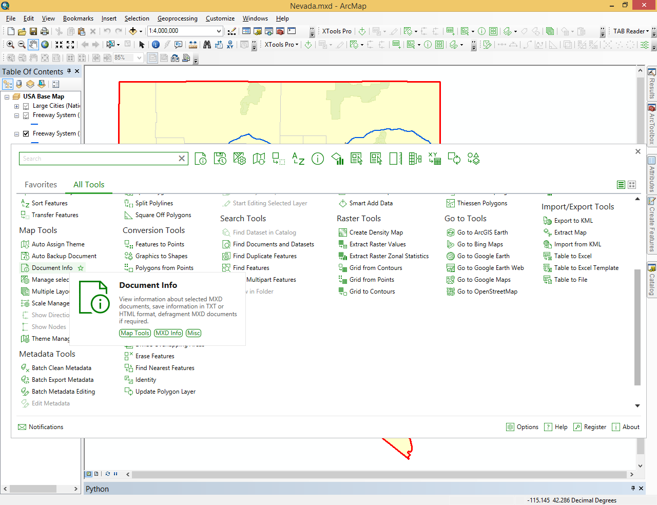
When you run the tool by default it shows information about the currently open map document in ArcMap. Besides, you can also select any other MXD document from the disk. This way you can retrieve information about an MXD document without actually opening it.
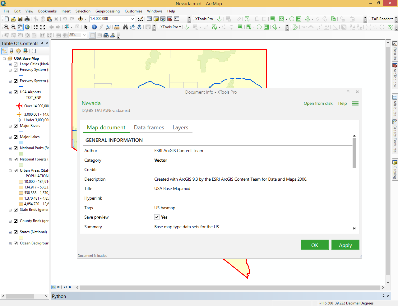
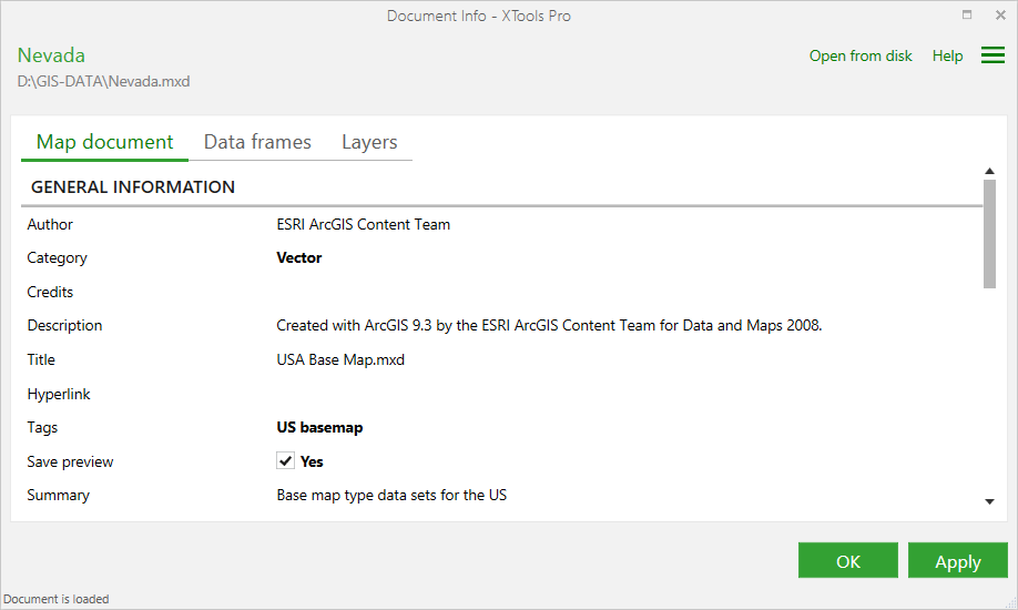
Document Info dialog consists of three main tabs:
- Map document
- here you can see general information about map document, similar to what you get with the Map Document Properties dialog in ArcMap - Data frames
- in this part you can see all data frames (maps) and their properties in map document - Layers
- in this part you can see all layers and their properties in the map
Map document
Following information about MXD documents is provided by the MXD Info tool:
General information
- includes details that you can get from the Map Document Properties in ArcMap:
- Author (editable)
- Category (editable)
- Description (editable)
- Credits (editable)
- Hyperlinks (editable)
- Tags (editable)
- Save preview (editable)
- Summary (editable)
- Title (editable)
- Relative paths (editable)
- Default geodatabase
Date
- shows dates when the map document was created, modified, accessed, last saved, last printed and last exported
Initial data
- provides ArcGIS version and template/styles used in the map document
Maps
- shows data frames in the map document
Layers that may cause rasterization
- lists map layers that may cause rasterization when printing or exporting map, indicating the reasons for rasterization, e.g.:
- Layer transparency
- Raster-based picture symbols
- Field-based transparency
Data frames
Following information about data frames is provided by the MXD Info tool:
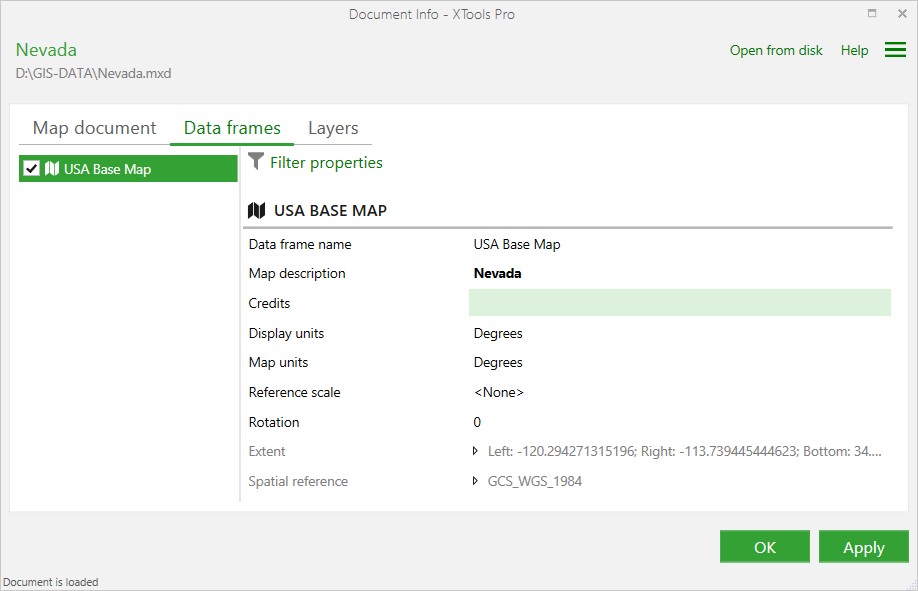
- Map (data frame) name (editable)
- Map description (editable)
- Credits (editable)
- Display units (editable)
- Map units (editable)
- Reference scale (editable)
- Rotation (editable)
- Extent
- Spatial reference
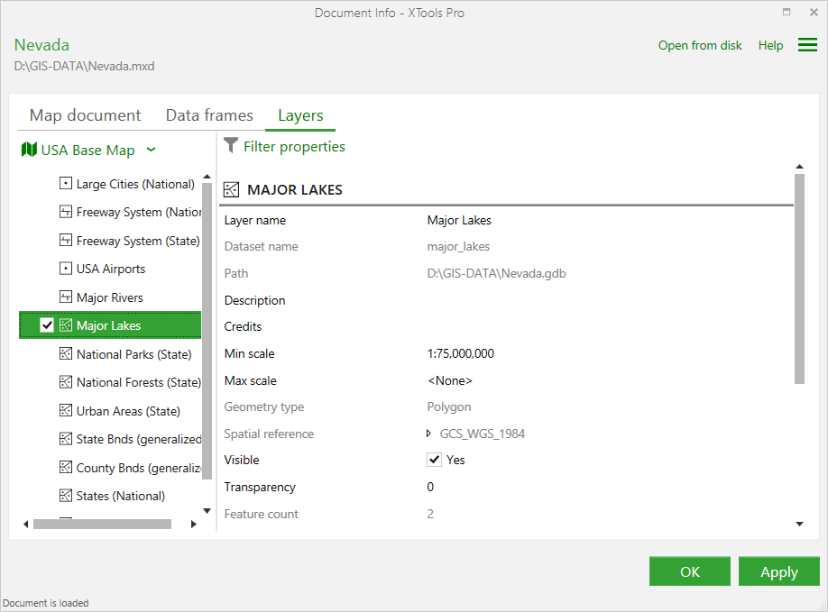
Layers
Following information about layers is provided by the MXD Info tool:
- Layer name (editable)
- Dataset name
- Path
- Description (editable)
- Min scale (editable)
- Max scale (editable)
- Geometry type
- Spatial reference
- Visible (editable)
- Transparency (editable)
- Feature count
- Field count
- Definition query (editable)
- Labels (editable)
- Z values
- M values
- Times
- Relates
- Joins
- Transformation
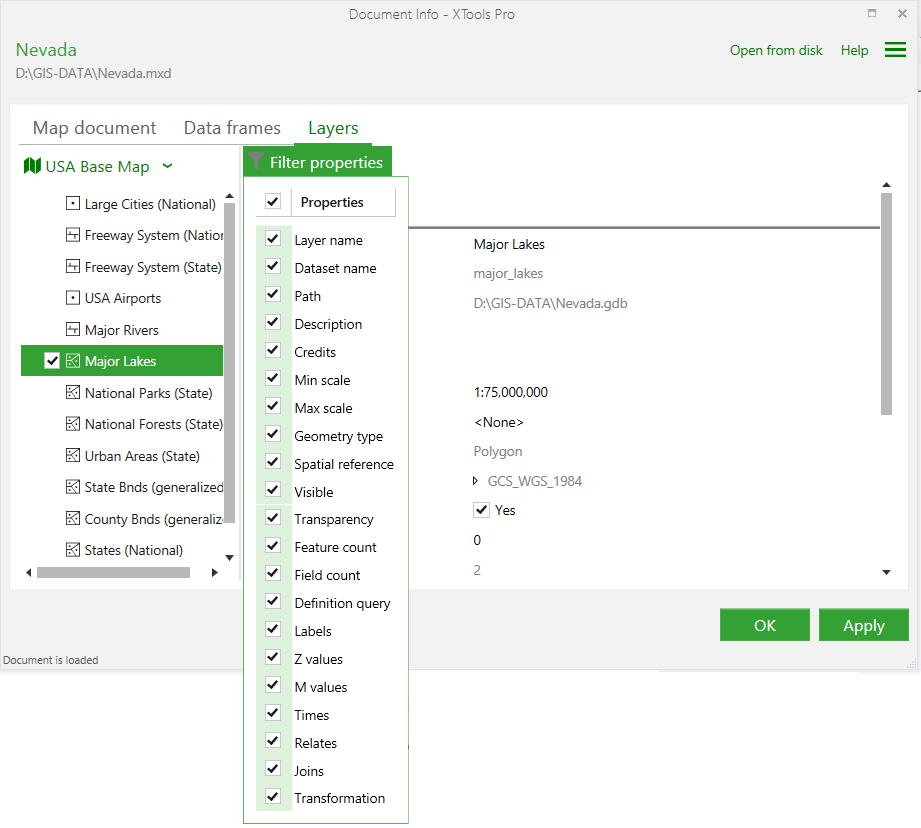
For more convenient work both data frame and layer properties can be filtered so you can only those properties you are interested in at the moment:
Other operations
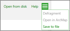
There are following additional operations available for map documents:
Defragmenting
- MXD Info allows defragmenting map documents loaded from disk
Opening in ArcMap
- if you opened a map document from disk you can select to open it in ArcMap
Saving to file
- map document properties and details can be saved to a file on disk, text and HTML formats supported.
For the map documents currently open in ArcMap you can apply edits and changes and then save them with map document itself. For the map documents loaded from disk you can save edits and changes directly in the MXD Info dialog window.
 Paid tool. Try this and all other XTools Pro features free for 14 days or buy XTools Pro license now.