Rotate Point Symbols
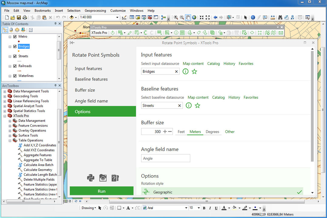
Rotates point symbols in the maps according to the specified baselines.
 Available in XTools Pro for ArcMap and for ArcGIS Pro
The "Rotate Point Symbols" tool is provided for rotating symbols of point features on the map along specified polylines. As a result, new angle values are added to the attribute table and point symbols are rotated on the map according to the angle values.
Rotation angles are calculated as follows:
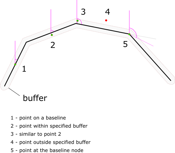
Points 1, 2, 3, and 5 are within the buffer area. For the points 1, 2, 3 symbol rotation angle is taken from the nearest line segment, for the point 5 rotation angle is calculated as mean value between adjacent line segments. Point 4 is not within the buffer area so its symbol won’t be rotated.
At that, for proper symbols rotation it is recommended that the input points and baseline features are in the same coordinate system.
Example: you can use the Rotate Point Symbols tool when designing a topographic map to rotate bridge symbols along the roads: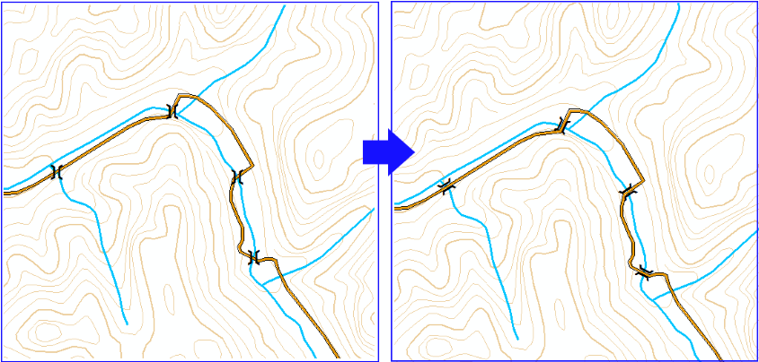
 Paid tool. Try this and all other XTools Pro features free for 14 days or buy XTools Pro license now.