Show Perimeter/Length
Allows displaying perimeter and length values of polygon and polyline features.
 Available in XTools Pro for ArcMap and for ArcGIS Pro
For polygons, the tool allows displaying perimeter values in the feature label points. For polylines, the tool shows length values above the feature midpoints in the direction of a polyline from its start to end. Values can be displayed in different linear units.
For multipart polygons, perimeters can be shown for the whole feature or for each feature component separately. For multipart polylines, length values can be shown for the whole feature or for each feature part separately.
The following layer types are supported:
- feature layers
- selection layers
- feature services
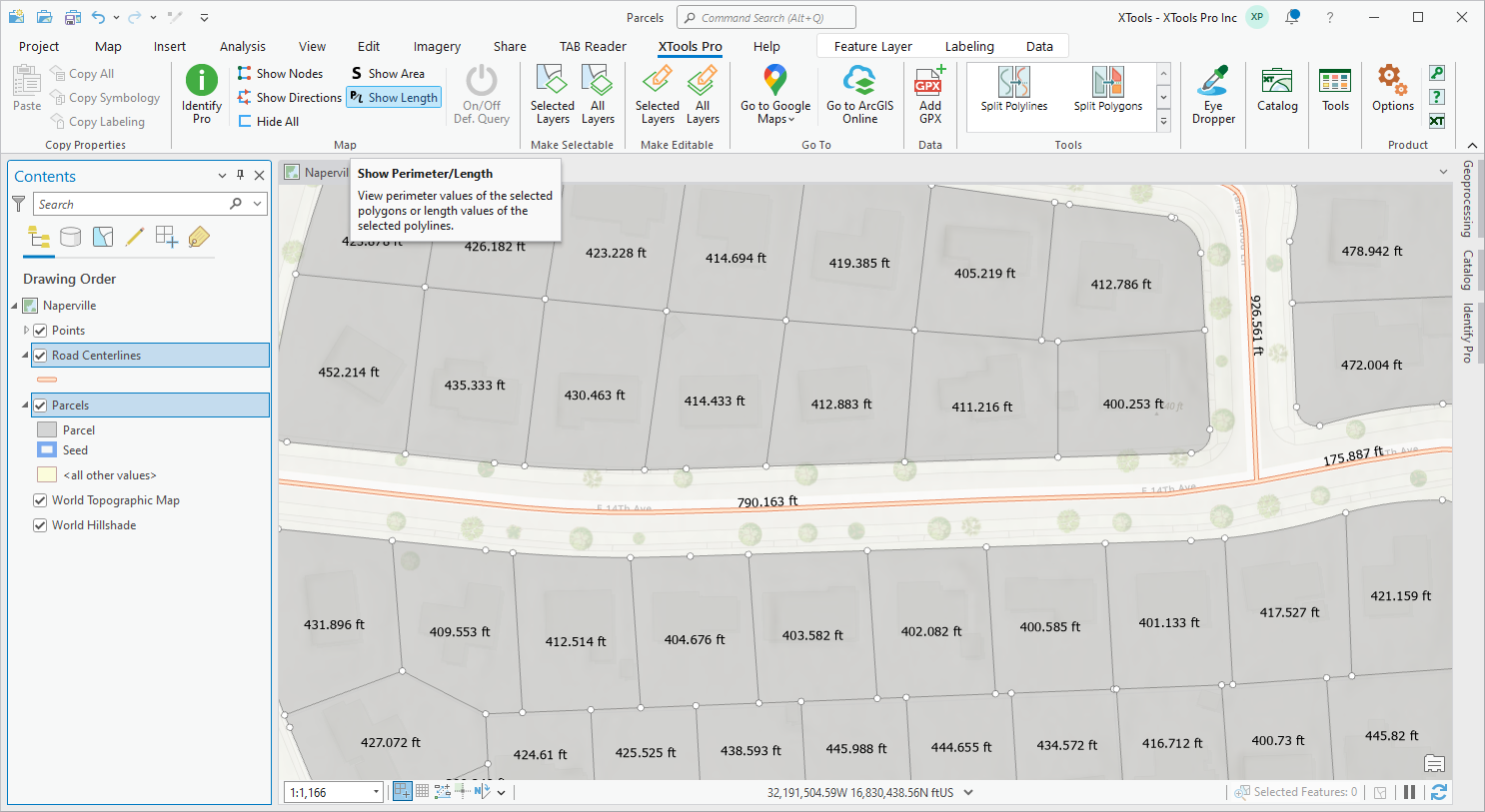
To display feature values click the Show Perimeter/Length button from the XTools Pro ribbon or Tools Pane, and values for all features of the selected layer will appear.
If there are selected features in the selected layer, the values will be shown for the selected features only. Besides, values can be displayed for a few layers selected in the Contents pane.
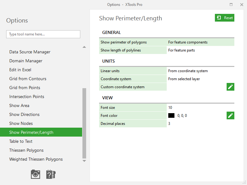
Displayed values are represented with graphic text symbols. Text font size and color, count of decimal places can be customized (see XTools Pro Options).
Working with multipart features
Polygons
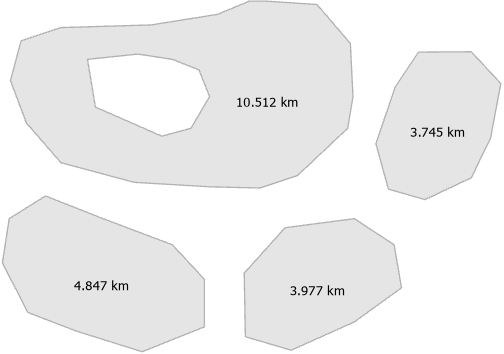
By default, perimeter values for multipart polygons are shown for each component separately in its label points. Feature component may contain single or multiple parts (e.g. polygons with holes).
For feature components:
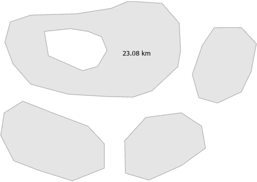
In XTools Pro Options you can select the option to show perimeter values for the whole features. In this case, the value is located in the label point of the largest feature component.
For the whole feature:
Polylines
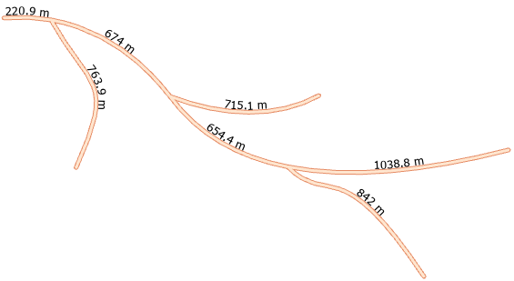
By default, length values for multipart polylines are shown for each part separately above its midpoints.
For feature parts:
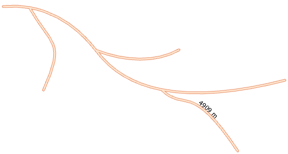
As with polygons, you can select the option to show length values for the whole features (see XTools Pro Options). In this case, the value is located above the midpoint of the first feature part.
For the whole feature:
Please note that if the polygon or polyline feature is just displayed partially in the map current extent, its value is always shown for its visible part.
Showing values in different units
By default, values are shown in units of selected layer datasources spatial reference. However, you can select an active map coordinate system or specify custom projected coordinate system and linear units (see XTools Pro Options).
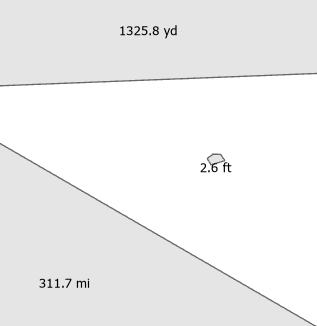
You can specify fixed units to show all values in the same units. At that, If selected features are of different size, you can choose adaptive metric or imperial units. In this case, displayed units are dynamically adapted to the feature size.
For example, adaptive imperial units:
 Paid tool. Try this and all other XTools Pro features free for 14 days or buy XTools Pro license now.