Dozen things you cannot do in ArcGIS without XTools Pro

XTools Pro provides a lot of various tools and features to ArcGIS users, among them there are tools that don’t have analogs in the standard ArcGIS functionality no matter the license level. Here are 12 examples of such tools.
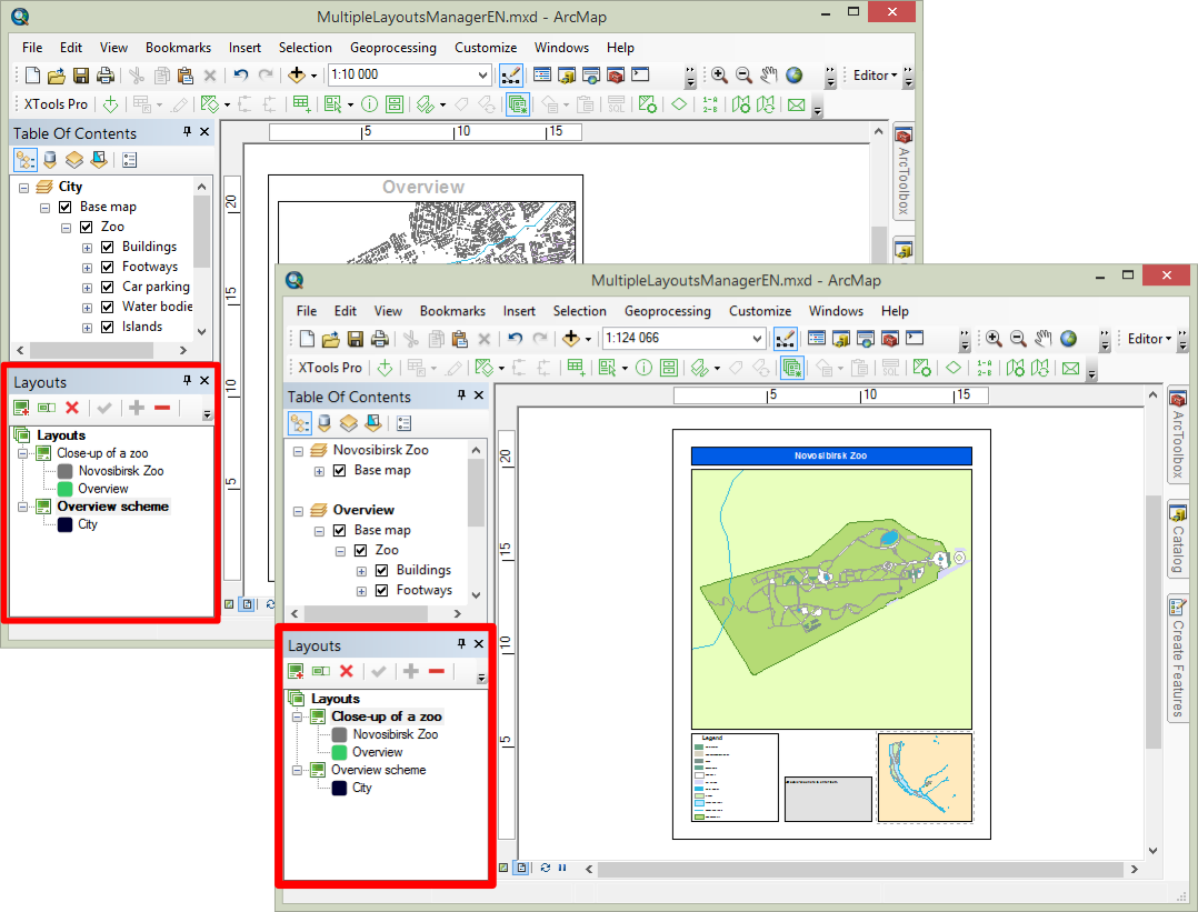
1. Creating multiple layouts in ArcGIS
If you remember the old ArcView GIS 3.x days most probably you were used to creating multiple layouts in map projects, something that is missing in ArcGIS Desktop. XTools Pro brings back this functionality to ArcGIS users. With the Multiple Layouts Manager you can create and use as many layouts as you need within one map document in ArcMap. Different layouts may refer to different data and maps and may be saved with difference layout and printer settings.
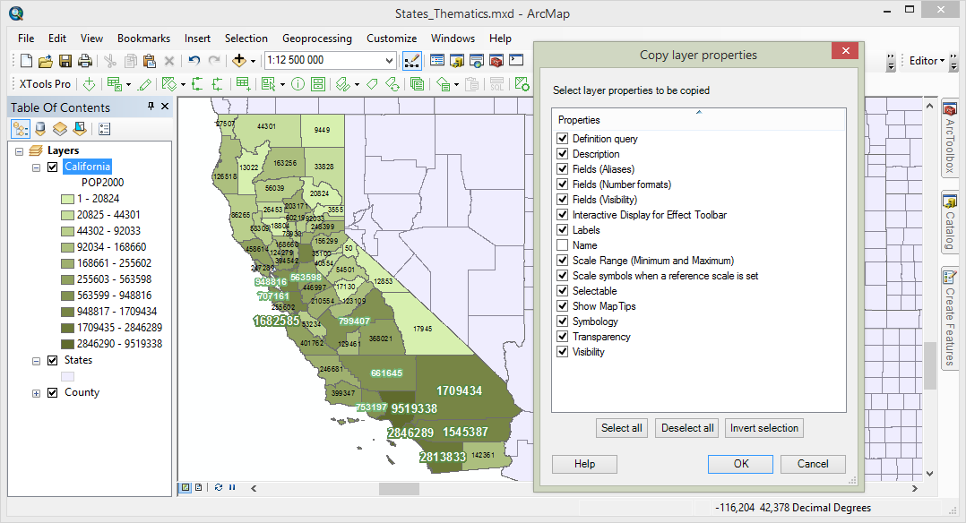
2. Copying properties between map layers
Copy layer properties between layers in a few clicks - between layers within one map, between layers in different data frames and even between layers in map documents opened in different ArcMap windows. All this is available with the Copy Layer Properties tool. Simply click on a layer to copy properties from, select properties to copy, then select layer(s) to paste properties to and click paste. That easy - one selected property, be it symbology or labels, or all supported properties, no matter the geometry type - all that applies will be copied. And can be rolled back if needed with the standard ArcMap Undo feature.
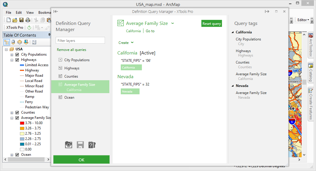
3. Creating multiple definition queries for one layer and easily switching between them
This is made possible with the Definition Query Manager tool. Besides just that there are:
- Button on the toolbar, indicating if there is a query and if it’s turned on/off
- Creating queries from selections
- Turning on/off definition queries for multiple layers (see tags).
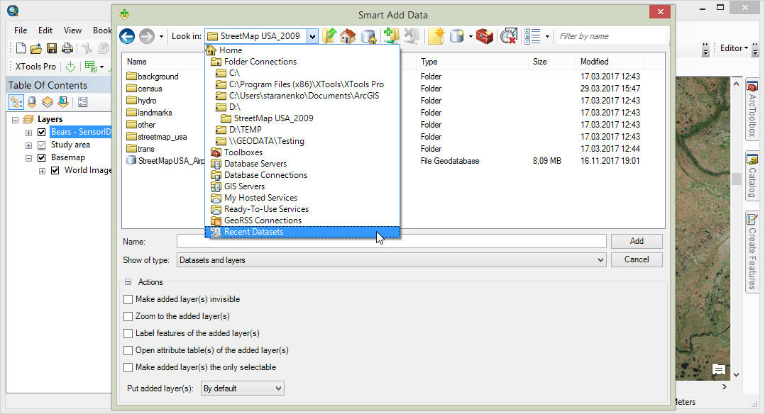
4. Using advanced filters browsing and adding data to maps
Use flexible filters browsing and adding datasets to the maps with the Smart Add Data dialog. Filter datasets by names, data types and formats, geometry types etc. In addition, there is a number of predefined tasks that can be applied to the datasets added to the map and a Recent Datasets virtual folder allowing to save time browsing and searching for the recently used datasets.
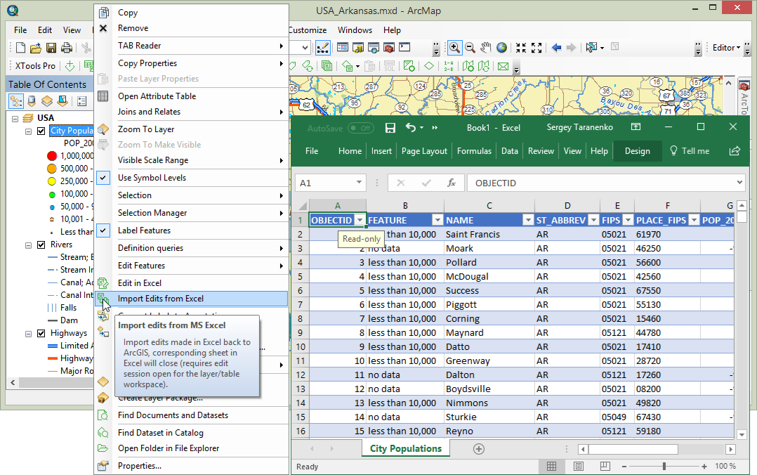
5. Editing tables with Excel
Edit attribute and standalone tables with Excel. The Edit in Excel tool brings the power of Excel to tables editing capabilities in ArcGIS. Use Excel to apply formulas, validate, filter and analyze data, spell check records and for other tasks limited or not supported with ArcMap.
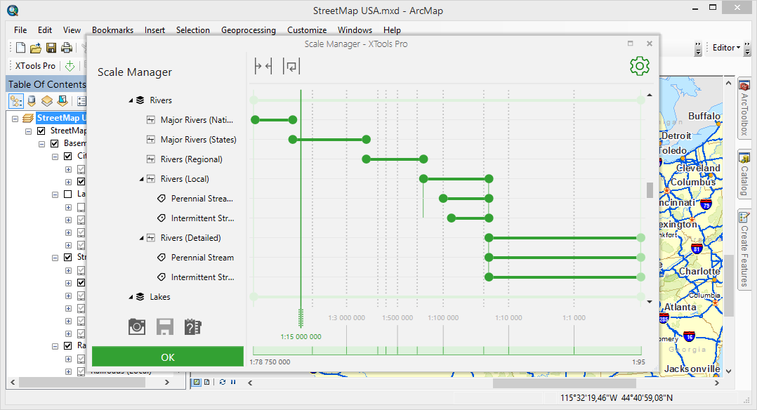
6. Managing scale ranges in the maps interactively
With XTools Pro you can work with map scale ranges in a new way. View, edit and manage all scale ranges used in the map with the new Scale Manager tool. Visual, interactive, and fun to use, this feature in XTools Pro is really a new additional way for managing scale ranges in the maps.
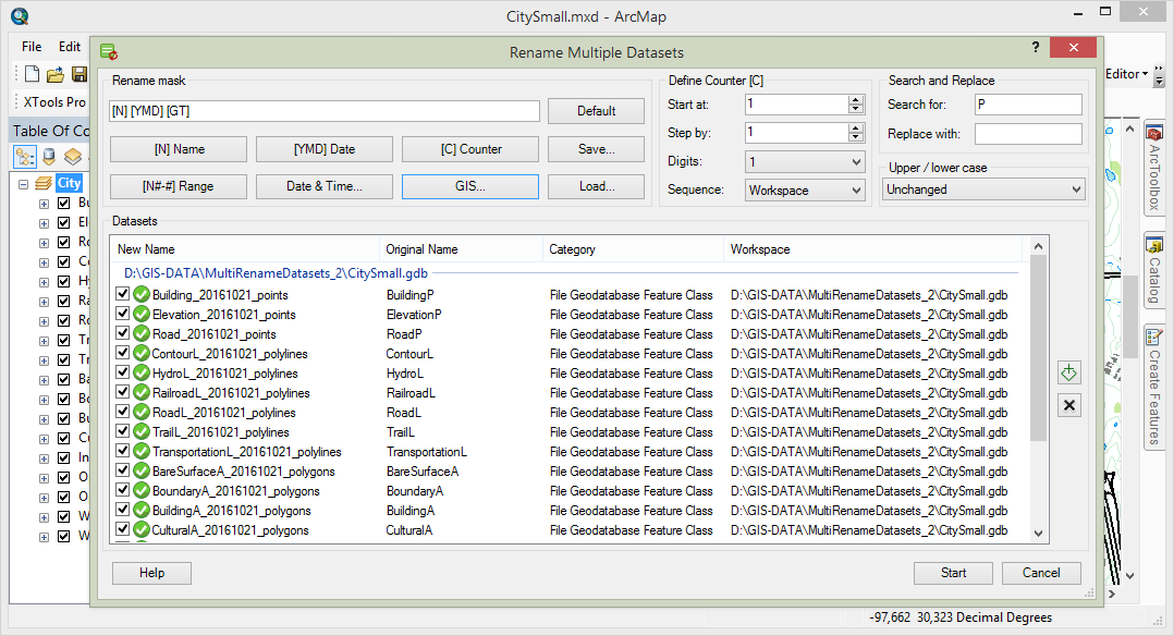
7. Renaming multiple datasets
Rename lots of datasets at once using various flexible advanced renaming masks provided with the Rename Multiple Datasets tool. At that, renaming masks may consist of original names, layer names, geometry type, dates, counters etc. Supported use cases are: modifying names adding characters, adding counters, replacing parts of names, replacing datasets names with their layer names, adding geometry types to the datasets names, changing words capitalization and a lot more. All that can be easily and promptly done (and undone, if required) with XTools Pro.
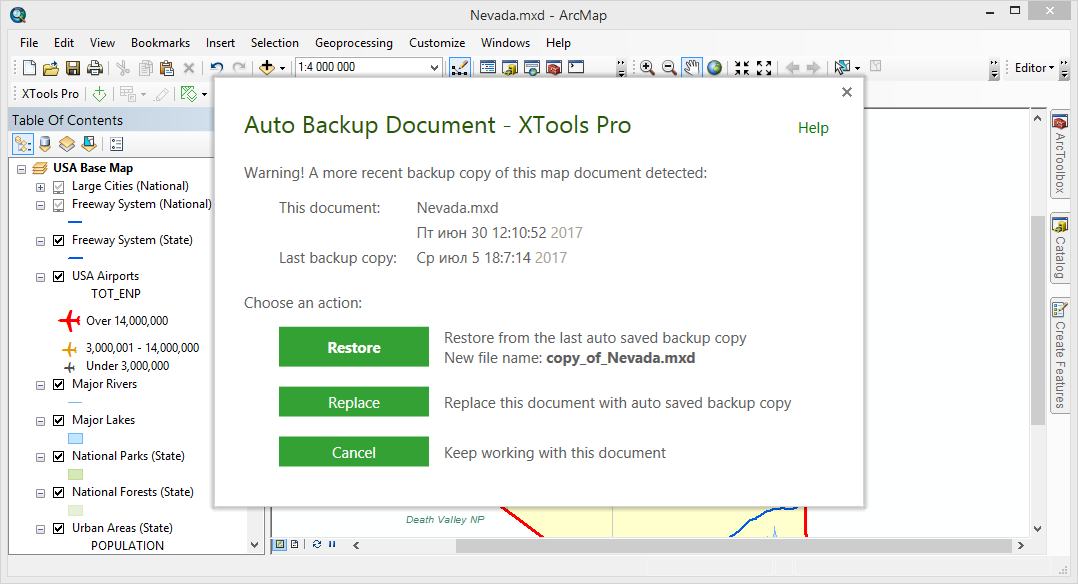
8. Creating backup copies of map documents
Create backup copies of your map documents enabling the Auto Backup Document feature. Backup copies can be automatically created in the specified folder in the given period of time, as frequent as required. This way you can always have your work in ArcMap saved no matter what may happen with ArcMap.
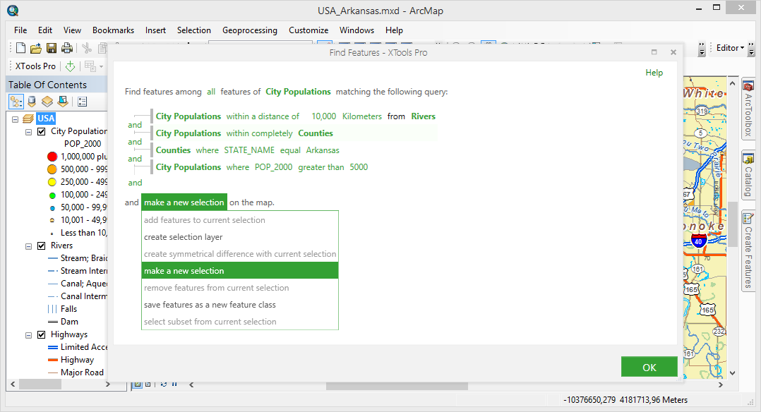
9. Finding features using advanced expressions
Combine attribute and spatial expressions in one search query with the Find Features tool. This way you can search for features in the maps using unlimited number of combined attribute and spatial criteria. A number of options are available for work with found features.
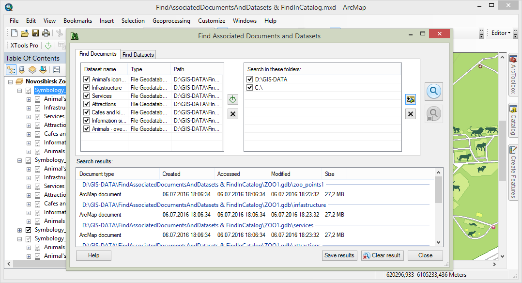
10. Finding associated documents and datasets
Search for map documents and datasets using the Find Documents and Datasets tool. XTools Pro allows searching for map documents referencing the specified datasets and vice versa, searching for datasets used in the specified map documents.
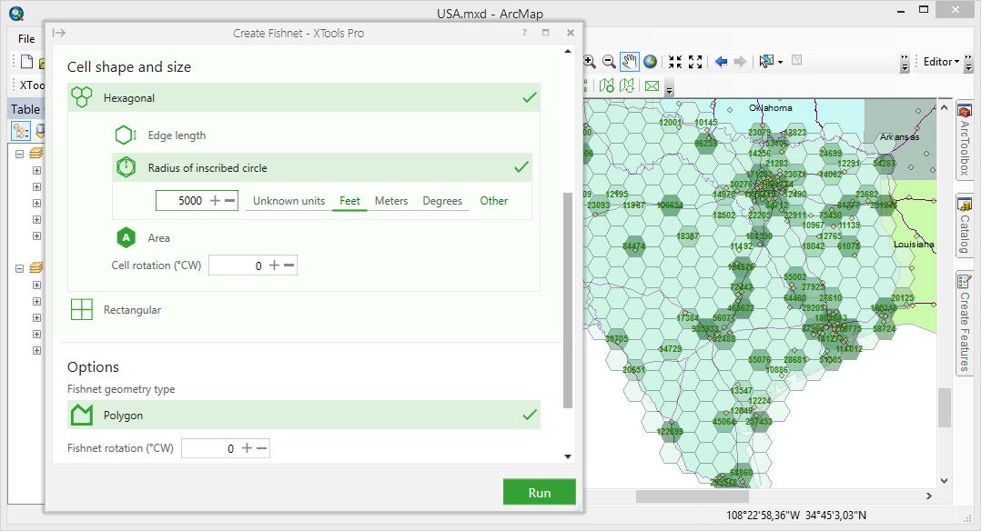
11. Creating hexagonal fishnets
Create hexagonal fishnets to visualize your data and be in the “cool club”. With the Create Fishnet tool you can build not only usual rectangular fishnets but also hexagonal fishnets. They can be effectively used for various thematic mapping tasks. As opposed to the rectangular cells hexagons may reduce sampling bias due to edge effects of the grid shape, better fit to irregular and curved boundaries and look more impressive at certain scales because of the less apparent linear patterns.
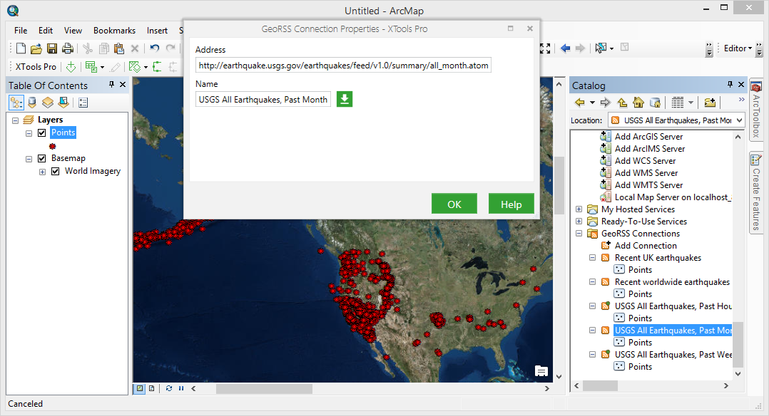
12. Bringing GeoRSS data to ArcGIS
Add GeoRSS feeds to the maps. XTools Pro brings support for live and updated GeoRSS data to ArcGIS allowing to work with and visualize the latest information from the published GeoRSS feeds.