XTools Pro 21 Released
The new version brings more tools and features from ArcMap to ArcGIS Pro. Among them you will find such well-known and popular tools like Identify Pro, Modify Table, Domain and Data Source Managers. As well, the simple handy features like Show Nodes and Directions and Make Selected or All Layers Editable are now also available to ArcGIS Pro users.
In ArcMap you can now use the Modify Table geoprocessing tool, export multiple tables to single Excel workbooks, copy field order between layers and fill holes in polygons. Besides, enjoy the new colored icons on the toolbar.
What’s new in XTools Pro 21 for ArcGIS Pro
User interface
The most useful and handy tools and features are now available on the Map and other tabs on the ribbon.
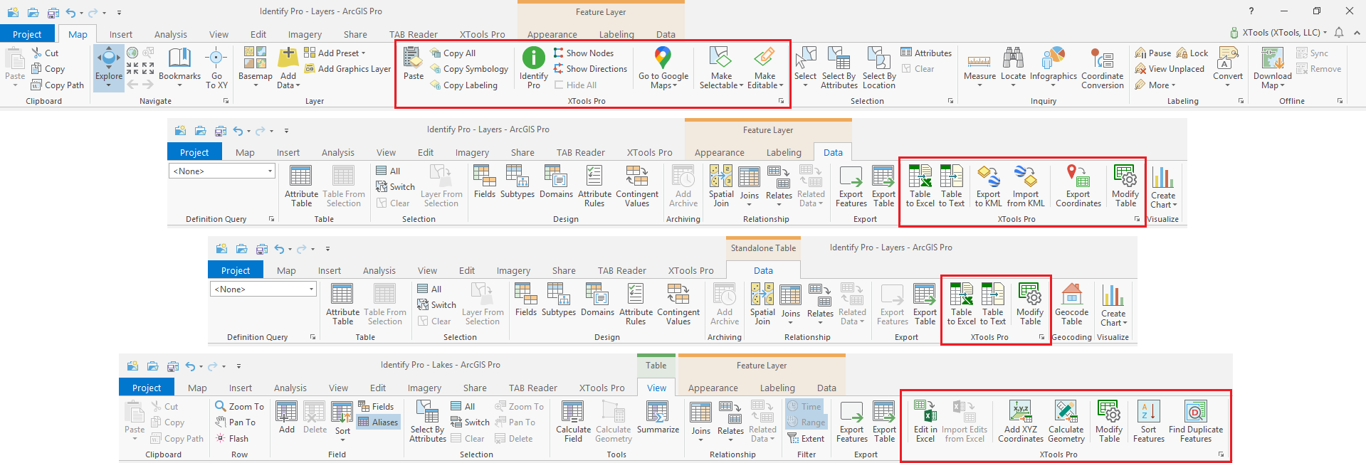
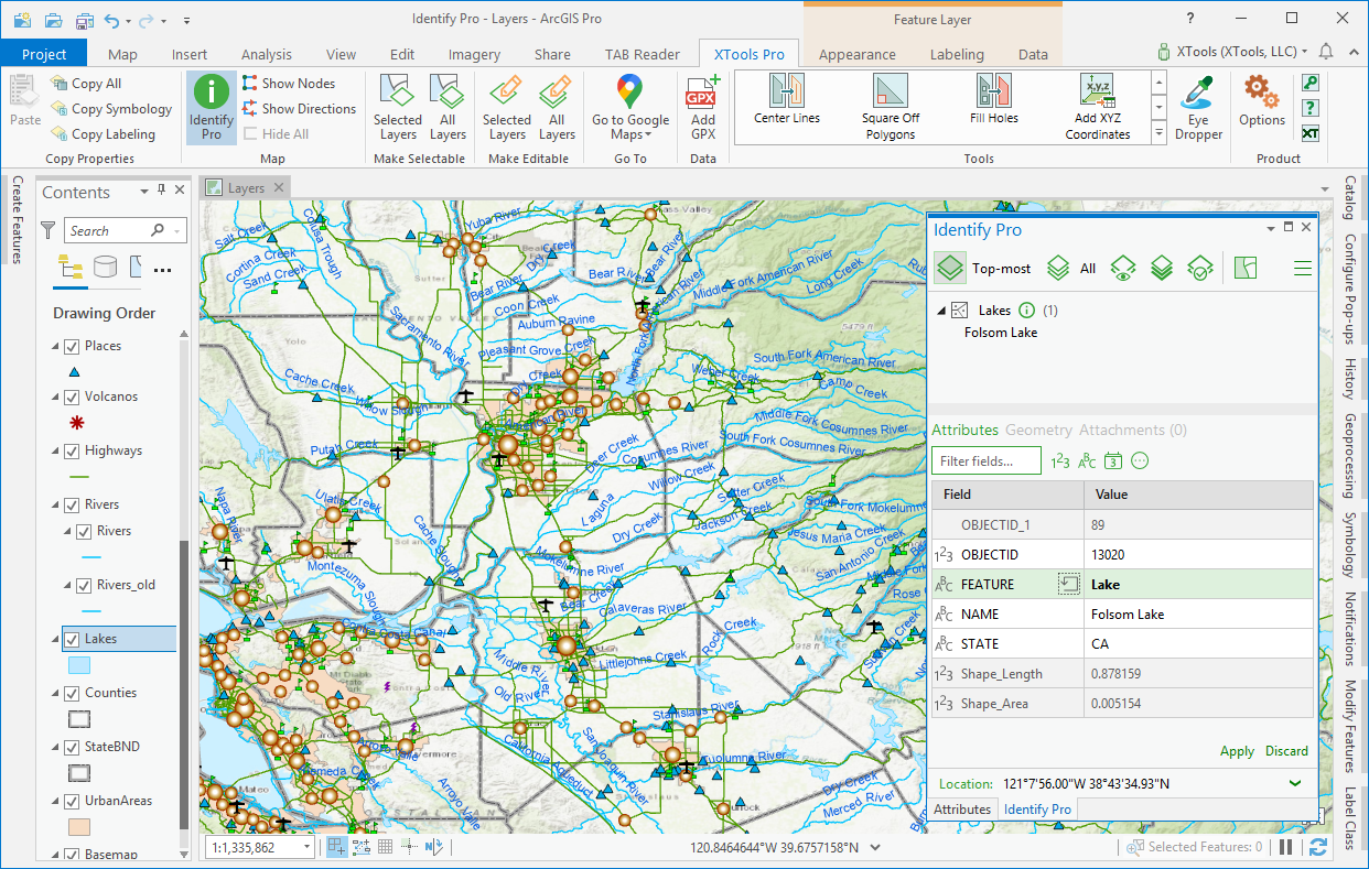
Identify Pro
The well-known feature identification tool is now brought to ArcGIS Pro.
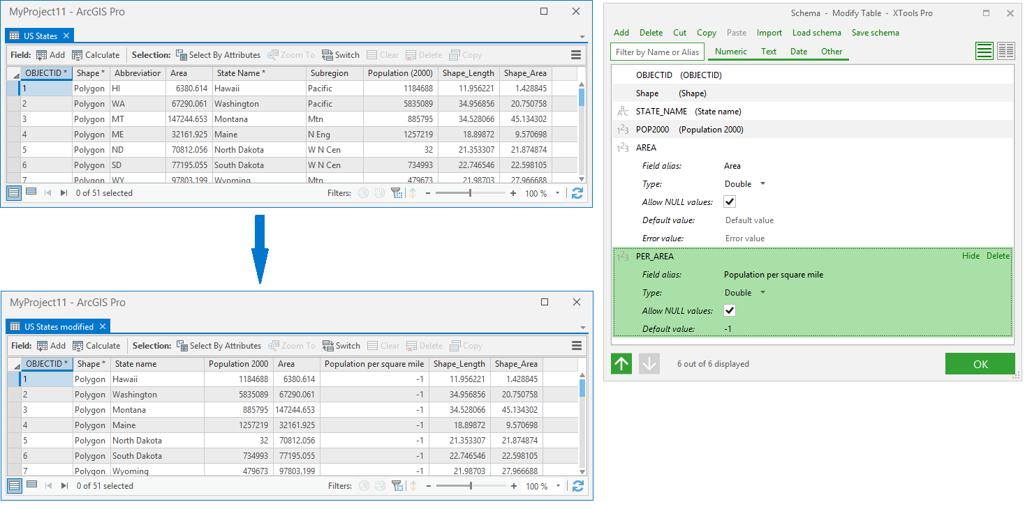
Modify Table
The popular tool for reordering, renaming, adding and removing fields is now available in ArcGIS Pro.
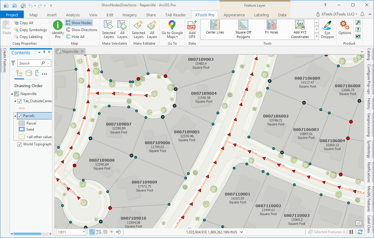
Show Nodes, Show Directions
The handy tiny features to show/hide feature nodes and directions are now available to ArcGIS Pro users.
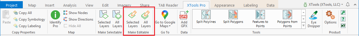
Make Layers the Only Editable,
Make All Layers Editable
A couple of new features for ArcGIS Pro users to easily and promptly manage layers editability in the maps.
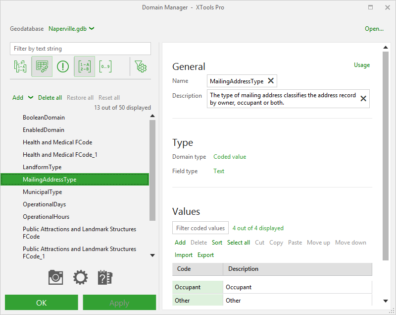
Domain Manager
The powerful tool to manage geodatabase domains is added to ArcGIS Pro.
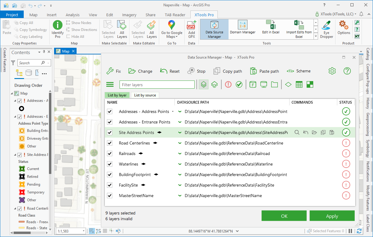
Data Source Manager
The tool to effectively change and fix broken links to data sources is now available in ArcGIS Pro.
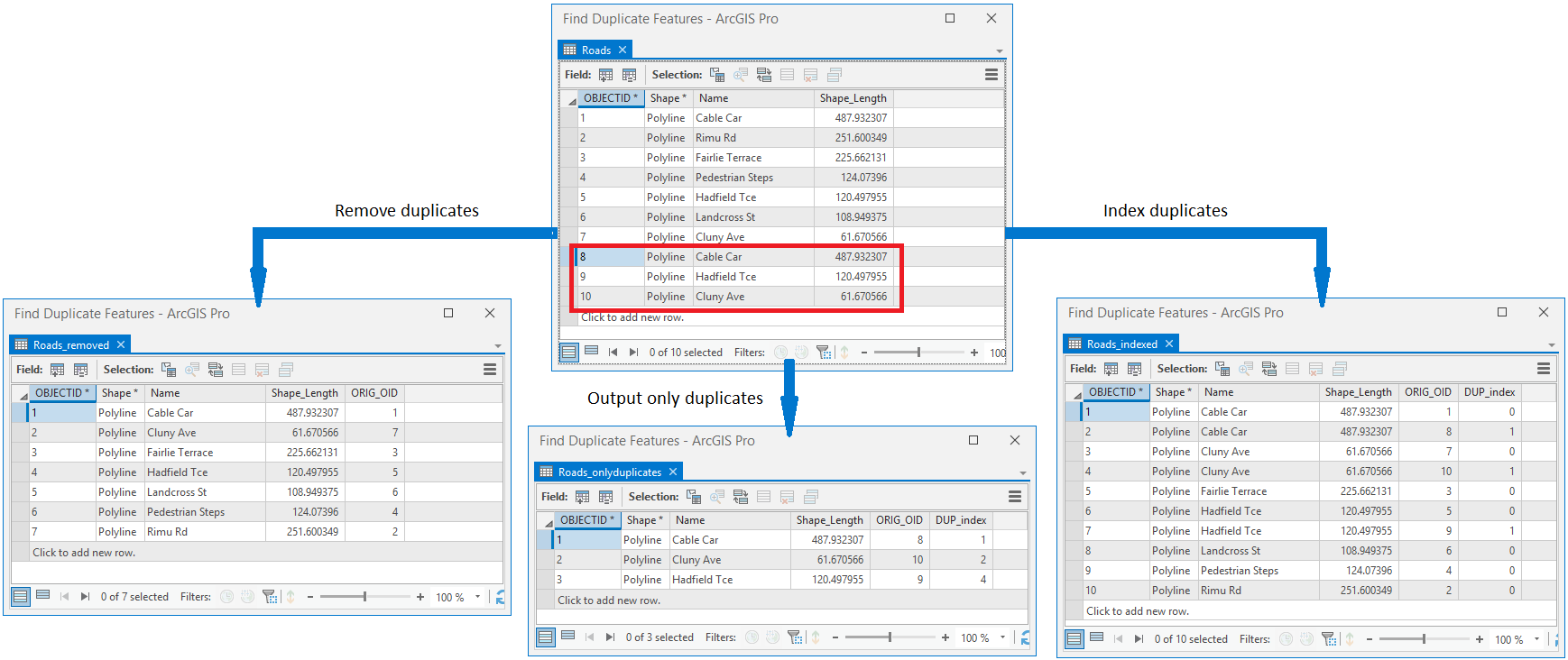
Find Duplicate Features
The tool allows to compare and find duplicate feature by one or a few fields.
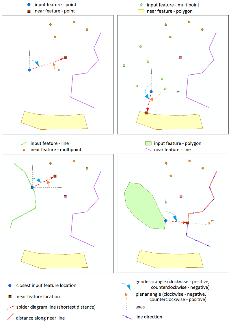
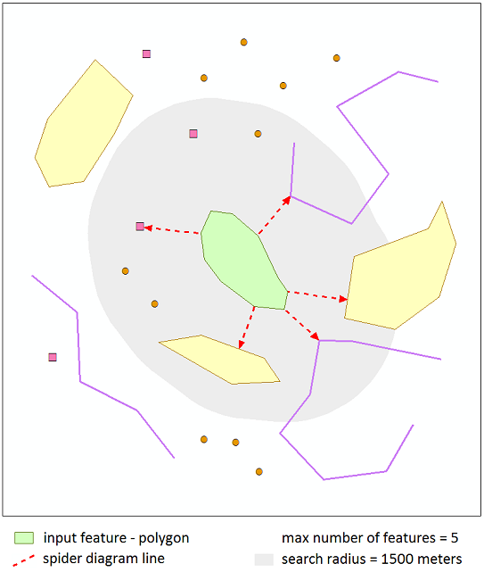
Find Nearest Features
The tool to find nearest features is added to ArcGIS Pro.
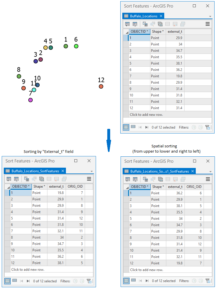
Sort Features/Records
Now you can sort features and records by one or a few fields in ArcGIS Pro.
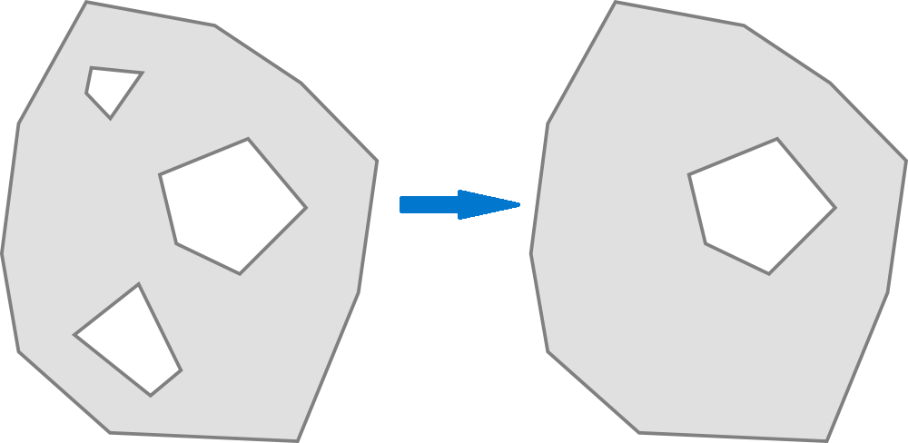
Fill Holes
A new tool to easily fill unnecessary holes in polygon features.
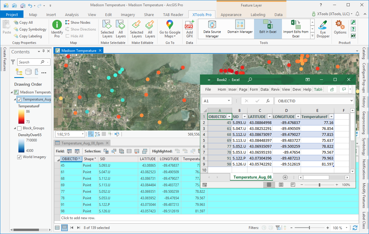
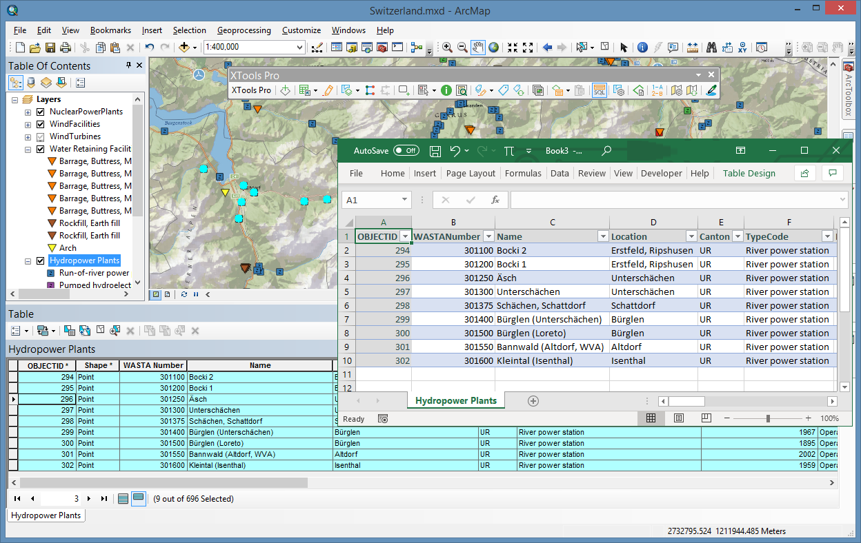
Edit in Excel
Added support for layer properties (selected features, definition queries, fields order and visibility, joined and read-only fields).
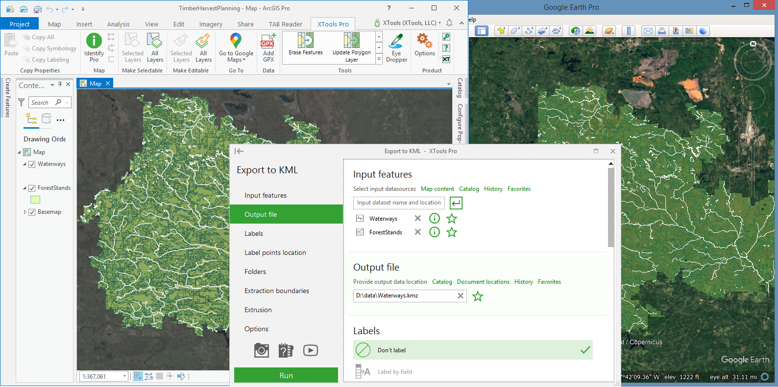
Export to KML
Added an option to export multiple layers to single KML files.
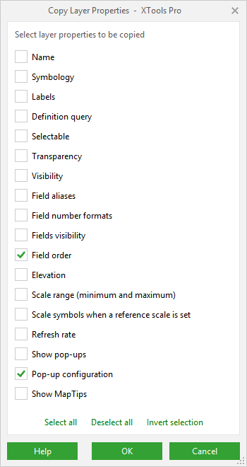
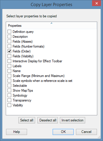
Copy Layer Properties
Now you can copy field order and pop-up configuration settings between layers.
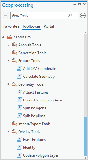
Geoprocessing tools
Following geoprocessing tools have been added and are available from XTools Pro Toolbox:
- Conversion tools - Polygons from Polylines
- Geometry tools - Attract Features
- Feature tools - Add XYZ Coordinates, Calculate Geometry
- Overlay tools - Erase Features, Identity, Update Polygons Features
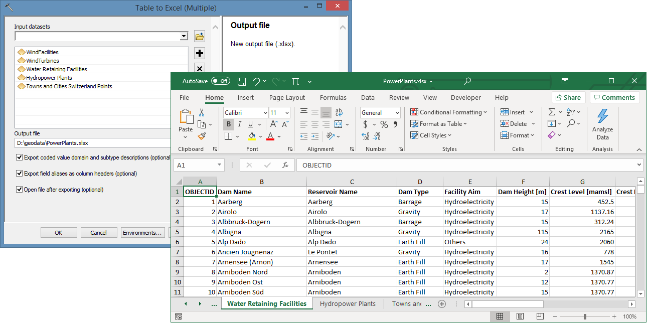
- Import/Export tools - Export to KML, Import from KML, Table to Excel (Multiple)
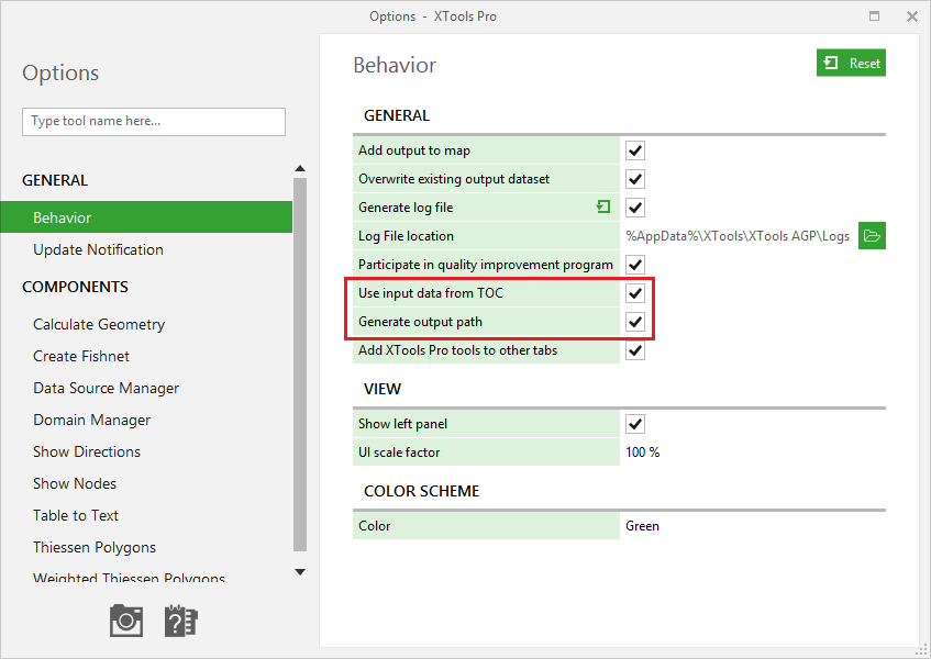
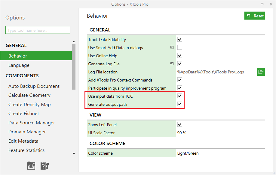
Options
Using selected layers as input features and generating default output paths can be switched off in the XTools Pro Options, this may speed up working with the tools.
Other changes
- XTools Pro 21 can be used with ArcGIS Pro 2.6 - 2.7 versions.
- Minor bug fixes and enhancements.
What’s new in XTools Pro 21 for ArcMap
Fill Holes
A new tool to easily fill unnecessary holes in polygon features.
Modify Table
- Now you can save and re-use field schemas.
- Added a geoprocessing tool to the XTools Pro toolbox.
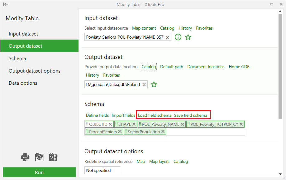
Table to Excel (Multiple)
A new geoprocessing tool to export attributes of all map layers to single Excel workbooks.
Edit in Excel
Added support for layer properties (selected features, definition queries, fields order and visibility, joined and read-only fields).
Copy Layer Properties
Attribute field order can now be copied between map layers.
Find Nearest Features
- Added an option to find more than one nearest feature.
- Fixed work with multipoints.
Extract Map
- Transformations for coordinate system are now taken into account in the background mode.
- Layer representations are kept in the extracted maps.
- Definition queries are kept in the extracted maps.
- Output map packages are created if used in the 64-bit background geoprocessing.
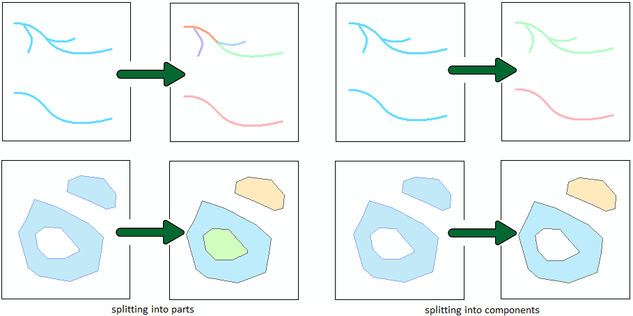
Split Multipart Shapes
Different split methods (splitting into parts or components) are now supported.
Data Source Manager
Improved search algorithm.
Options
Using selected layers as input features and generating default output paths can be switched off in the XTools Pro Options, this may speed up working with the tools.
Other changes
- New colored icons on the toolbar
- XTools Pro 21 can be used with all ArcGIS 10.x versions.
- Minor bug fixes and enhancements
