XTools Pro 21 Updates Released
New June 2021 updates add a number of new features, options, improvements and bug fixes. Among them – optional dialog window in the Edit in Excel tool allowing to select input layers and fields, support for relates in the Table to Excel tool, support for layer properties in the Modify Table tool and more.
What’s new in XTools Pro for ArcGIS Pro
Support for ArcGIS Pro 2.8
XTools Pro 21.1 can be installed and used with ArcGIS Pro 2.8.
Edit in Excel
- Added optional dialog window allowing to select input layers and fields to edit in Excel.
- Improved performance.
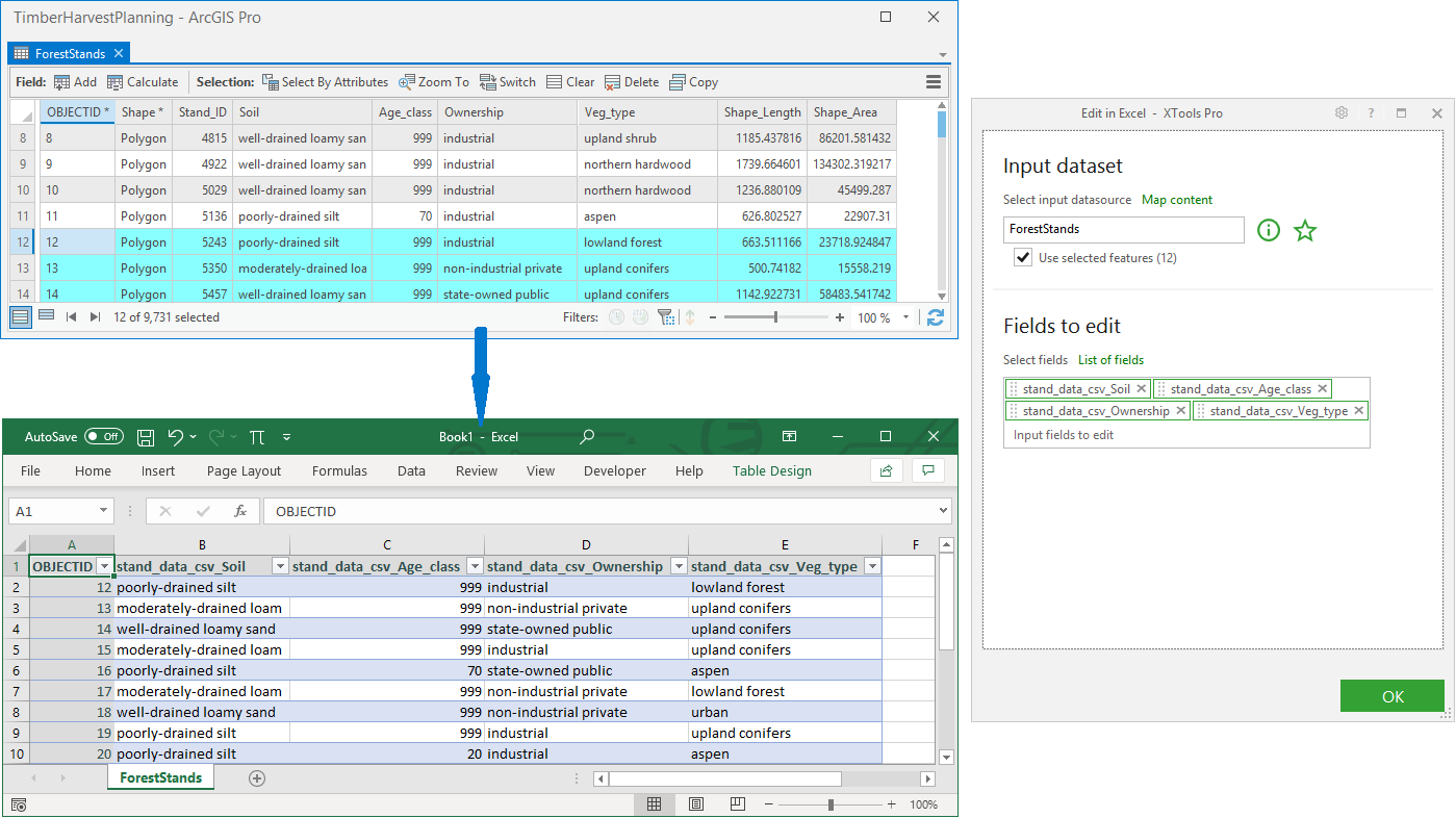
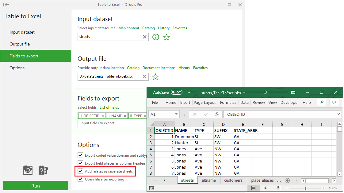
Table to Excel
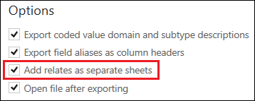
Relates are now supported and can be added to the output XLSX workbook as separate sheets.
Modify Table
Field properties (aliases, order, visibility) of the input layers are now supported.
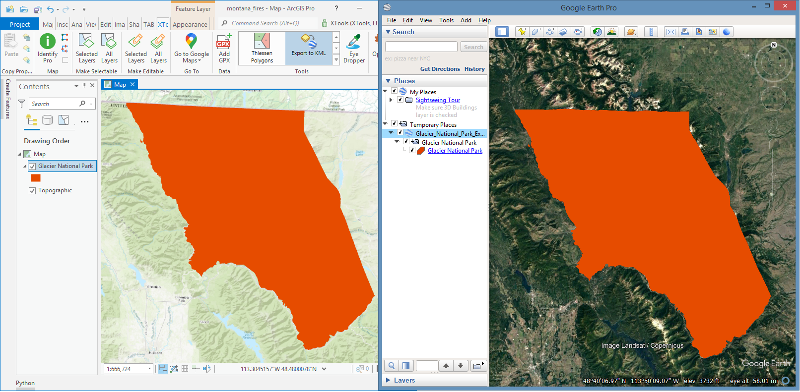
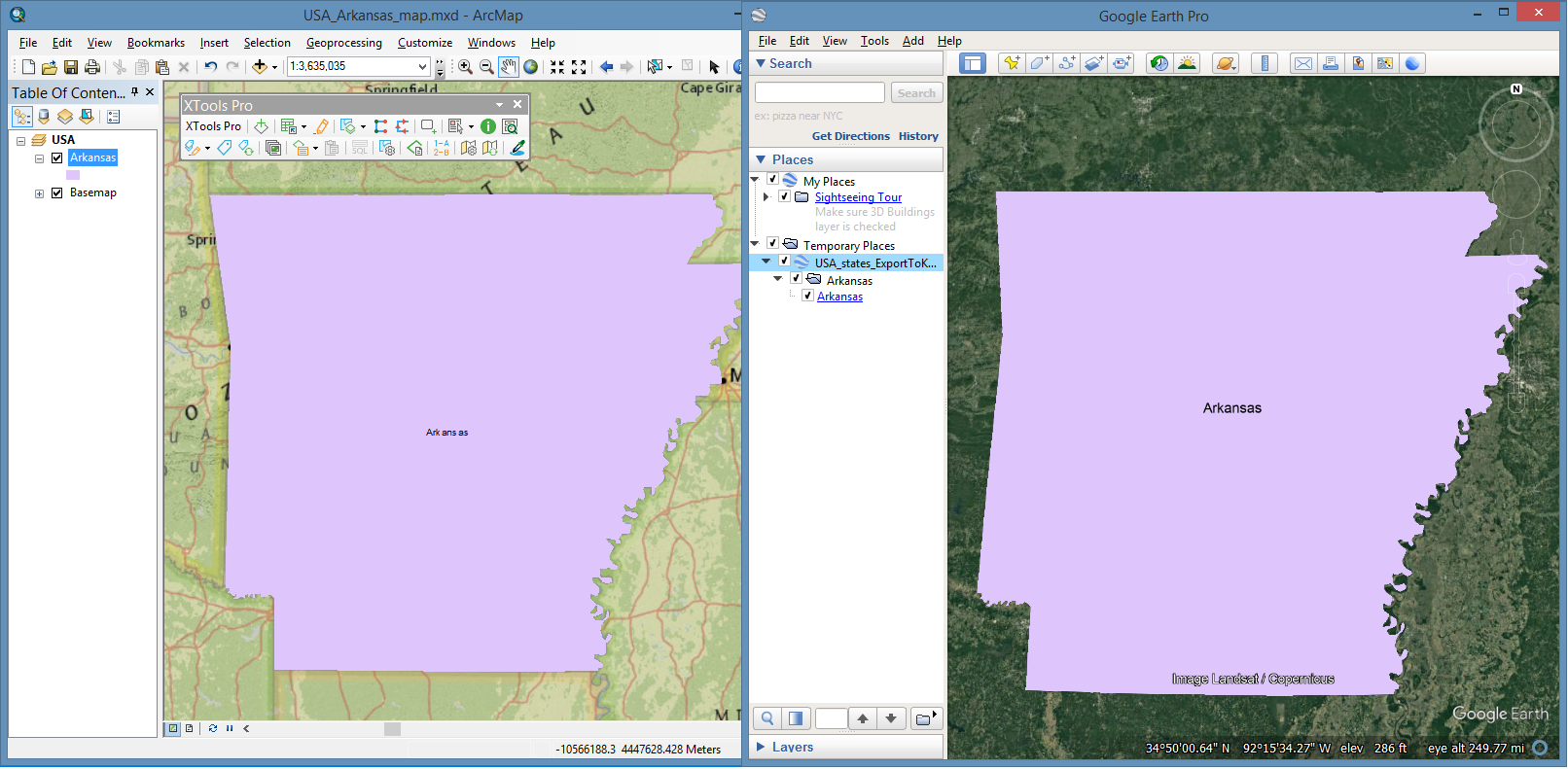
Export to KML
- Selected tool parameters are kept for the next session by default.
- Fixed exporting invisible outlines for polygon symbols.
- Features are now always labeled in the Contents window (in Google Earth, ArcGIS Earth etc.).
Import from KML
- Selected tool parameters are kept for the next session by default.
- Fixed work with feature labels.
- Improved tool performance.
Split Polylines
Split method "At intersections" is added.

Data Source Manager
Fixed work with raster files.
Domain Manager
Fixed import/export of domain values.
Create Fishnet
- Fixed clipping by selected features.
- Fixed clipping of polyline fishnets.
- Fixed work with changed extent.
Other changes
- XTools Pro 21.1 can be used with ArcGIS Pro 2.6 - 2.8 versions.
- Minor bug fixes and enhancements.
What’s new in XTools Pro for ArcMap
Edit in Excel
- Added optional dialog window allowing to select input layers and fields to edit in Excel.
- Improved performance.
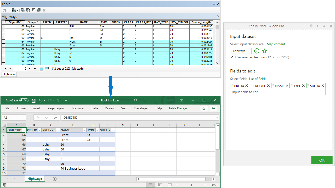
Table to Excel
Relates are now supported and can be added to the output XLSX workbook as separate sheets.
Modify Table
- Field properties (aliases, order, visibility) of the input layers are now supported.
- Fixed work with BLOB fields.
Export to KML
- Fixed exporting invisible outlines for polygon symbols.
- Features are now always labeled in the Contents window (in Google Earth, ArcGIS Earth etc.).
Import from KML
Fixed work with feature labels.
Extract Map
- Only the required map layers are now extracted, if selected in the tool dialog window.
- Fixed the "Drop empty layers" option.
- Fixed extent of the clipped output rasters.
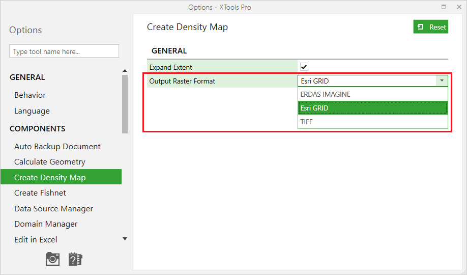
Create Density Map
Output raster format is added to the XTools Pro Options.
Create Fishnet
Fixed clipping by selected features.
Other changes
Minor bug fixes and enhancements.