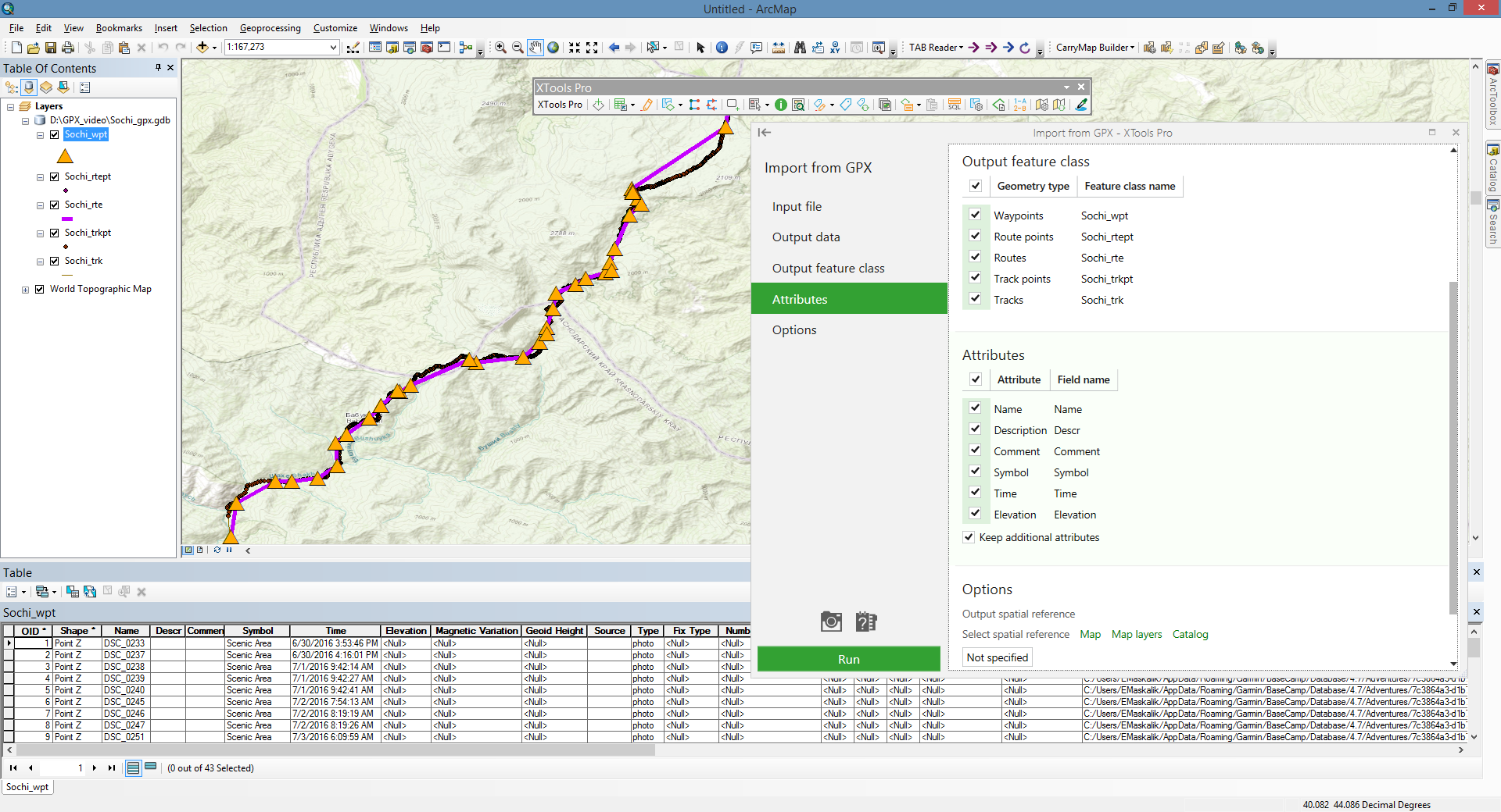
Import from GPX
Allows importing data from GPX file to ArcGIS (shapefiles or geodatabase feature classes) keeping the most part of attributes including extensions.
 Available in XTools Pro for ArcMap and for ArcGIS Pro
GPX, or GPS Exchange Format, is a light-weight XML data format that stores recorded GPS data (waypoints, routes and tracks and their attributes) to use in different applications and online services. In GPX file all coordinates are in WGS84 coordinate system, all measurements are in metric units, timestamps are recorded in Coordinated Universal Time (UTC +00:00) conforming to ISO 8601.
Import from GPX tool imports GPX file data (version 1.0 and 1.1) to shapefiles and geodatabase feature classes (points and polylines). Attributes including extensions saved in GPX file will be kept in a feature class attribute tables. You can select output spatial reference to project GPX data into the coordinate system you wish. Also you may specify output time zone for converting input timestamps.
Notes:
- Waypoints are converted to a Point Z feature class.
- Routes are converted into two feature classes: Point Z feature class with route points and Polyline Z feature class with routes.
- Tracks are converted into two feature classes: Point Z feature class with track points and Polyline Z feature class with tracks. Besides, each track polyline will be multipart feature where track segments will be parts.
- If points from GPX file do not have elevation attributes, output feature Z coordinates will be "0".
Importing attributes
All GPX version 1.0 - 1.1 attributes are supported. Importing data from GPX file you can select attributes that will be added to the output feature class attribute table from the input GPX file:
- Name
- Description
- Comment
- Symbol
- Time
- Elevation
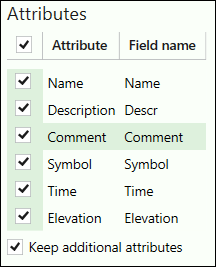
You can select to keep all additional attributes that can be recorded in the input GPX file. Optional attributes that can be added are:
for waypoints, route points, track points:
- magnetic variation (in degrees)
- geoid height (in meters)
- source
- links
- type (classification) of the point
- type of GPX fix
- number of satellites
- horizontal dilution of precision (hdop)
- vertical dilution of precision (vdop)
- position dillution of precision (pdop)
- number of seconds since last DGPS update (DGPS data age)
- ID of DGPS station used in differential correction
for routes and tracks lines:
- source
- links
- GPS route/track number
- type (classification) of the route/track
Besides, following extensions with their attributes are supported:
- GARMIN GPX Extensions v2
- GARMIN GPX Extensions v3
- GARMIN Waypoint Extensions v1
- GARMIN Trackpoint Extensions v1
- GARMIN Trackpoint Extensions v2
Notes:
- If original GPX file doesn't have some attribute data, these output fields will be empty.
- Link attribute may be multiple. Count of output Link attribute fields is defined by the first geometry.
- Extension attribute fields are defined by the first geometry.
- Default additional attribute field names cannot be changed.
Video Tutorial
This video demonstrates how you can use the XTools Pro tools to work with GPX files in ArcGIS.
You will see how you can bring GPX files directly to ArcMap and ArcGIS Pro, import GPX files to ArcGIS formats and export data from ArcGIS to GPX files.
 Paid tool. Try this and all other XTools Pro features free for 14 days or buy XTools Pro license now.