Constrained Thiessen Polygons
Builds Thiessen polygons from point features within user defined boundaries.
 Available in XTools Pro for ArcMap and for ArcGIS Pro
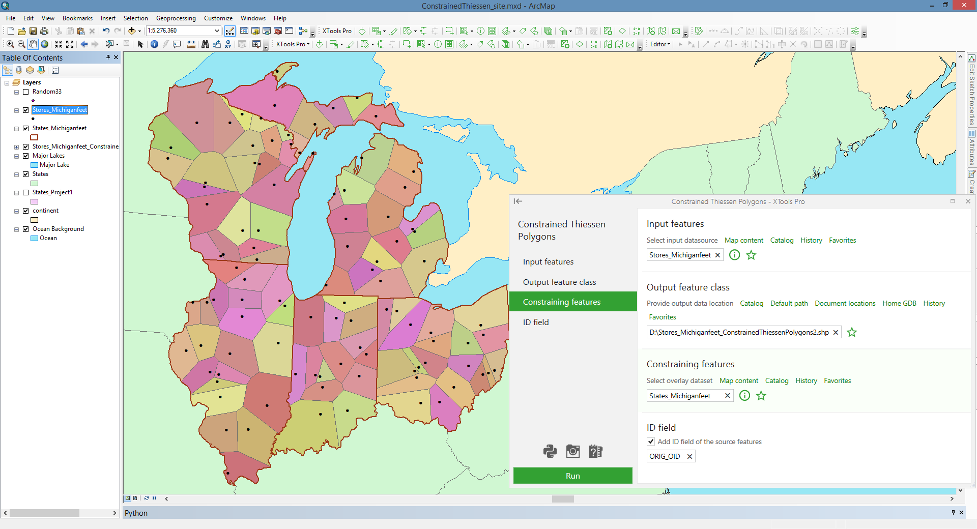
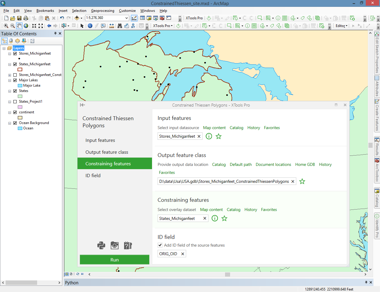
The tool allows building Thiessen polygons from point features within the user defined boundaries. This way users may constrain output Thiessen polygons by other polygons.
Building constrained Thiessen polygons may be used for defining the accessibility (proximity) zones considering various natural, administrative or other boundaries. Analysis of potential customers location territories for a retail chain store based on its proximity within a state is the tool application example.
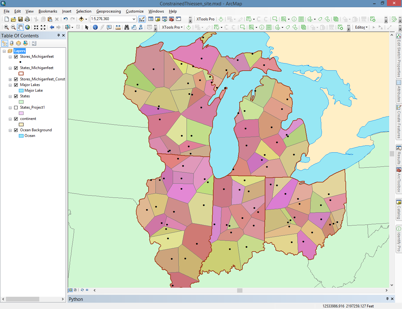
Constrained Thiessen Polygons tool creates Thiessen polygons within the user defined constraining polygon features. If you build classic Thiessen polygons and then clip them by mask, the resulting Thiessen polygons won't be Thiessen polygons, but the Constrained Thiessen Polygons tool addresses this problem.
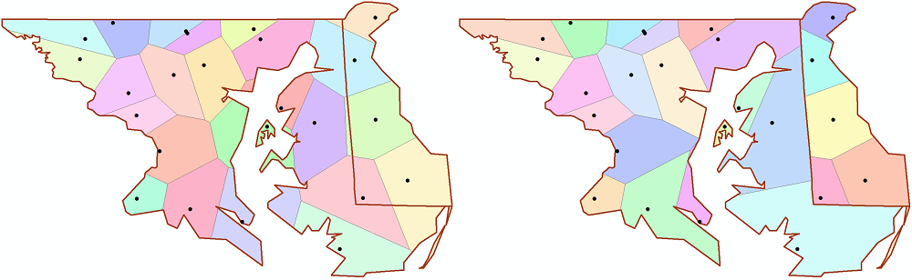
Thiessen polygons cut by mask Constrained Thiessen polygons
Besides, the tool provides following additional options for the created Thiessen polygons:
- Use selected features – only selected input points will be processed
- ID field - allows adding ID field with source features IDs to the output layer attribute table. Default ID field name can be changed.
 Paid tool. Try this and all other XTools Pro features free for 14 days or buy XTools Pro license now.