Align Polygons
Rotates polygons along selected baselines.
 Available in XTools Pro for ArcMap and for ArcGIS Pro
The "Align Polygons" tool is provided for aligning polygons along specified baseline features. At that, it is possible to define maximum distance to baselines within which polygons will be aligned.
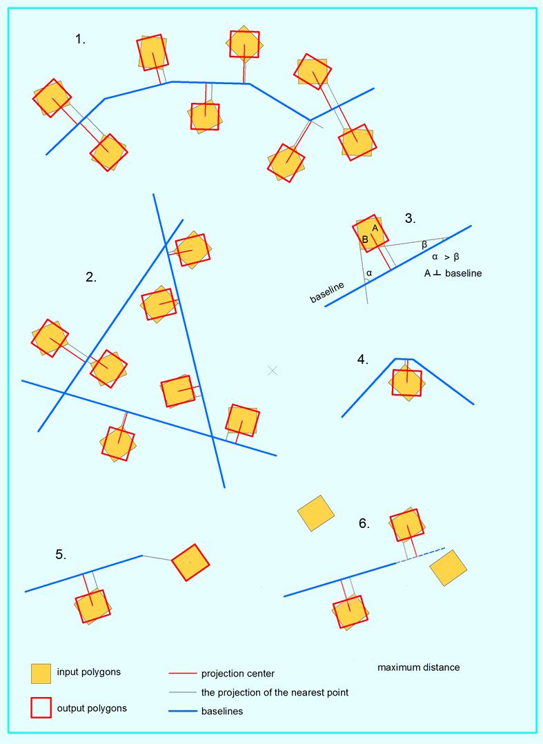
Output polygons are stored in a new feature class (pic. 1, 2).
For each input polygon the tool defines the closest segment of the specified baseline features.
When aligned the polygons are rotated so that the polygon side having the least angle with the baseline feature becomes parallel to the baseline feature (pic. 3). At that polygon side length does not matter.
Nearest to a polygon segment of the baseline is taken into account (pic. 4).
If maximum distance is specified, then all polygons located partly or wholly within the specified distance from their baseline features are rotated.
If maximum distance is not specified and a polygon nearest point cannot be projected to the baseline (pic. 5), then it is copied to the output feature class without rotation.
If a polygon is within the maximum distance from the baseline and its nearest point cannot be projected to the baseline, then it is rotated along the extended baseline segment (pic. 6). If it’s not within the maximum distance, then it is copied to the output feature class without rotation.
Curves in polygons are densified and then aligned accordingly.
Attributes of the input polygons are transferred to the output feature class. As an option, it is possible to add a field with input feature IDs.
 Paid tool. Try this and all other XTools Pro features free for 14 days or buy XTools Pro license now.