XTools Pro 18 Released

The new XTools Pro 18 version introduces such new tools and features as Interactive editing tools, Rotate Point Symbols, Align Polygons, Attract Features, Center Lines Outside, Calculate Polygon Width as well as many redesigned and enhanced tools.
What’s new in XTools Pro 18 for ArcMap
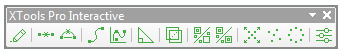
Interactive Editing Tools
New toolbar with interactive tools for use in edit sessions:
Smooth, Simplify, Square Off Polygons, Split Multipart Shapes, Disperse Points, Divide Overlapping Polygons.
NEW TOOLS
Rotate Point Symbols
Rotates point symbols according to reference lines.
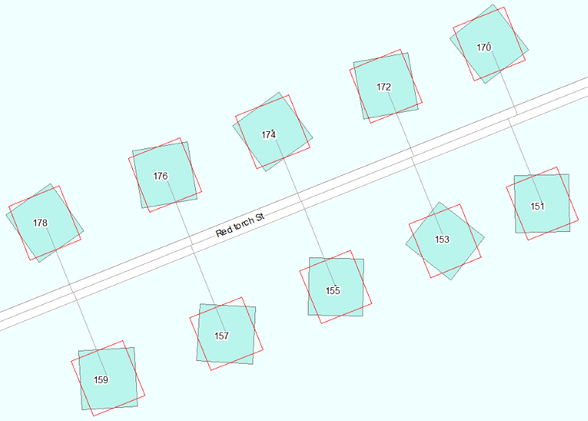
Align Polygons
Aligns polygons along reference lines.
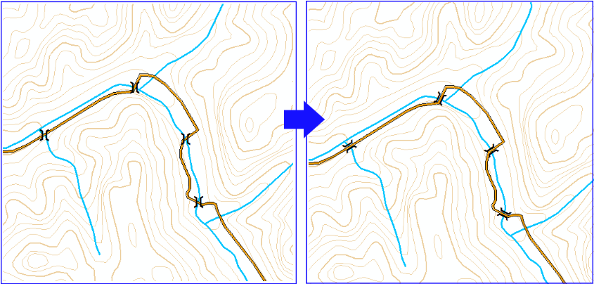
Attract Features
Attracts features to reference lines.
Outside Center Lines
A new tool to create center lines between polygons.
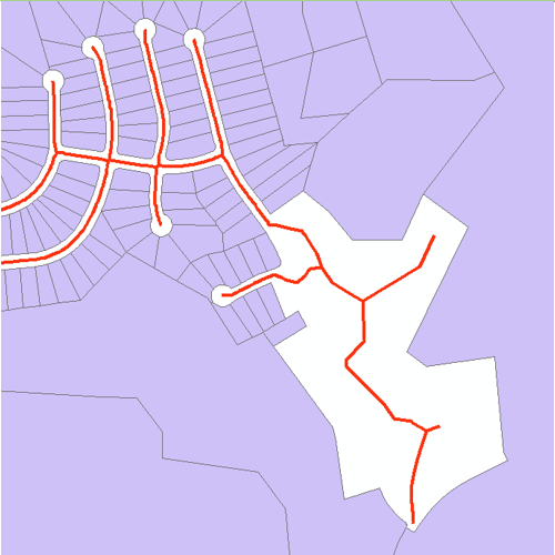
Calculate Polygon Width
Calculates width of polygon features along center lines.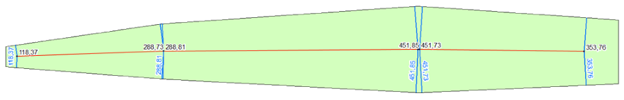
UPDATED AND ENHANCED TOOLS
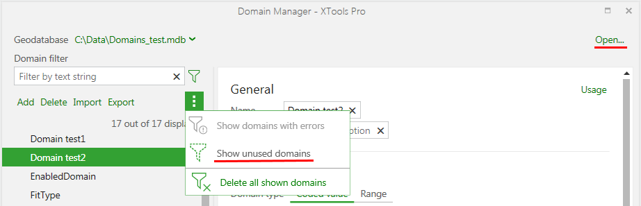
Domain Manager
- Now you can open geodatabases from the tool dialog window.
- Added new filter to show unused domains.
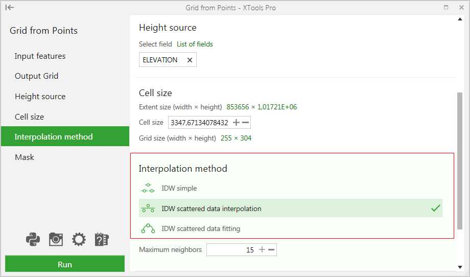
Grid from Points
New algorithm used for interpolating input points with significantly increased performance.
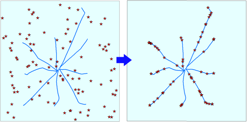
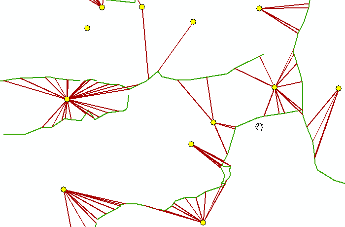
Find Nearest Features
Added spider diagrams to visualize found nearest features.
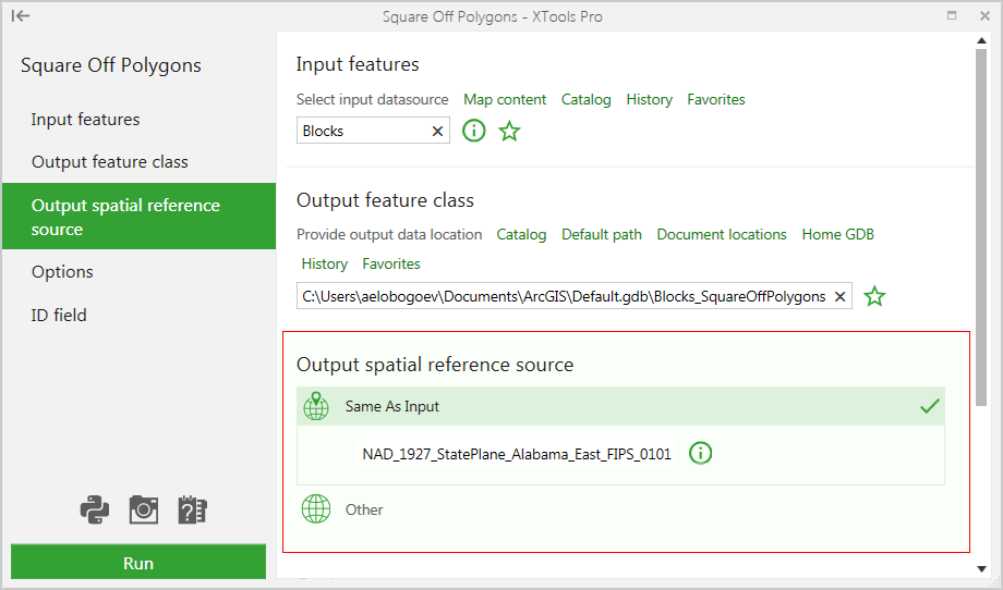
Square Off Polygons
New option to select required spatial reference.
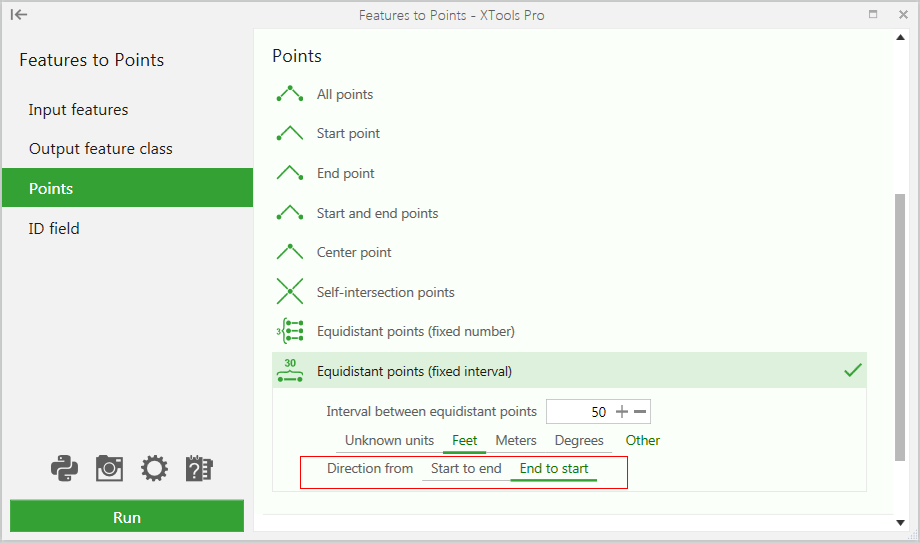
Features to Points
New option to manage direction of point generation for fixed intervals.
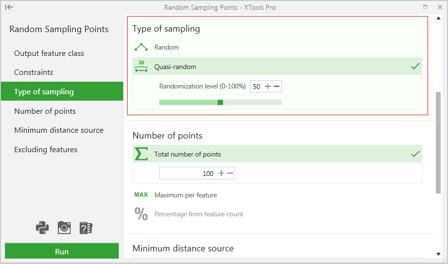
Random Sampling Points
- Improved algorithm of points distribution.
- Added new option for generating quasi-random points.
Convex Hull
New algorithm used for creating hulls.
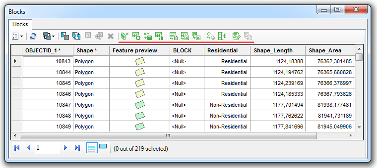
Attribute Table Window
Table tools added to the XTools Pro table window for faster and more convenient access.
What’s new in XTools Pro 18 for ArcGIS Pro
Name change
XTools AGP name is retired and the add-in is now a part of XTools Pro, called XTools Pro for ArcGIS Pro. As a part of a single product it’s included in the XTools Pro license cost and can be tested with XTools Pro trial licenses.
NEW TOOLS
Import from KML
Imports data from KML (KMZ) files.
Export to KML
Exports data to KML (KMZ) files.
Create Fishnet
Creates rectangular and hexagonal fishnets.
Split by Attributes
Splits feature classes to separate feature classes by specified attribute fields.
Rotate Point Symbols
Rotates points symbols according to reference lines.
Outside Center Lines
Creates center lines between polygons.
Align Polygons
Aligns polygons along reference lines.
Attract Features
Attracts features to reference lines.
Calculate Polygon Width
Calculates width of polygon features along center lines.
UPDATED AND ENHANCED TOOLS
Features to Points
New option to manage direction of point generation for fixed intervals.
Square Off Polygons
New option to select required spatial reference.
Convex Hull
New algorithm used for creating hulls.